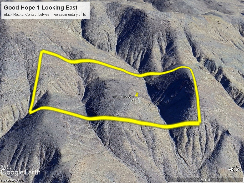
GOOD HOPE 1 MINE
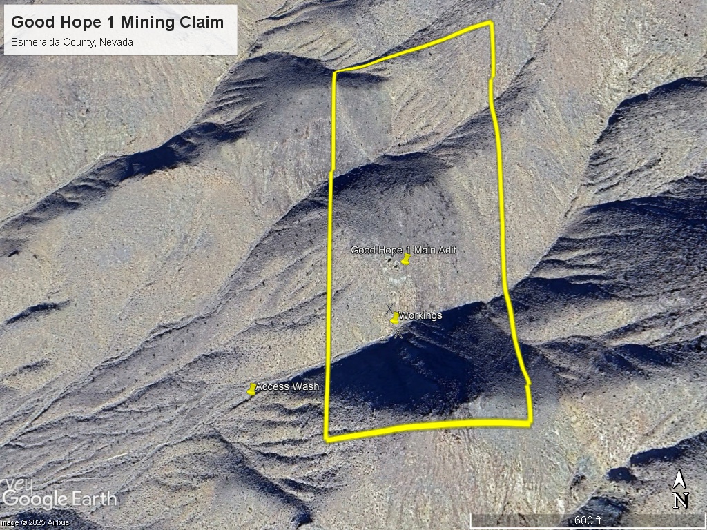
The Good Hope 1 mining claim consists of one (1) unpatented lode claim covering 20.66 acres on federal land managed by the U.S. Bureau of Land Management. The claims cover a former producing gold-silver mine in Esmeralda County, Nevada
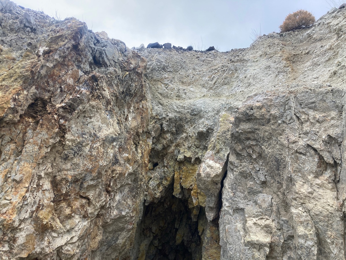
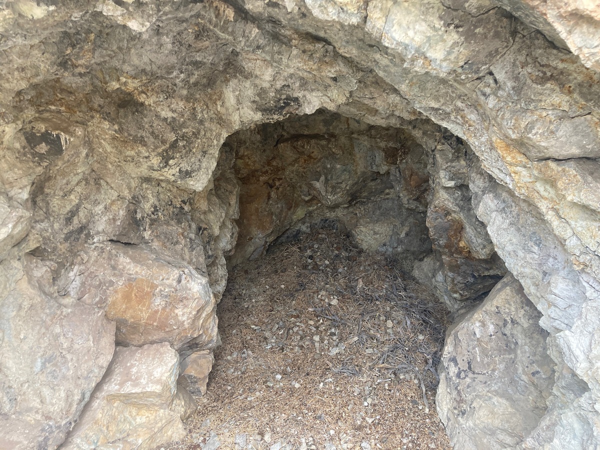
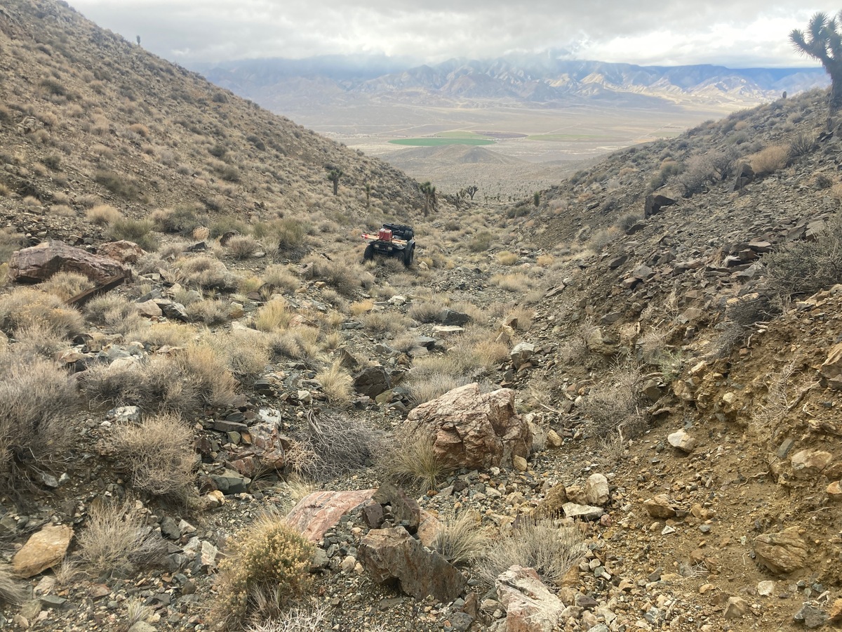
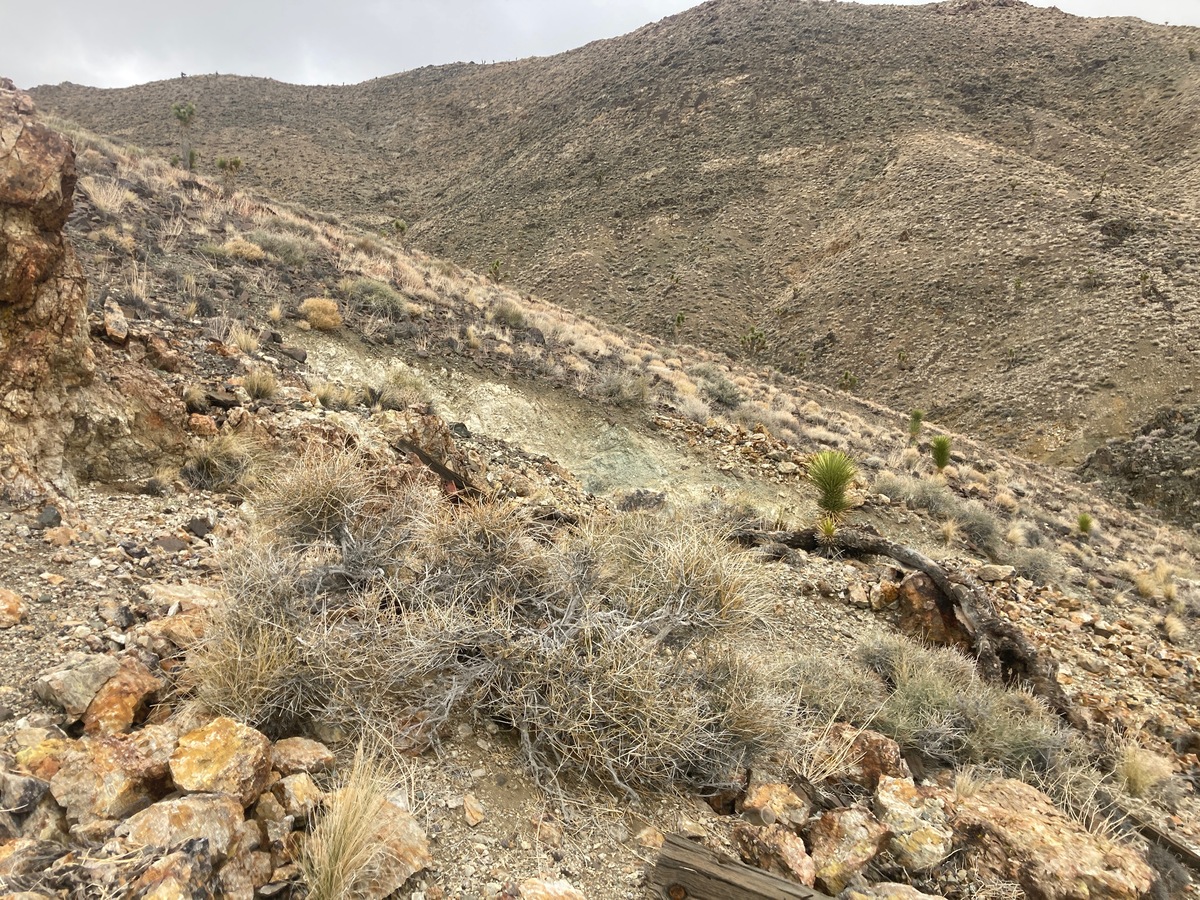
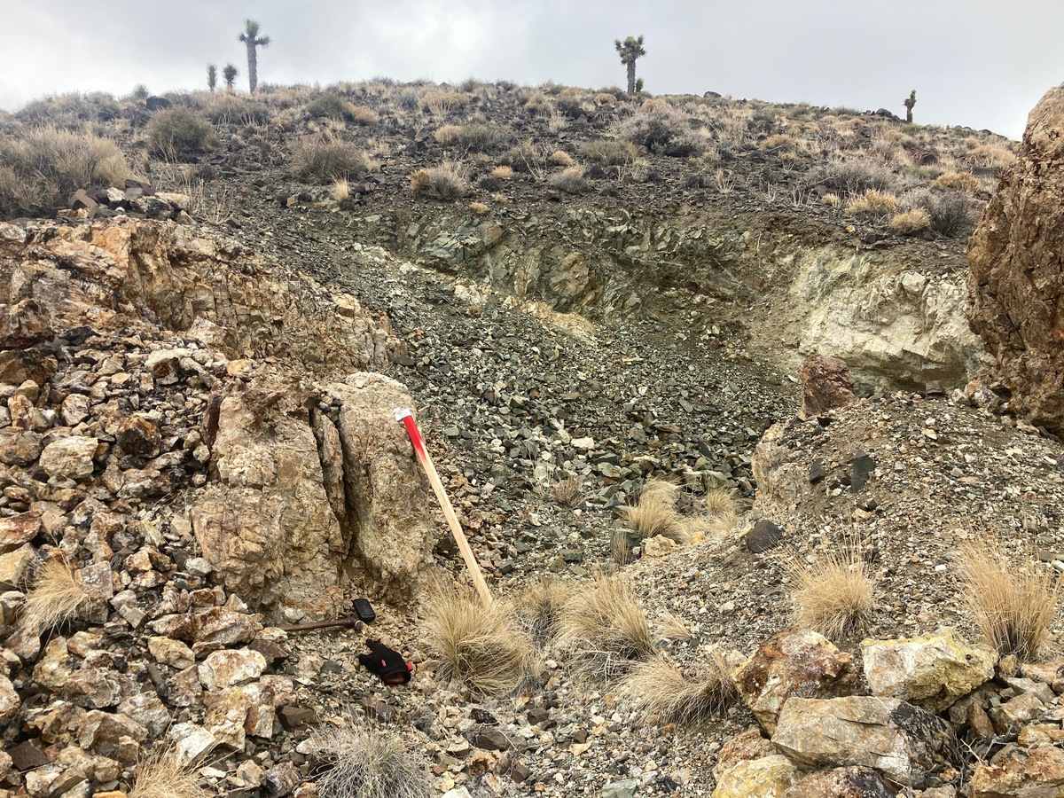
The claim has one adit, and various prospect pits and tailings piles. I took one sample from the dumps and got .1046 ounces per ton gold and 1.5 ounces per ton silver.
The Good Hope Mine and other nearby mines in the Good Hope District produce some spectacular gold grades (historical reports of up to 10 ounces per ton). From a nearby mine I took a sample that had a .9 ounce per ton gold assay from the vein material, and a .42 ounce per ton gold value from the dumps.
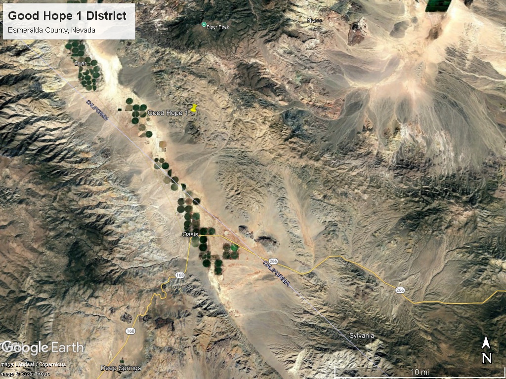
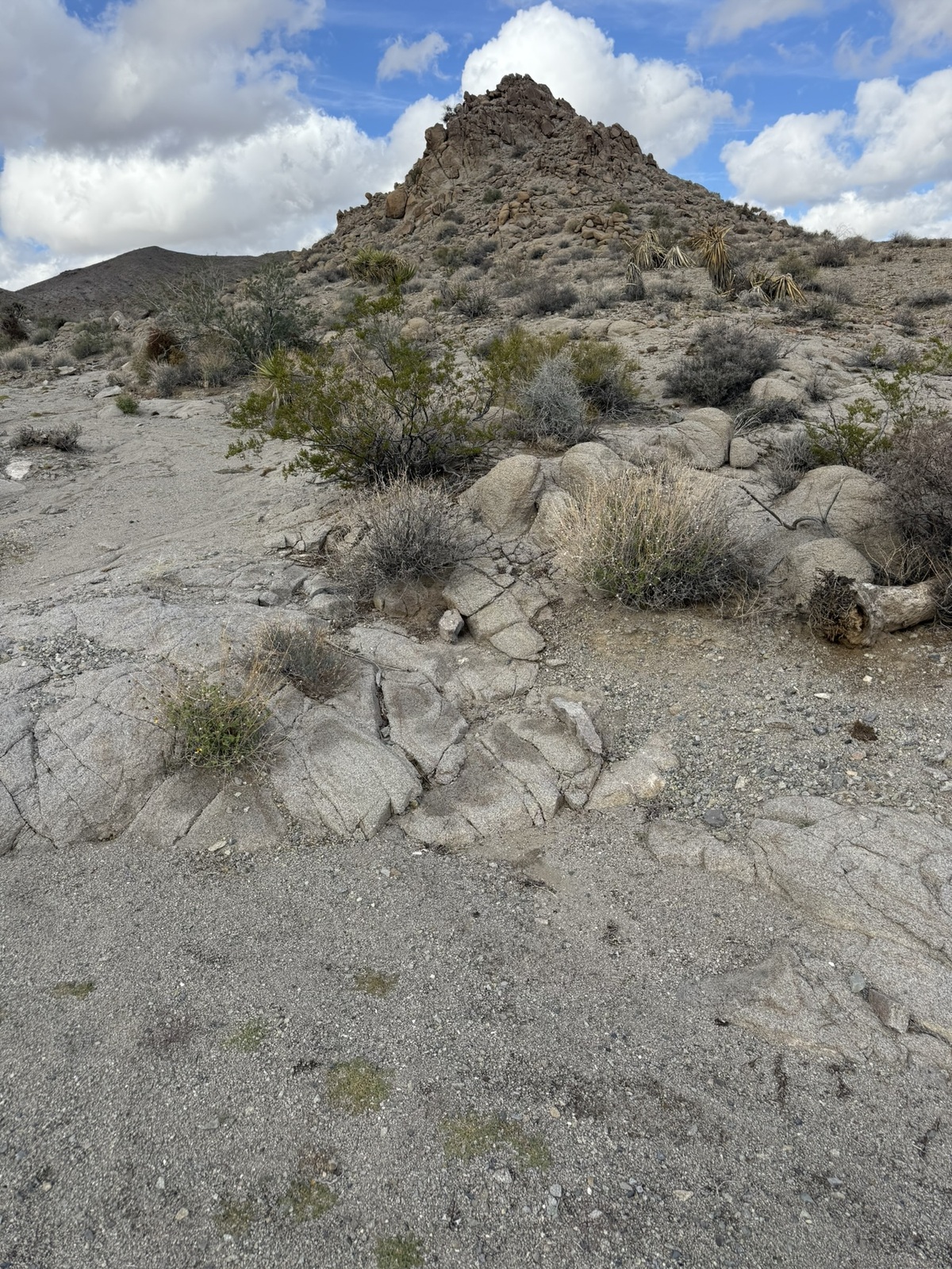
Location and Access: From Dyer, California on the California-Nevada border – head south to 2 miles onto a county road (detailed gps coordinates and maps will be provided). There is a navigable wash / jeep trail that heads directly to the mine – which is on the southwestern slopes of the Silver Peak Range.
GPS Coordinates: Lat: 37.607397° Long: -117.917746° (Good Hope main adit)
Mining and Exploration Potential: The Good Hope mine is located in a Good Hope District – which is an overlooked, but promising district near the California / Nevada border.
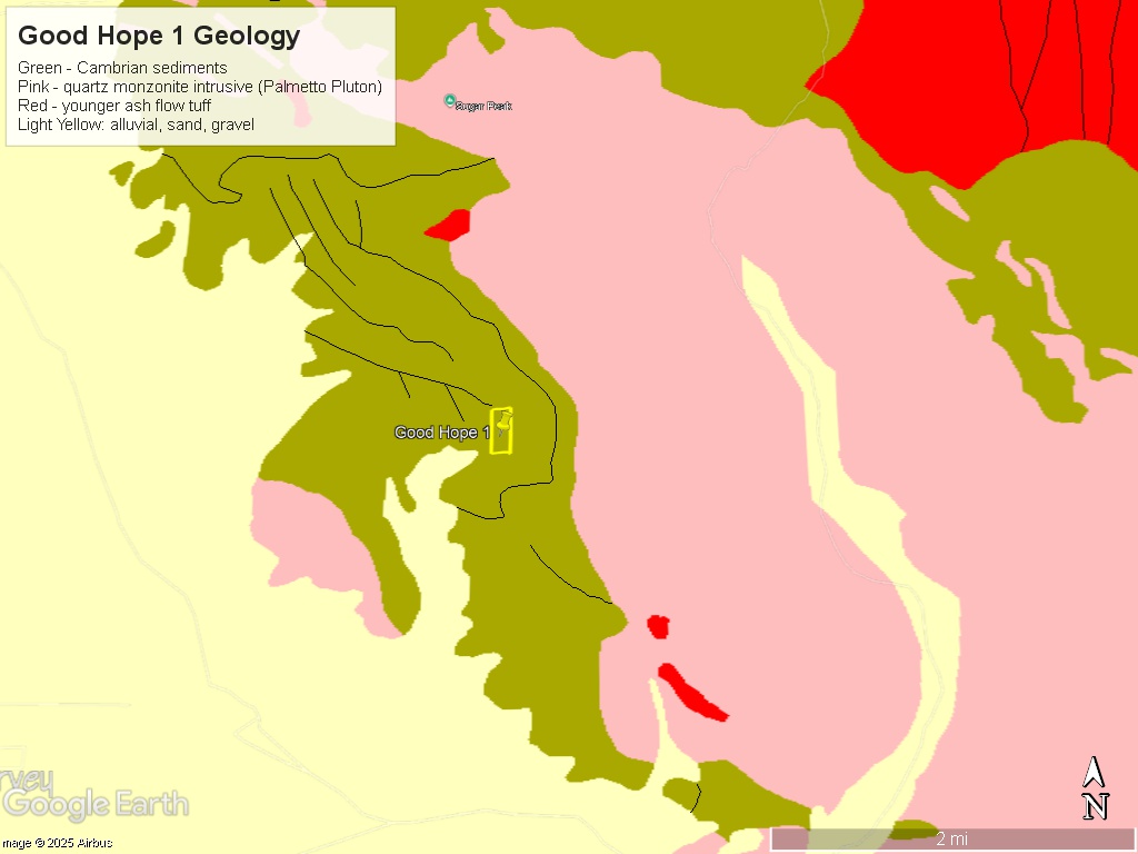
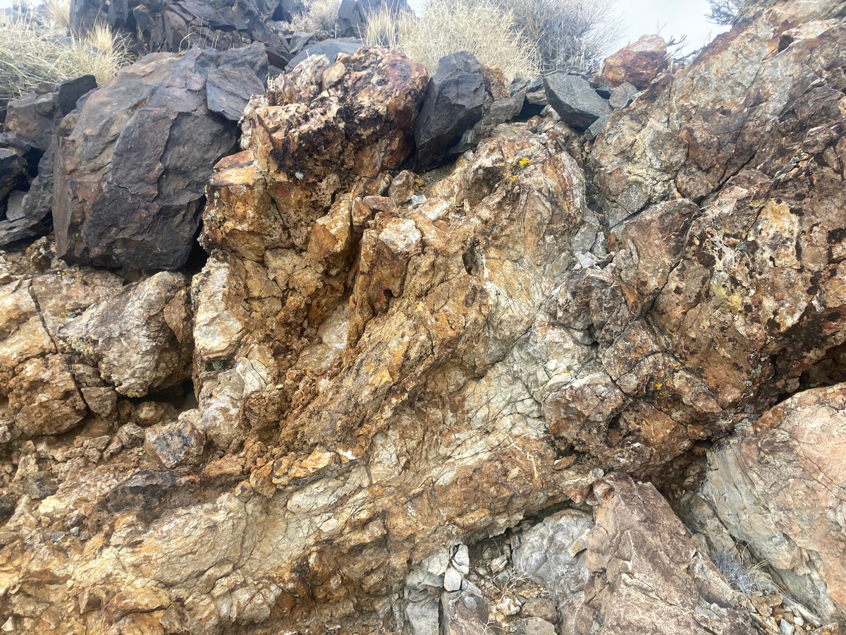
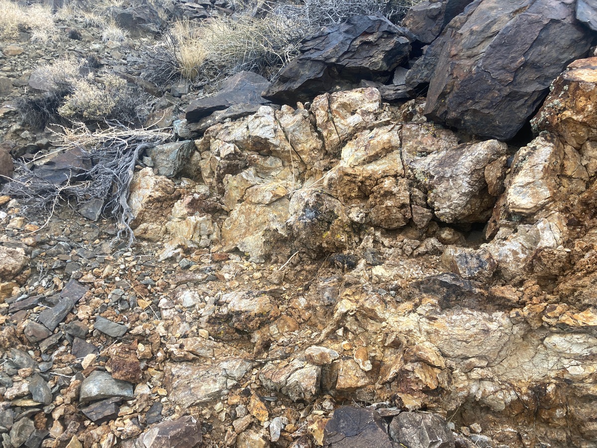
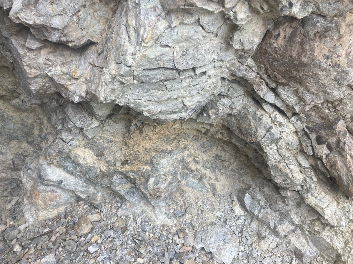
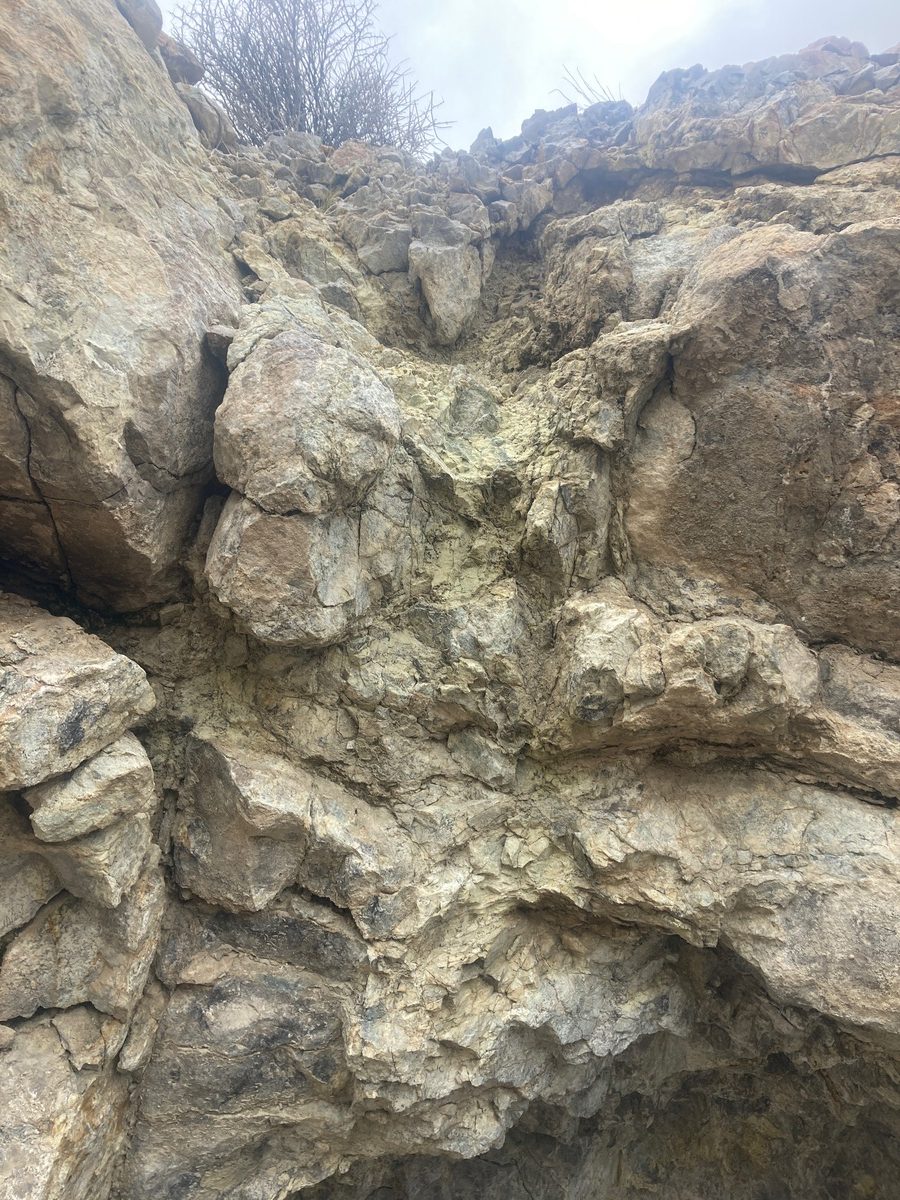
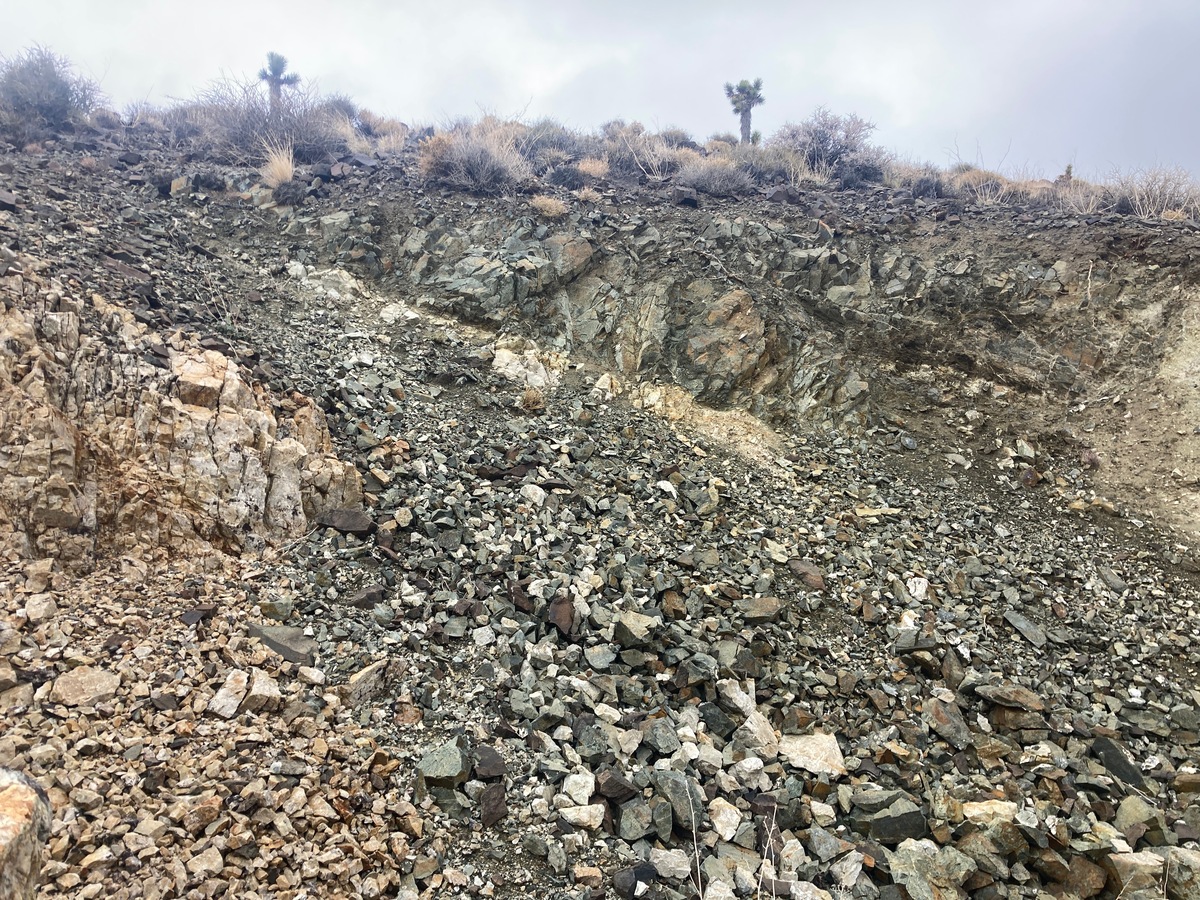
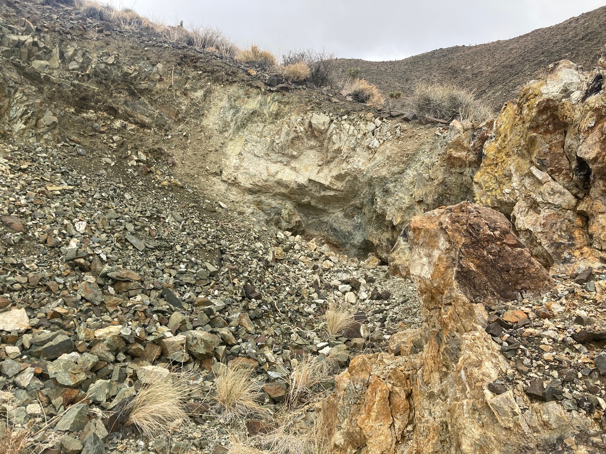
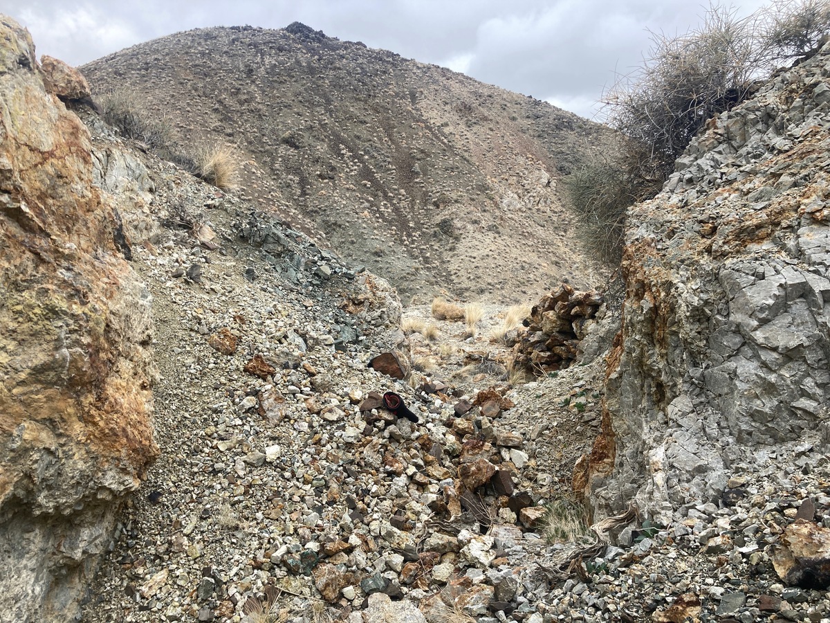
The veins at the Good Hope are in fractures and shear zones in the granodiorite intrusive (Palmetto Pluton).
The veins themselves are heavily altered quartz and quartz breccia. The instrusive is surrounded by older Cambrian metasediments and the contacts could also be mineralized.
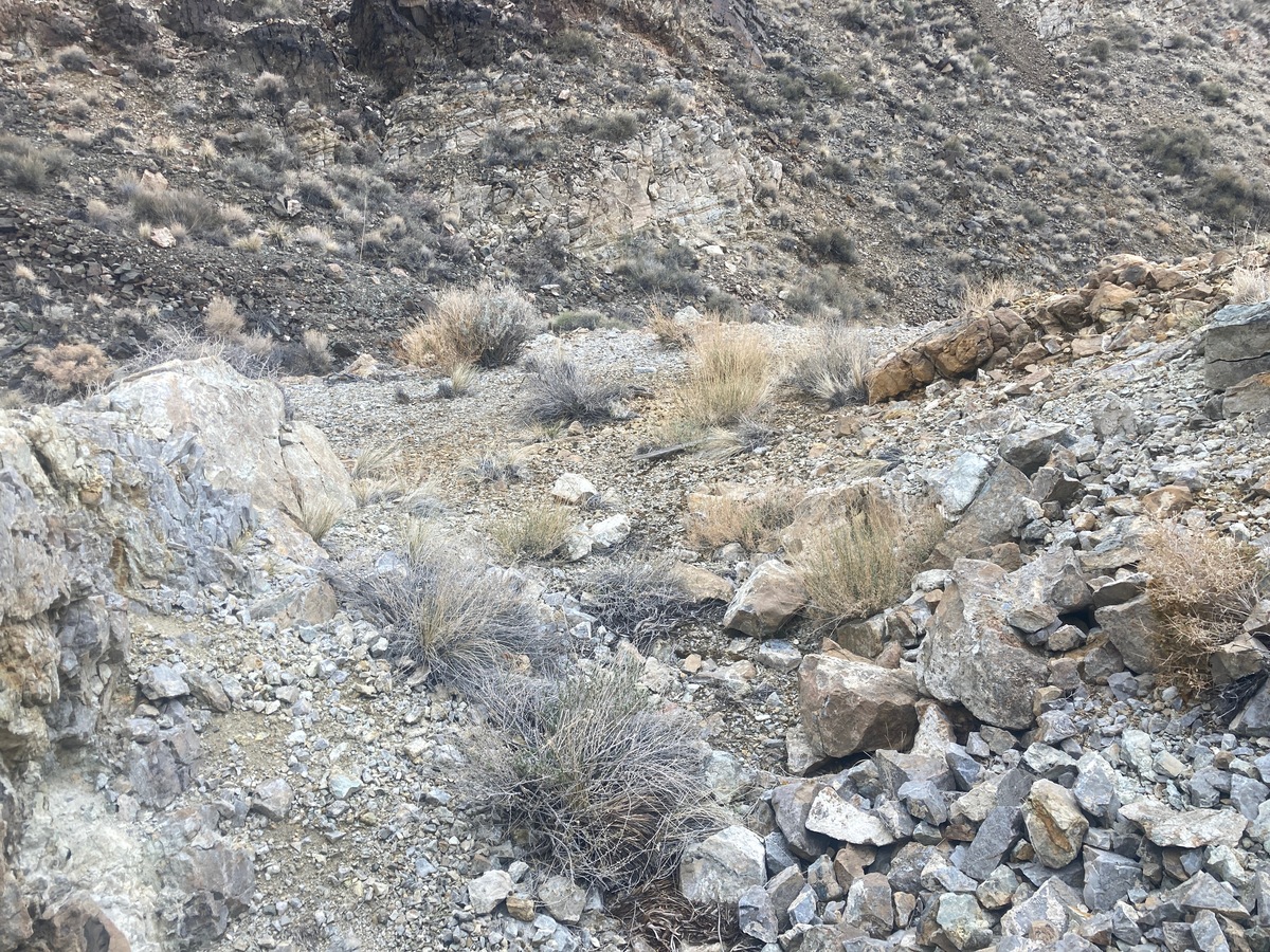
Both soil sampling and geophysical methods should be effective in finding additional ore bodies. However, the existing workings expose several promising vein structures.
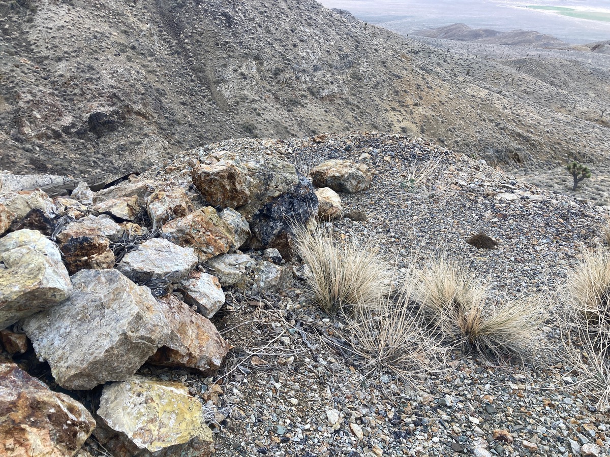
The old workings expose a north-south vein structure on a parallel fault to the main fault to the east. This structure could be over 1 mile long.
Both my clients and I have been able to map the vein structures by these old workings sometimes for 1000+ feet.
One idea is to map this vein structure – even as it is covered by soil and sample it along the entire length. In this way a significant discovery could be generated that may be worth a serious mining effort.
There has been an uptick in interest in this area of Nevada since the recent discoveries at Tonopah, Beatty and Goldfield. Both Beatty and Goldfield have major international mining companies developing large scale mines. This level of interest in the area could attract future buyers and increase the value of these types of deposits.
A new discovery made here – whether high grade vein or open pit deposits – would have no problem finding a buyer.
The Good Hope District lies in southern Esmeralda County, Nevada. The Palmetto area was discovered in 1866 during post-Comstock rush. Mines in the area produced direct shipping ore until about 1880 then closed down until after 1900.
The Good Hope Mine was the first producer and shipped ore to Furnace Creek, California.
There was a revival after the discoveries of Tonopah and Goldfield in the 1900-1905. The nearby Windypah District was discovered in 1903. Many mines produced up until WWII when the gold mines were closed by government decree.
The mines in this area have often been one and two man operations. The Good Hope District Report from the Nevada Bureau of Mines mentions a small active mining operation in the 1980’s.
In 2010, Redstar Gold and a large mining company partner drilled the Oasis Divide project and discovered a large, but deep copper-gold porphyry system. Redstar Gold sold their Nevada portfolio to NV Gold in 2014 which currently owns the Oasis Divide property. The copper porphyry discovery shows the potential for this district and helps explain the abundant copper oxides in the veins.
Regional Geology: The Good Hope Mine is located in the Walker Lane mineral belt which is part of the Basin and Range physiographic province. The Basin and Range province covers most of Nevada and consists of narrow NE trending mountain ranges between flat, arid valleys and basins.
The Walker Lane mineral belt is an area with a high density of parallel strike-slip faults extending from Reno to Las Vegas roughly along the California- Nevada border. Faulting and volcanic activity make the Walker Lane favorable for hosting gold and silver deposits including some of the most famous precious metal mining districts in the US including the Comstock, Goldfield, Tonopah, Bullfrog, Mineral Ridge, and Round Mountain.
Local Geology: The Good Hope District encompasses the northwestern part of the Cretaceous to Jurassic Age Palmetto pluton and surrounding Cambrian metasediments.
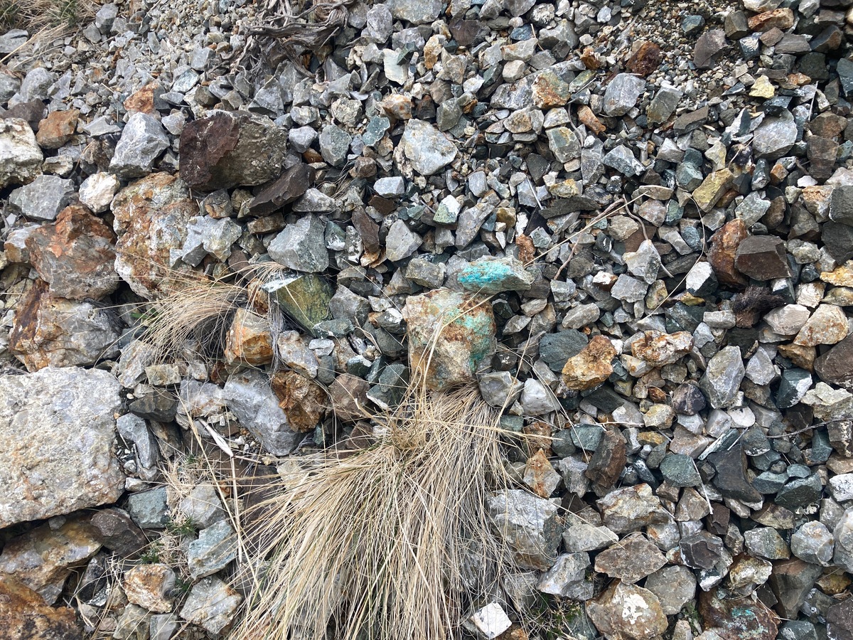
- The district is best known for silver-bearing quartz veins that were historically described as “copper stained” and sometimes containing galena (a lead sulfide).
- A common setting here is mineralized quartz veins along the contact between hard, older metamorphosed rocks like quartzite and slate.
- Much of the local bedrock is very old marine sedimentary rock that has been altered/metamorphosed (hardened and changed by heat/pressure).
- The district sits near granitic intrusions, including quartz-monzonite bodies; these intrusions supplied heat and mineralizing fluids.
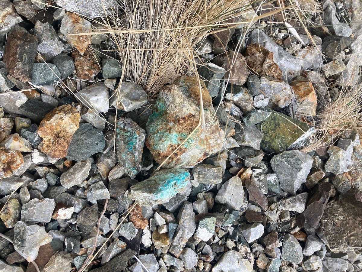
- The Good Hope ore shows classic oxidized vein material: lots of quartz with rusty iron-oxide staining (limonite/goethite) and bright green-blue copper staining.
- The green-blue colors usually come from secondary copper minerals formed during weathering (common examples are malachite, azurite, or chrysocolla).
- Iron-oxide “gossan” and boxwork textures are good surface clues that sulfide minerals were once present and have weathered out.
- For small-scale prospecting, focus on: (1) quartz veins, (2) contacts between different rock types, and (3) intersections of faults/fractures.
- Vein grade can be patchy: ore often occurs in small “shoots” along a structure rather than evenly throughout the vein.Top of Form
- Gold-silver ratio is 1:1.
Available Reports:
Albers, J.P. and Stewart, J.H., Geology and Mineral Deposits of Esmeralda County, Nevada, Nevada Bureau of Mines and Geology, 1972.
Jeanne, R.A., ‘Preliminary Report on the Exploration of the Heavy Rock Property, Esmeralda County, Nevada’, CR Exploration Company, 1983.
Lincoln, F.C., ‘Mining Districts and Mineral Resources of Nevada’. Nevada Publications. 1983 reprint of 1923 Original.
Patera, A., ‘Palmetto, Sylvania, and Tule Canyon, Nevada’, Western Places Vol. 11, No. 4, Western Places, 2022.
Tingley, J.V., Good Hope District Summary Report, Nevada Bureau of Mines and Geology, 1983.
FAQ
Why Nevada?
Nevada is consistently ranked as one of the top mining jurisdictions in the world for being mining-friendly and continuing to produce major discoveries. If Nevada was a country it would be the 5th largest gold producer in the world (after Australia, Canada, China, and Russia). Nevada is home to the Carlin Trend, the Cortez Trend, the Walker Lane Trend, the Getchell Trend and many other prolific gold producing regions. In addition to gold Nevada also has major mines producing silver, copper, lithium, iron ore, magnesium, gems and many other minerals. Nevada is 85% owned by the federal government and most of this land is available for claim staking. This means some of the best mining ground in the world is open to small prospectors – a very unique situation. There are many mining companies active in Nevada and therefore, multiple potential buyers for any discovery you make. Canadian based junior exploration companies are particularly active in Nevada.
Why Buy a Claim?
Buying a claim is a great way to get started in mining and prospecting. Buying a claim that is professionally staked reduces your upfront work and the risk of making a mistake on your paperwork or in the field. Our claims are in areas with historical mining activity and most have numerous pits, shafts, and adits to explore. Finding these claims takes lots of research that is already done for you. The best place to find gold is where people have already found it!
Why Us?
I have been working in mineral exploration in the southwestern United States and Alaska for 22 years. I have co-founded four junior mining companies and managed numerous drilling and exploration projects. I have worked with large and small mining companies and know what types of projects they are looking for that can be advanced by small prospectors. I have also worked on small hardrock production projects. I usually try to find claims that have known high grade veins that can be produced and that also have some exploration upside. We stand by our claims and fix any problems that come up. We can also help you with your annual filings. All our claims have a BLM serial number and can be found on the U.S. BLM MLRS website database. Our claim maps are professionally drafted.
How is ownership of the claim transferred?
Ownership of mining claims is transferred with a Quit Claim Deed which we prepare. We pay all claim transfer fees and file the claim transfer paperwork with the BLM and Esmeralda County. The BLM takes about 2-3 weeks to process the claim transfer request and register the claim in your name. The Esmeralda County Recorder usually returns the recorded Quitclaim Deed same day (filed electronically). Once the transfer is complete we will send you all the original documents including the file stamped Quitclaim Deed, the original location notices and claim maps.
How Much are the Annual Claim Fees?
The BLM charges a $200 per claim annual maintenance fee which is due on September 1st each year. The BLM fees can be paid online through their claim management portal. Esmeralda County requires that a Notice of Intent to Hold form is filed the first year by Nov 1st along with payment of the recording fee of $12 plus $12 per claim.
If you own less than 10 mining claims you can qualify for a waiver of the annual maintenance fee by filing a Small Miner’s Waiver. However, the Small Miner’s Waiver requires that you perform $100 in labor or improvements on the claim each year.
Claim fees are next due September 1, 2026.
International Buyers
International buyers must either have dual US citizenship and US address or have a US entity or company to own the claim.