Chloride Creek Gold #1
 1 / 6
Property details
Chloride Creek Gold #1 is a 20-acre placer claim in Sierra County, New Mexico, in the historic Chloride mining district on the east flank of the Black Range. The claim is recorded in Section 24, Township 11 South, Range 9 West, New Mexico Principal Meridian, and the location documents show a standard 20-acre placer layout of roughly 1,320 feet by 660 feet.
The real appeal here is the district setting. The Chloride district has a long record of precious- and base-metal mining, with intermittent production stretching back well over a century. Richard Harrison described the district as a mature mining camp with more than $18 million in historic metal value produced, and earlier state summaries classify Chloride as one of Sierra County’s important volcanic-epithermal districts, with recorded gold and silver production alongside copper, lead, and zinc.
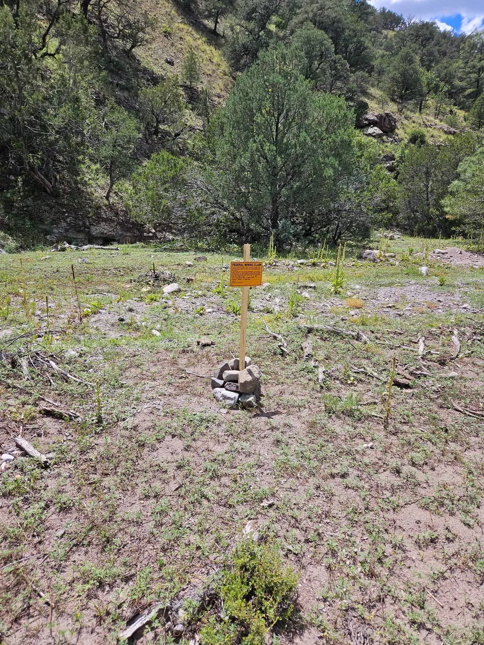
Geologically, Chloride Creek sits in a strongly mineralized volcanic terrain. The district is underlain by Tertiary volcanic and volcaniclastic rocks of the Mogollon-Datil field, cut by high-angle faults and fracture systems that hosted quartz-calcite vein mineralization with local fluorite and barite. Harrison also notes that flow-dome centers such as the Chloride Creek dome helped create radial and tangential fractures that localized mineralization. For a placer claim, that matters because creek gravels and shallow bench material can trap gold weathered out of those mineralized veins upstream. The site photo shows exposed creek-margin bedrock and coarse alluvial material, the kind of setting prospectors typically watch for pay streak concentration in a mountain drainage. Recent New Mexico permitting records also show that placer-gold mining is still being actively pursued elsewhere along Chloride Creek, which speaks to the drainage’s continuing small-scale gold potential.
Summary bullets
- 20-acre placer claim on Chloride Creek in Sierra County, New Mexico.
- Located in the historic Chloride mining district, a long-lived Black Range precious-metals camp.
- Claim documents show a 1,320′ x 660′ placer configuration in Section 24, T11S, R9W.
- District geology is classic fault-controlled epithermal terrain with quartz-calcite veins hosted by volcanic rocks.
- Creek gravels, shallow bench material, and exposed bedrock make this an attractive small-scale placer exploration target.
References:
Harrison, Richard W. “General Geology of Chloride Mining District, Sierra and Catron Counties, New Mexico.” In Truth or Consequences Region, edited by R. E. Clemons, W. E. King, G. H. Mack, and J. Zidek, 265–72. New Mexico Geological Society 37th Annual Fall Field Conference Guidebook. Socorro, NM: New Mexico Geological Society, 1986.
Buying a claim: common questions
Why Buy a Claim?
Buying a claim is a great way to get started in mining and prospecting. Buying a claim that is professionally staked reduces your upfront work and the risk of making a mistake on your paperwork or in the field. Our claims are in areas with historical mining activity and most have numerous pits, shafts, and adits to explore. Finding these claims takes lots of research that is already done for you. The best place to find gold is where people have already found it!
Why Us?
I have been working in mineral exploration in the southwestern United States and Alaska for 20 years. I have co-founded four junior mining companies and managed numerous drilling and exploration projects. I have worked with large and small mining companies and know what types of projects they are looking for that can be advanced by small prospectors.
I have also worked on small hardrock production projects. I usually try to find claims that have known high grade veins that can be produced and that also have some exploration upside. We stand by our claims and fix any problems that come up. We can also help you with your annual filings. All our claims have a BLM serial number and can be found on the U.S. BLM MLRS website database. We hire the same professional claim staking companies that the large mining companies hire and all the claims have professionally drafted and accurate maps. We also have current assays from ALS Minerals on most of our claims.
How is ownership of the claim transferred?
Ownership of mining claims is transferred with a Quit Claim Deed which we prepare. We pay all claim transfer fees and file the claim transfer paperwork with the BLM and the county. The BLM takes about 2-3 weeks to process the claim transfer (Quit Claim) and register the claim in your name. The County Recorder usually takes 1-2 weeks to return the recorded Quit Claim Deed. Once the transfer is complete we will send you all the original documents including the file stamped Quit Claim Deed, the original location notices and claim maps.
How much are the annual claim fees?
The BLM charges a $200 per claim annual maintenance fee (placer claims: $200 for each 20 acres) which is due on September 1st each year. The BLM fees can be paid online through their claim management portal. The county where the claim is located also requires a Notice of Intent to Hold to be filed along with a small recording fee.
If you own less than 10 mining claims you can qualify for a waiver of the annual maintenance fee by filing a Small Miner's Waiver. However, the Small Miner's Waiver requires that you perform $100 in labor or improvements on the claim each year.
Can international buyers purchase a claim?
International buyers must either have dual US citizenship and a US address or have a US entity or company to own the claim.