CLIPPER GOLD MINE
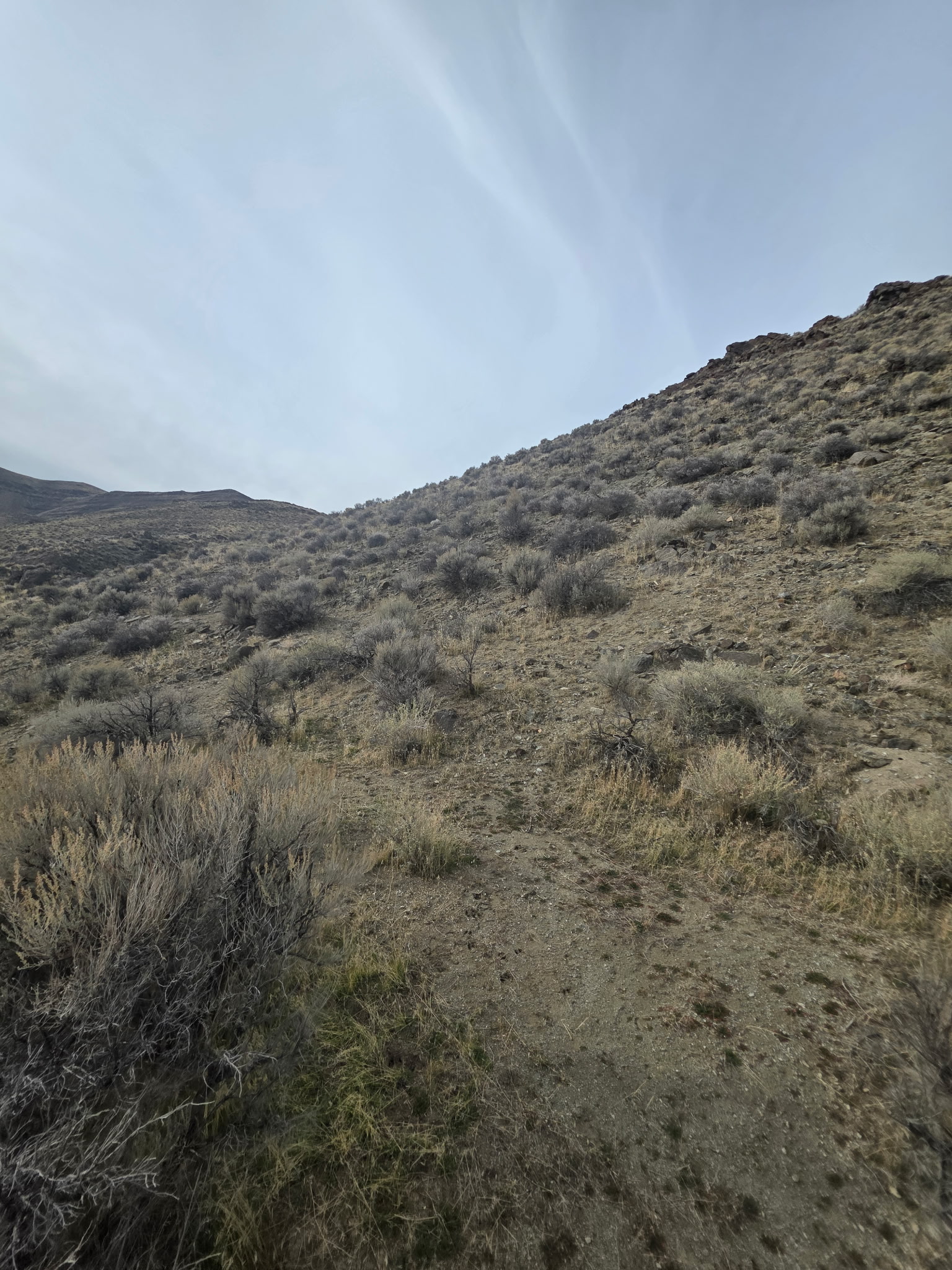
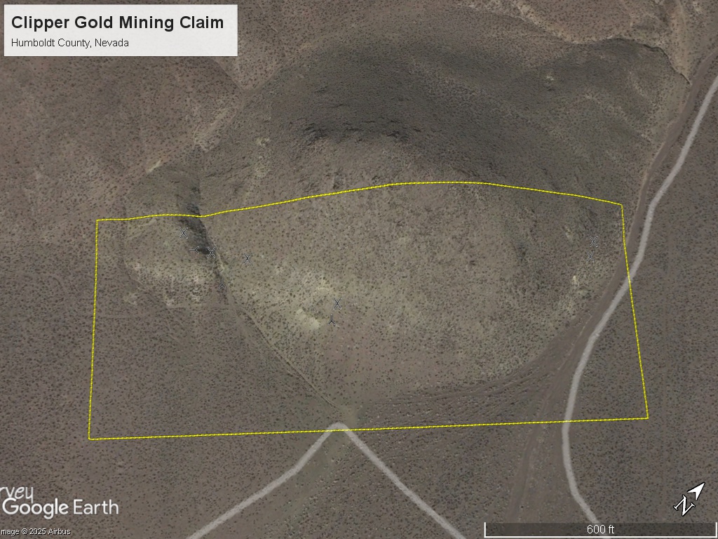
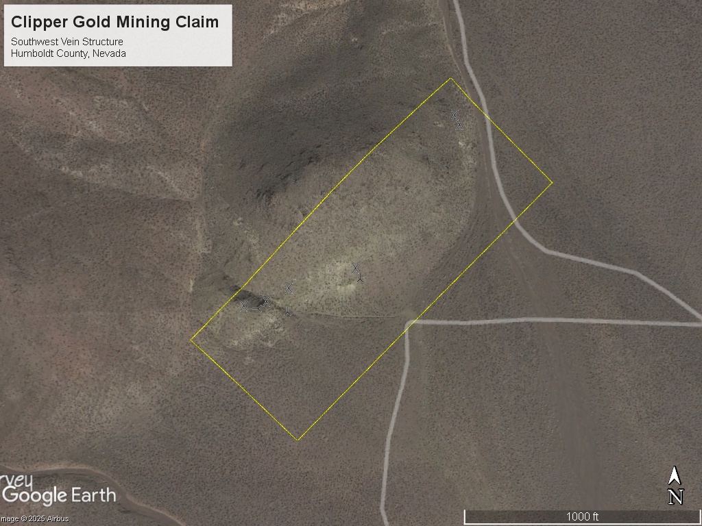
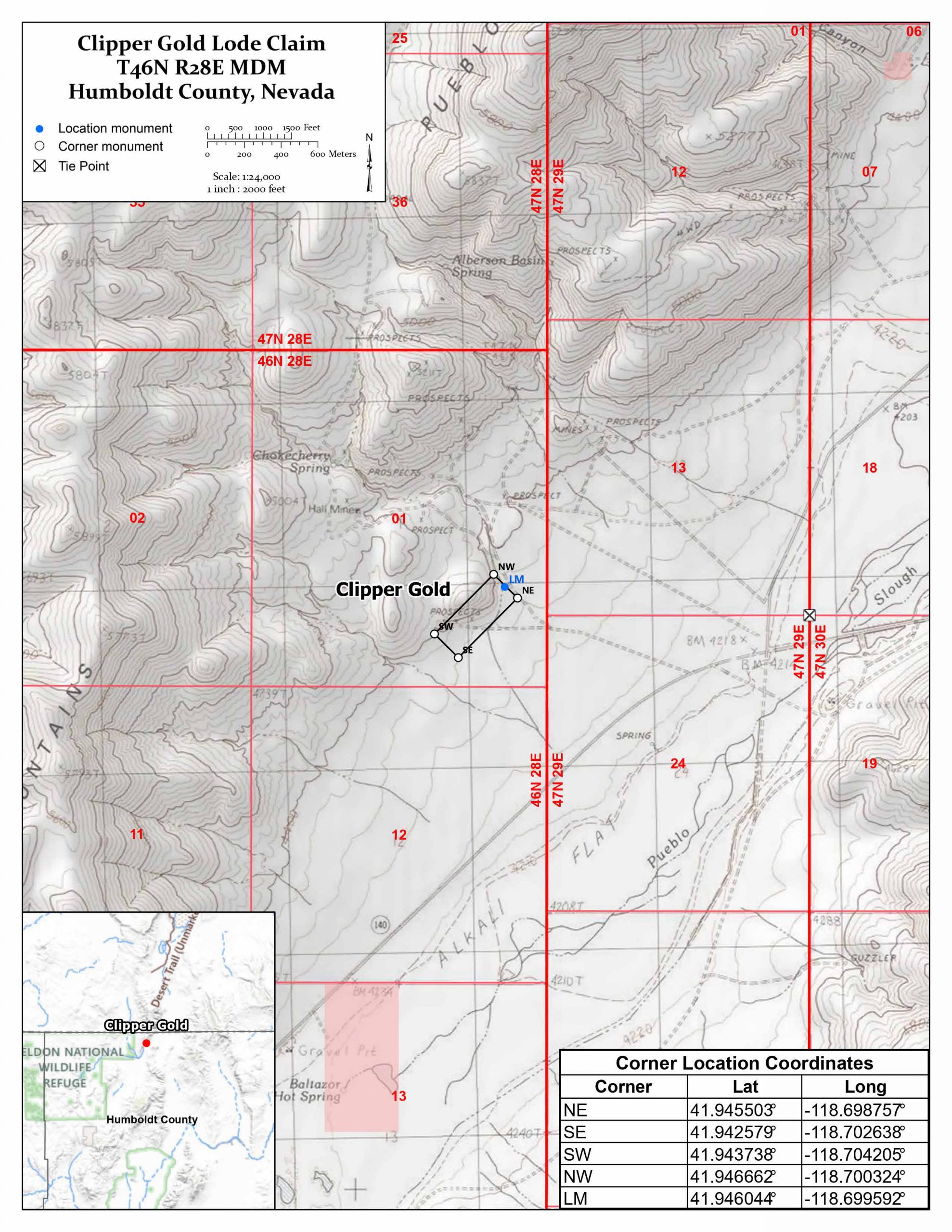
The Clipper Gold mining claim consists of one (1) unpatented lode claim covering 20.66 acres on federal land managed by the U.S. Bureau of Land Management. The claims cover the historical Clipper Group Mine in Humboldt County, Nevada which produced gold and silver (including specimen / native gold).
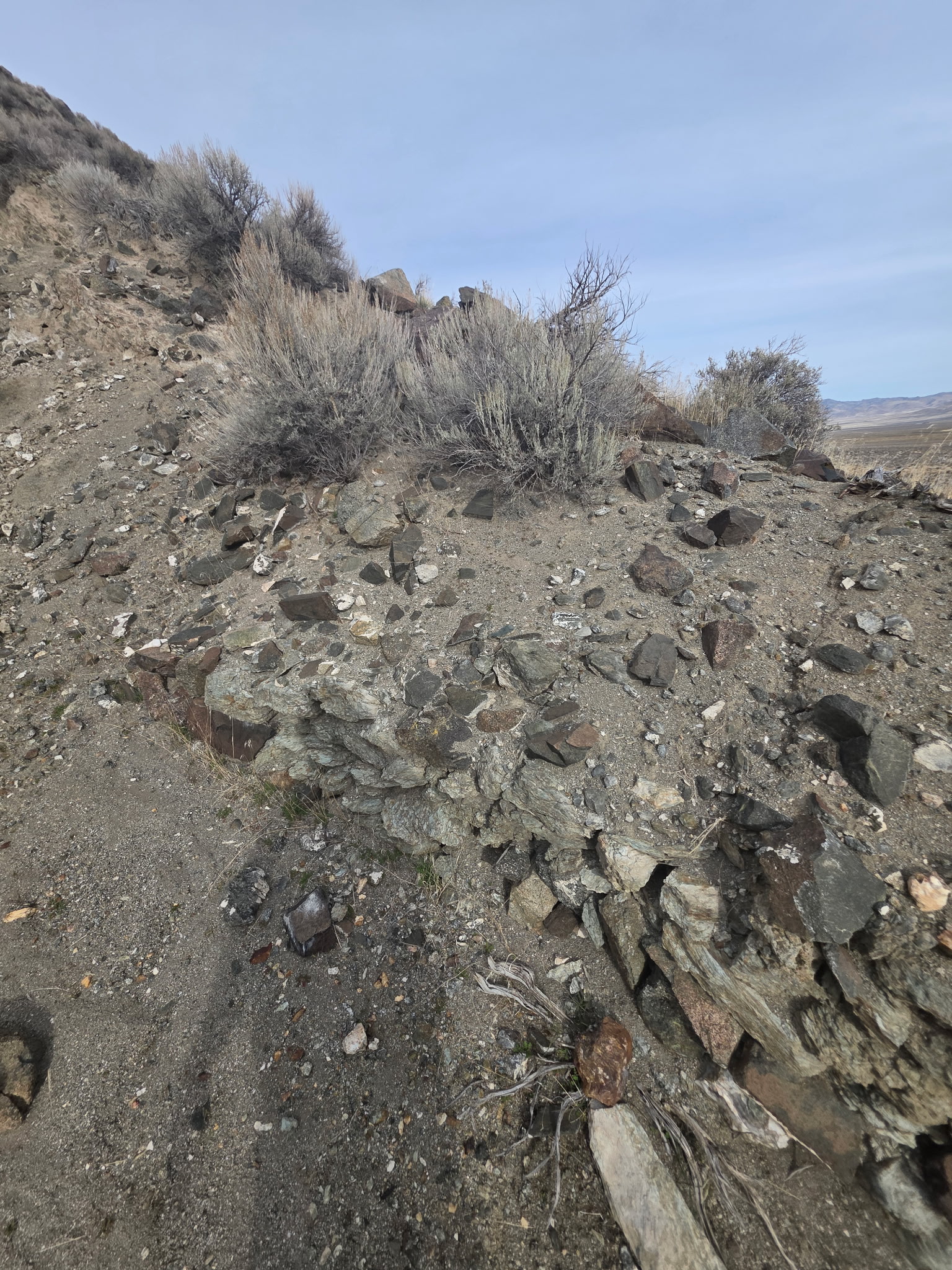
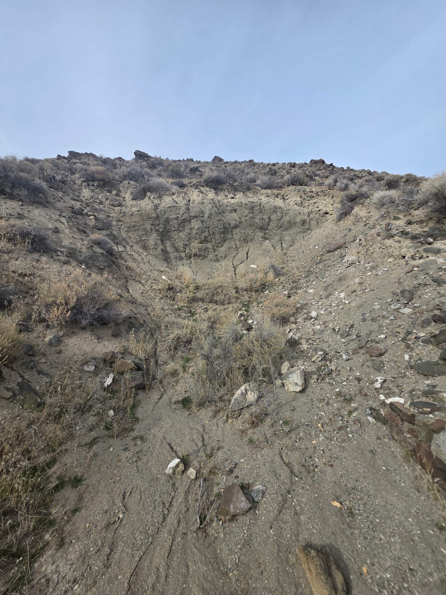
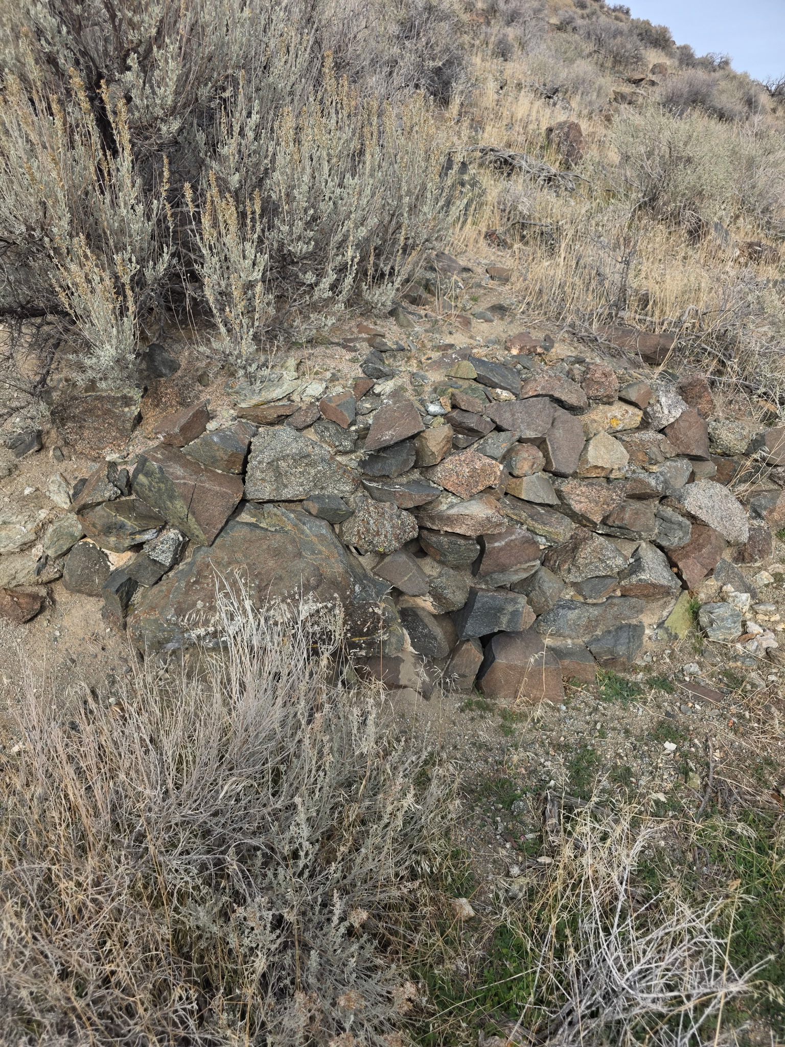
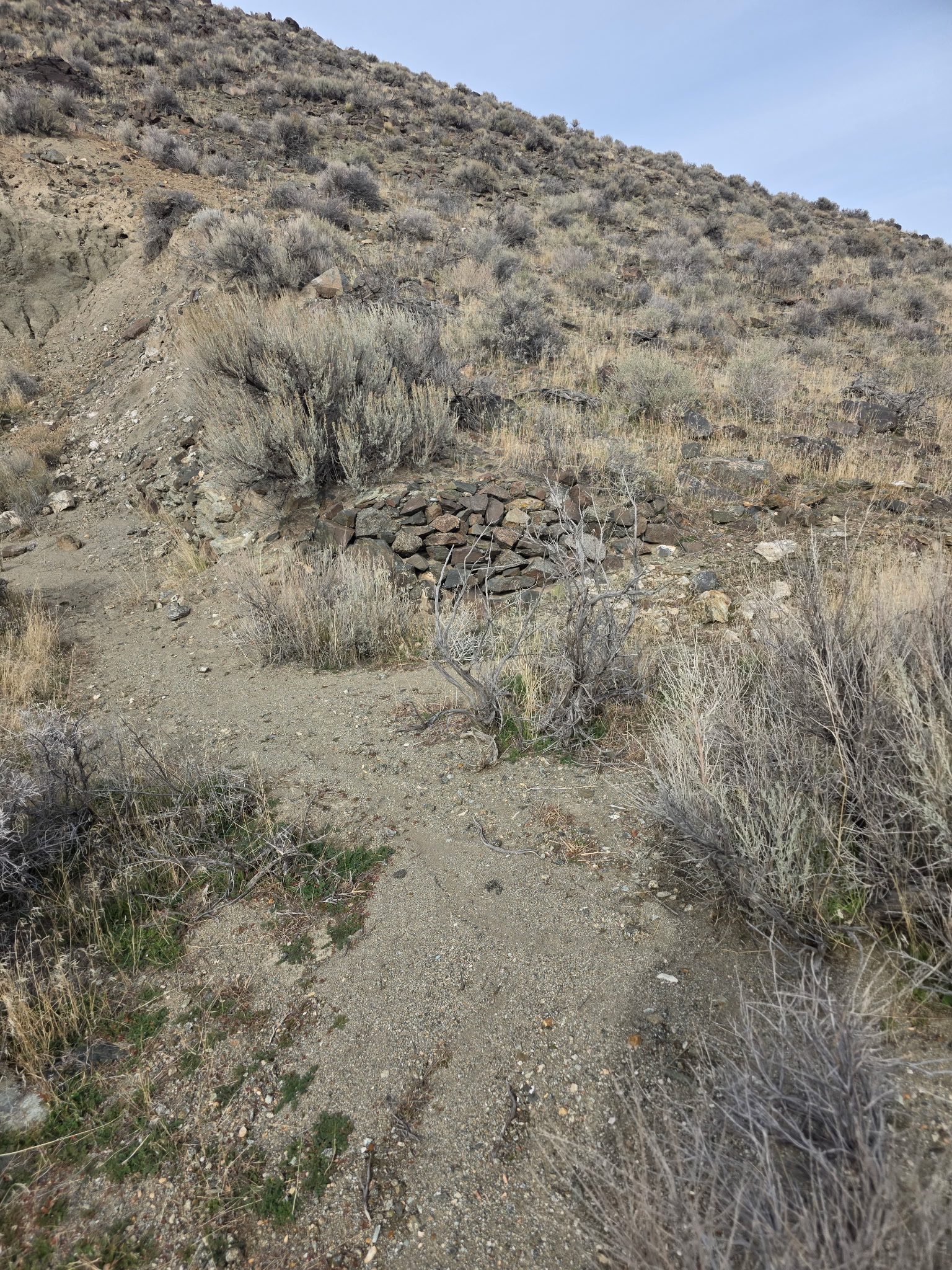
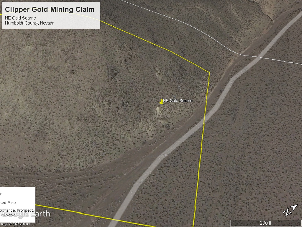
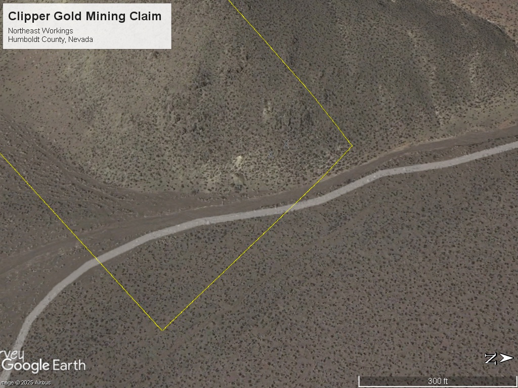
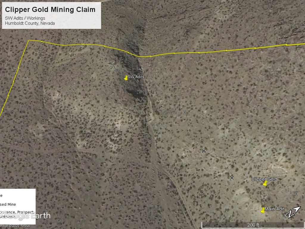
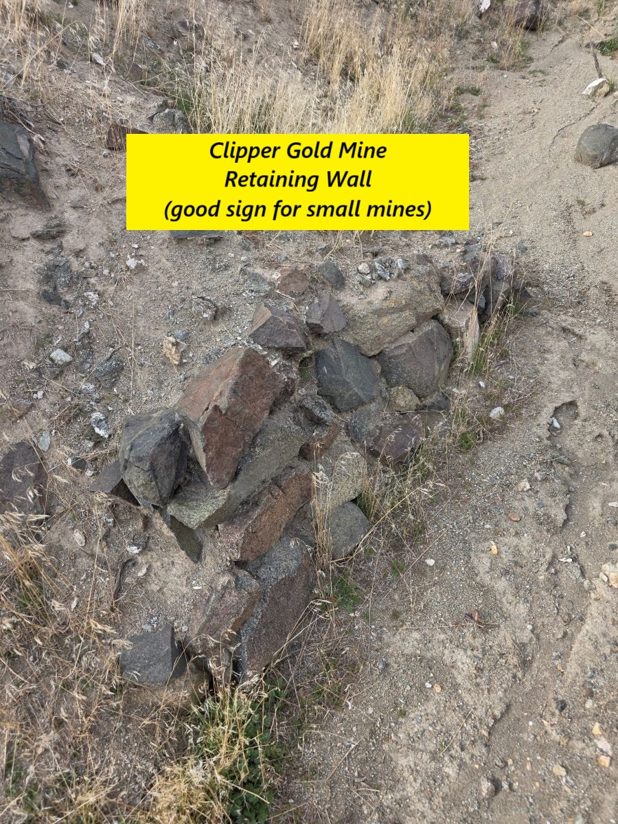
The claim has three (3) mapped adits (partially or wholly caved) and several prospect pits along with dumps and tailings.
This area of Nevada has some of the largest gold and silver mines in the United States, such as the Twin Creeks Mine and Turquoise Ridge, Hycroft, Relief Canyon, Florida Canyon, Lone Tree, Rochester, and Phoenix. There are also numerous advanced exploration projects.
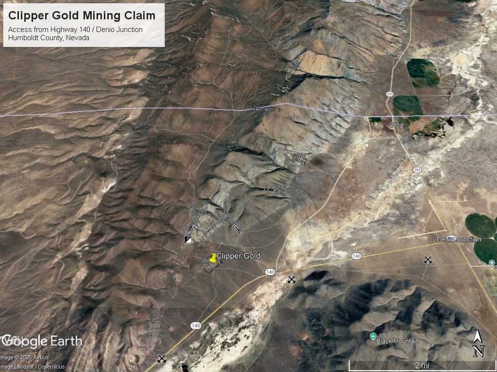
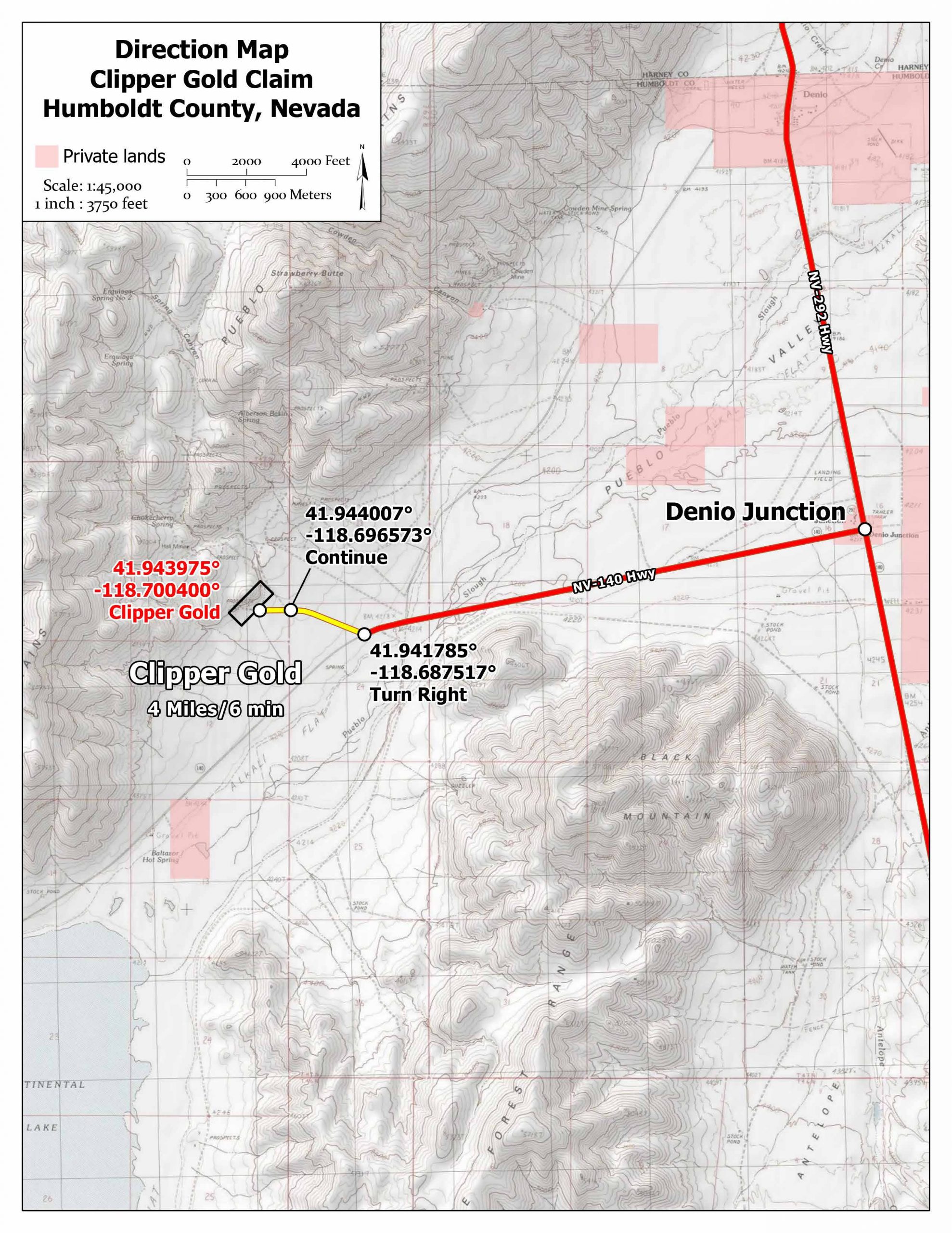
Location and Access: Starting at Denio, Nevada go south on Highway 292 to Denio Junction / Highway 140. Go west on Highway 140 for 3.2 miles to turnoff. Drive .62 miles directly to claim.
GPS Coordinates: Lat: 41.944421° Long: -118.701933° (Clipper Gold main adits).
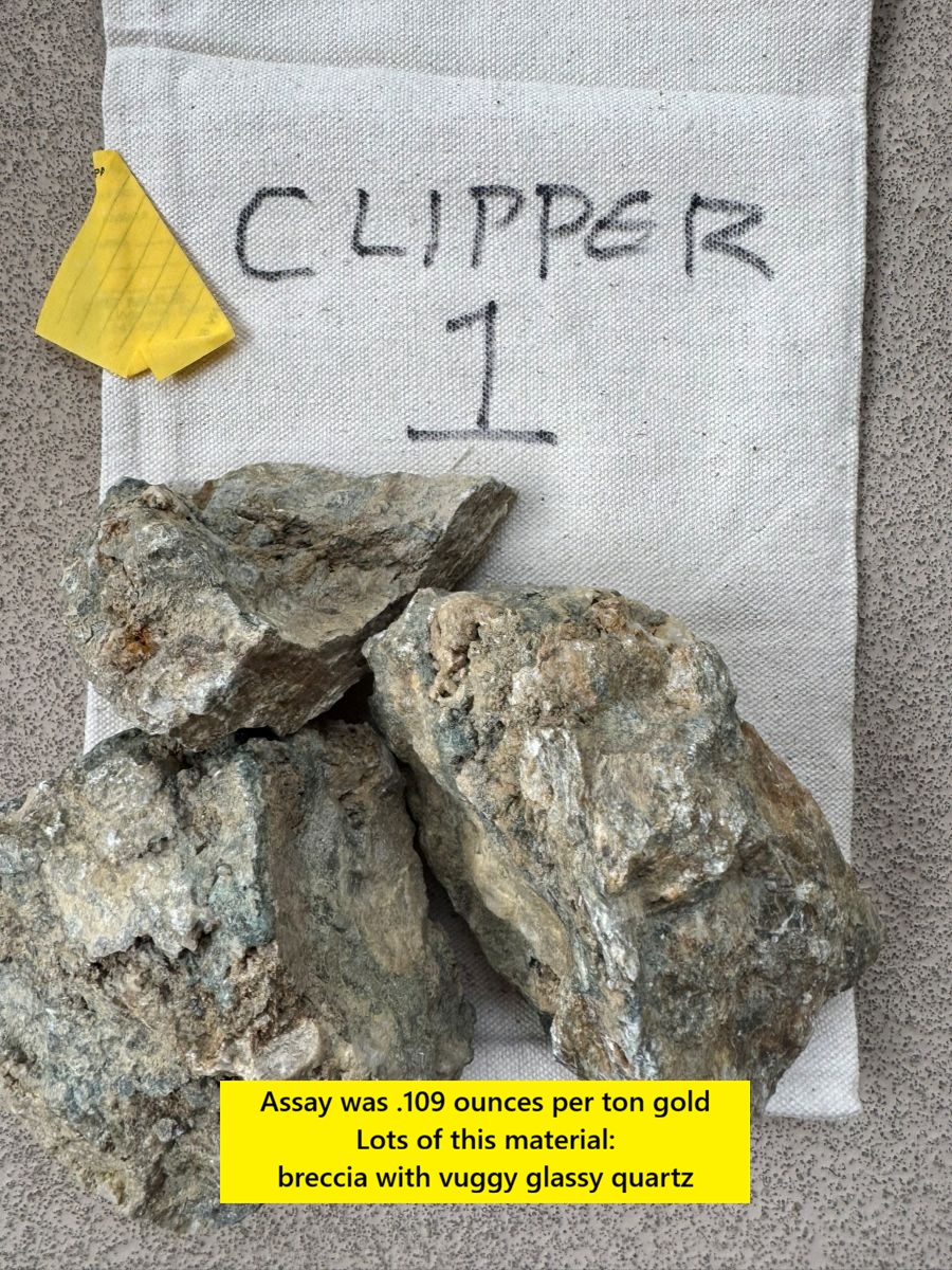
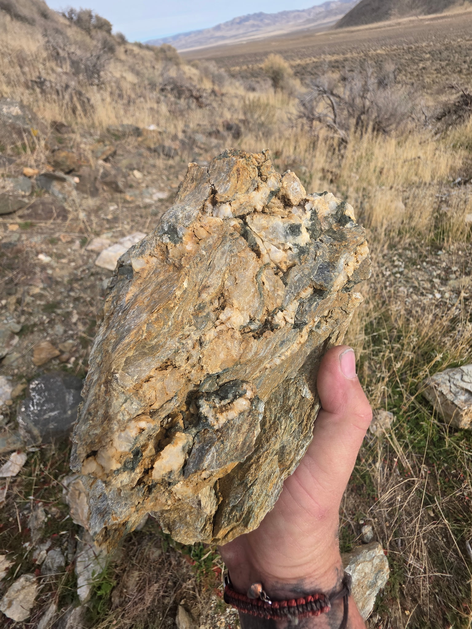
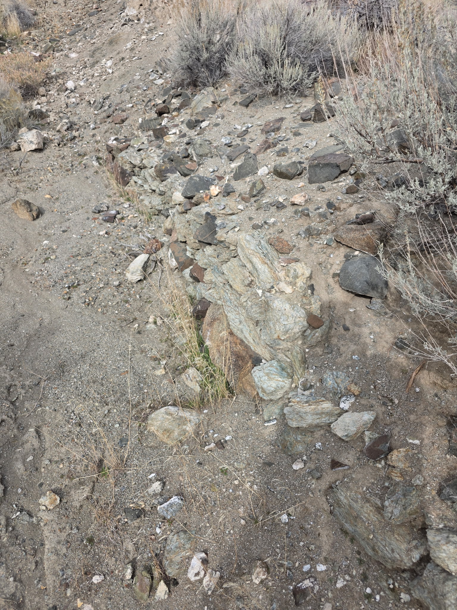
Mining and Exploration Potential: The Clipper Gold Mine was exploiting quartz veins in seams and fissures that would widen into lenses and pods. The nearby Cowden Mine was known as a pocket gold mine – which often produce spectacular grades in small bodies of ore.
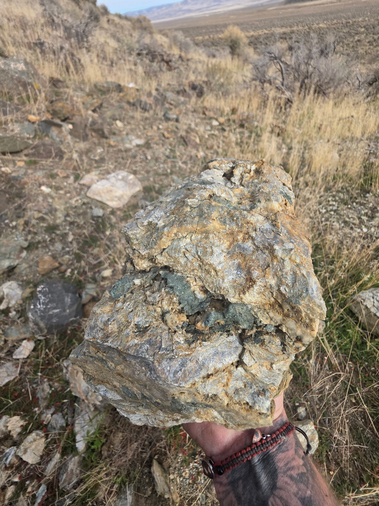
The most striking this about this mine is the massive area of hydrothermal alteration (green-ish rocks). These types of rocks usually occur around very large deposits. Tonopah, which produced 180 million ounces of silver and 2 million ounces of gold, has similar alteration around its deposits.
The pockets and seams of gold are probably the surface expression of a much larger mineralized system. Of special interest is that the mineralization is centered around an anticline structure which can concentrate gold bearing fluids and create large, high grade gold systems.
Anticline deposits are some of the highest grade and most valuable gold deposits in Nevada. For instance, Goldrush holds tens of millions of ounces and is 675 feet wide, 225 feet thick and 3.7 miles long.
In addition to using geophysics, mapping and sampling to find additional veins and pockets of high-grade gold, there is also the potential that geophysics could locate a large, sulphide-rich, bulk tonnage gold deposit.
This area is virgin ground for new exploration and is near some of the top producing districts in Nevada. It would be unusual if this district did not have an economic gold or silver deposit when nearly every other nearby district has one.
The geology is very favorable given the massive evidence of mineralizing fluids, faulting, and historical mining activity.
There is open BLM ground available to expand the claims if needed.
Clipper Gold has the potential for a larger discovery and also small pocket and seam mining – a great combination!
The Pueblo District is located in Humboldt County, Nevada approximately 4.8 miles from Denio, Nevada and 2.5 miles from the Oregon border.
There were four main mines in the Nevada part of the Pueblo District: the Hall Mine, the Clipper Group, the Mohawk, and the Cowden Mine.
All the mines were high grade gold except the Hall Mine – which was mined mostly for copper.
During the last investigation of the area (1984), the Cowden Mine had a full-time resident and miner who reported mining gold from pockets and seams.
The District has seen periodic activity from the 1800’s to the present day. However, there has been no major discovery.
The reputation of the Pueblo District is a ‘pocket mining’ district. Nearby Districts include the National District which was also the home of some of Nevada’s highest grade gold mines.
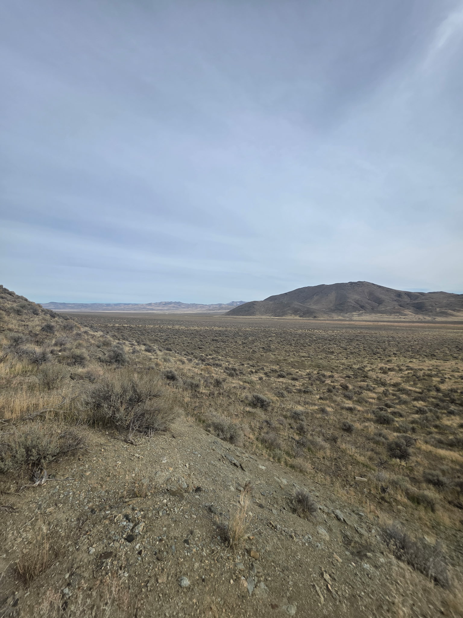
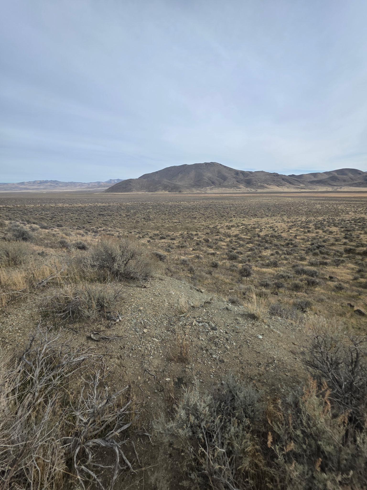
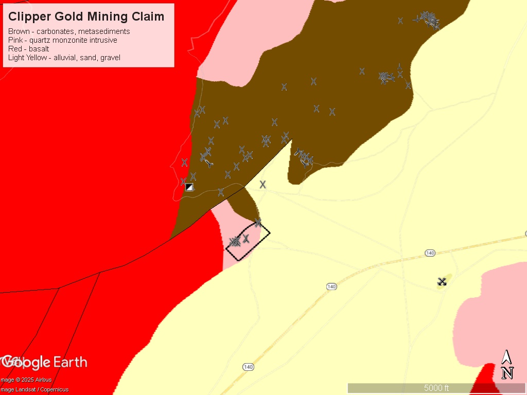
Regional Geology: The Clipper Gold Mine is located within the Basin and Range physiographic province. The Basin and Range province covers most of Nevada and consists of narrow NE trending mountain ranges between flat, arid valleys and basins. The Clipper Gold Mine is along the eastern flank and southern end of the Pueblo Mountains which run northeast into Oregon.
Local Geology: The geology of the property and nearby area is discussed in detail in a private geological report by D.L Evans.
Regional Faulting: major northeast trending fault that runs parallel to the Pueblo Mountain Range. This fault could be responsible for the line of springs along it, the mountain escarpment, and control the mineralization.
Local crosscutting faults – running NW-SE across the main regional fault and localizing the vein systems.
Massive metamorphism around the main regional fault. Northeast trending chloritic schist flanked by gneiss on both sides represents an aniticlinal fold. This shows intense metamorphic alteration turning shales and volcanic rocks into schist and gneiss.
The historic mines may have been leakage from the limbs of the anticline along erosional surfaces. This would mean that the main anticline target remains to be discovered. Anticline features are excellent traps for gold deposits to form (see my note about anticlines above).
The Clipper Gold claim has an area of bleaching and argillic alteration that coincides with the workings. This is a very good sign! This is central to the surrounding deposits – the Cowden and Hall mines as well as the Mohawk.
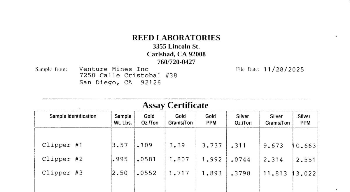
Quartz veins are both hard and glassy and in pockets sugary and vuggy – perhaps two different mineralizing events (see vein pictures above).
The gold deposits in the area were found in thin seams and fissures which widened into vuggy pockets and lenses. The original vein system may have also been moved and disrupted by local faulting and dissolved and re-deposited in pockets due to heat and fluids from the faults.
Available Reports:
Evans, D.L, Nevada Inn and Bingo Properties, Private Geological Report, 1968.
Quade, J., Cowden Mine Report, Nevada Bureau of Mines, 1984.
Quade, J., Hall Mine Report, Nevada Bureau of Mines, 1984.
Willden, R., Geology and Mineral Deposits of Humboldt County, Nevada, Nevada Bureau of Mines, 1964.
FAQ
Why Nevada?
Nevada is consistently ranked as one of the top mining jurisdictions in the world for being mining-friendly and continuing to produce major discoveries. If Nevada was a country it would be the 5th largest gold producer in the world (after Australia, Canada, China, and Russia). Nevada is home to the Carlin Trend, the Cortez Trend, the Walker Lane Trend, the Getchell Trend and many other prolific gold producing regions. In addition to gold Nevada also has major mines producing silver, copper, lithium, iron ore, magnesium, gems and many other minerals. Nevada is 85% owned by the federal government and most of this land is available for claim staking. This means some of the best mining ground in the world is open to small prospectors – a very unique situation. There are many mining companies active in Nevada and therefore, multiple potential buyers for any discovery you make. Canadian based junior exploration companies are particularly active in Nevada.
Why Buy a Claim?
Buying a claim is a great way to get started in mining and prospecting. Buying a claim that is professionally staked reduces your upfront work and the risk of making a mistake on your paperwork or in the field. Our claims are in areas with historical mining activity and most have numerous pits, shafts, and adits to explore. Finding these claims takes lots of research that is already done for you. The best place to find gold is where people have already found it!
Why Us?
I have been working in mineral exploration in the southwestern United States and Alaska for 23 years. I have co-founded four junior mining companies and managed numerous drilling and exploration projects. I have worked with large and small mining companies and know what types of projects they are looking for that can be advanced by small prospectors. I have also worked on small hardrock production projects. I usually try to find claims that have known high grade veins that can be produced and that also have some exploration upside. We stand by our claims and fix any problems that come up. We can also help you with your annual filings. All our claims have professionally drafted maps.
How is ownership of the claim transferred?
Ownership of mining claims is transferred with a Quitclaim Deed which we prepare. We pay all claim transfer fees and file the claim transfer paperwork with the BLM and Humboldt County. The BLM takes about 2-3 weeks to process the claim transfer and register the claim in your name. The Humboldt County Recorder usually returns the recorded Quitclaim Deed in less than 2 hours if filed electronically. Once the transfer is complete we will send you all the original documents including the file stamped Quitclaim Deed, the original location notices and claim maps.
How Much are the Annual Claim Fees?
The BLM charges a $200 per claim annual maintenance fee which is due on September 1st each year. The BLM fees can be paid online through their claim management portal. Humboldt County requires that a Notice of Intent to Hold form is filed the first year by Nov 1st along with payment of the recording fee of $12 plus $12 per claim.
If you own less than 10 mining claims you can qualify for a waiver of the annual maintenance fee by filing a Small Miner’s Waiver. However, the Small Miner’s Waiver requires that you perform $100 in labor or improvements on the claim each year.
International Buyers
International buyers must either have dual US citizenship and US address or have a US entity or company to own the claim.
Ebay Local Pickup
Real estate on Ebay is listed as ‘local pickup’ since it cannot be shipped. But the claim transfer can be done electronically and through the mail. No need to pickup in person!