COWAN BAR PLACER GOLD
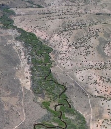
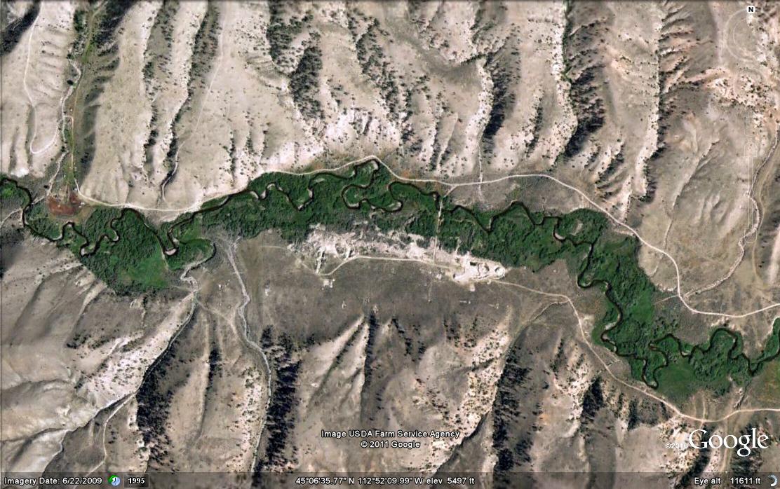
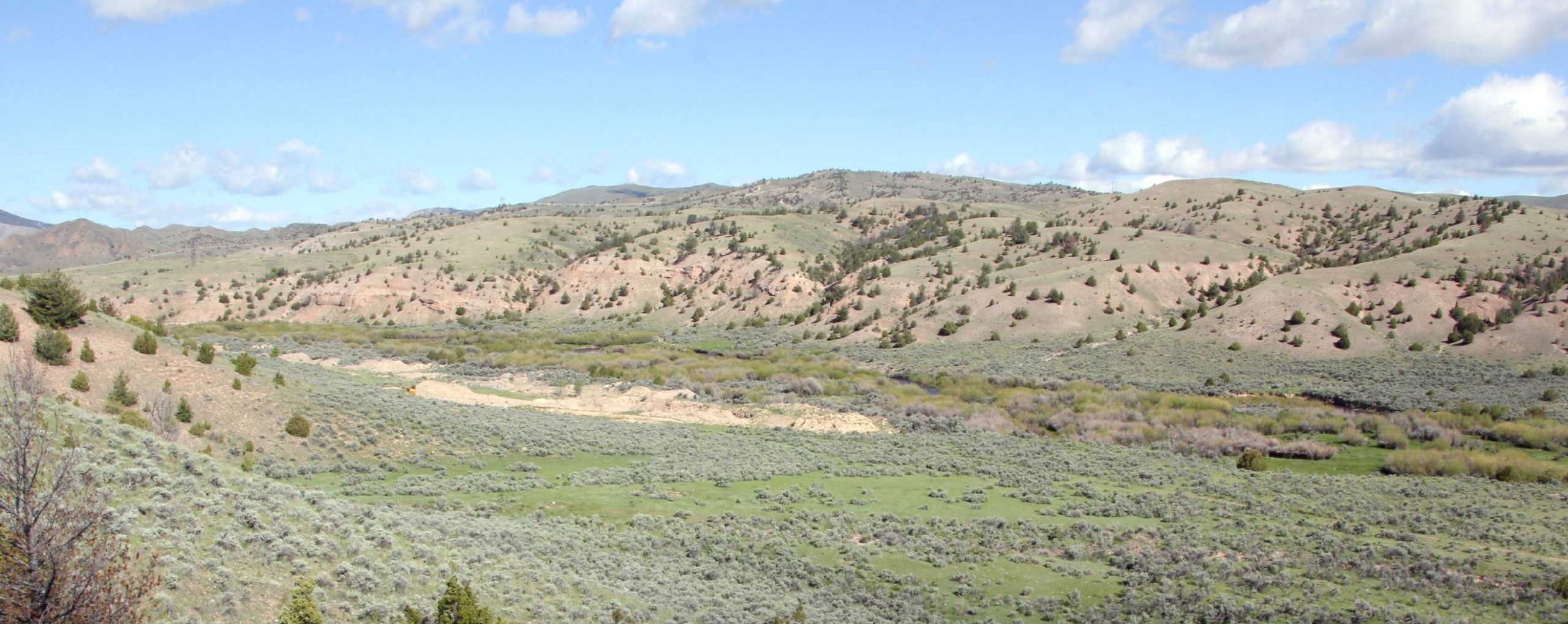
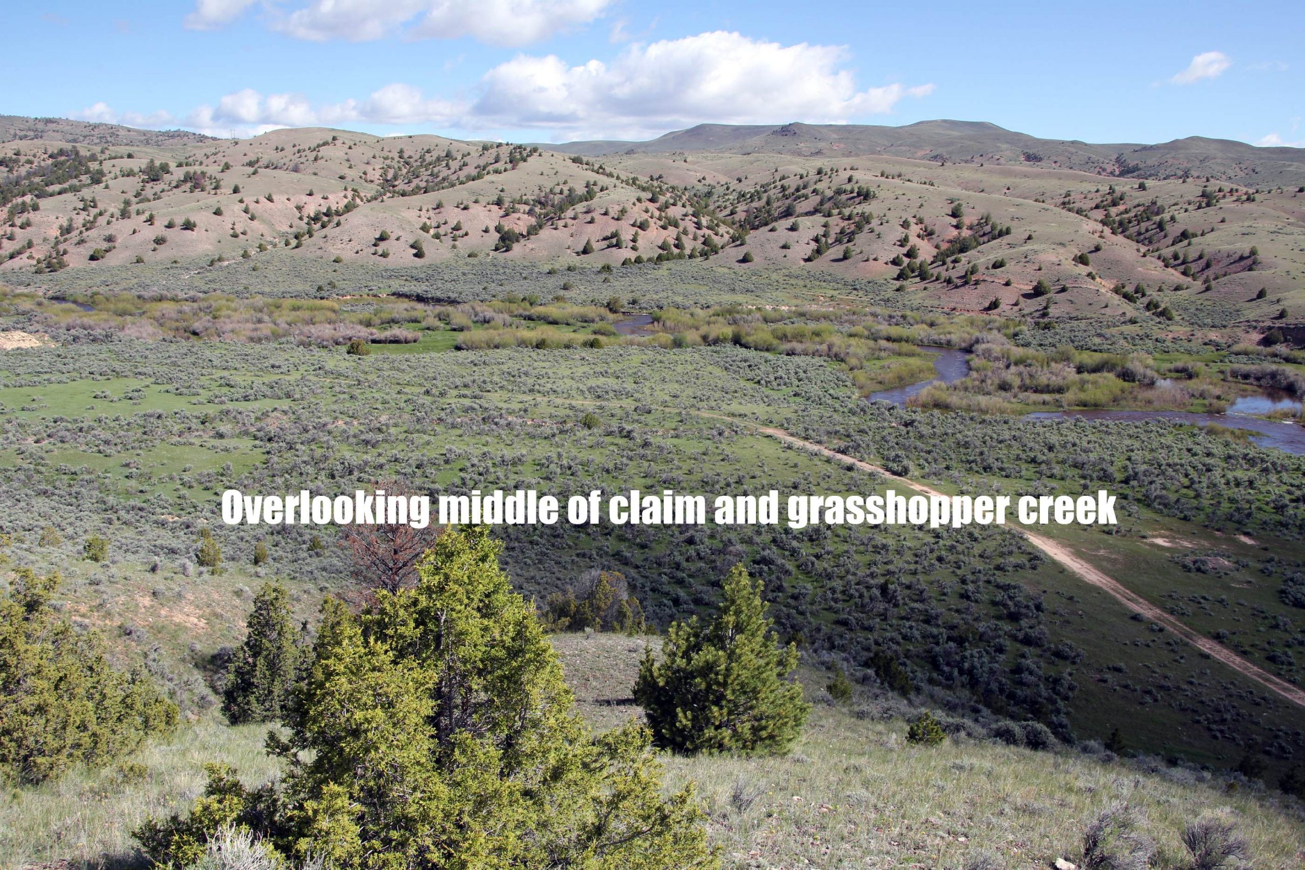
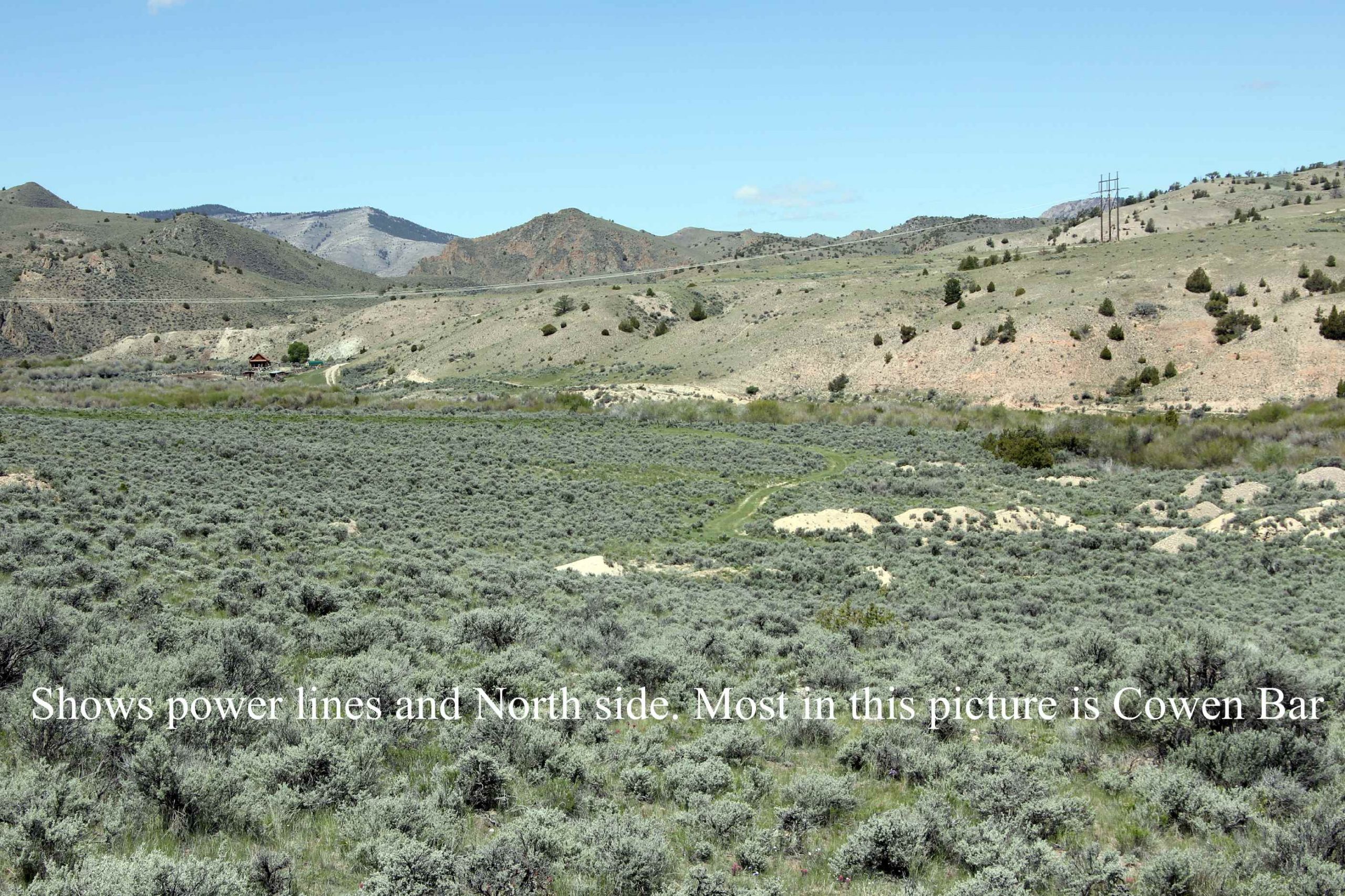
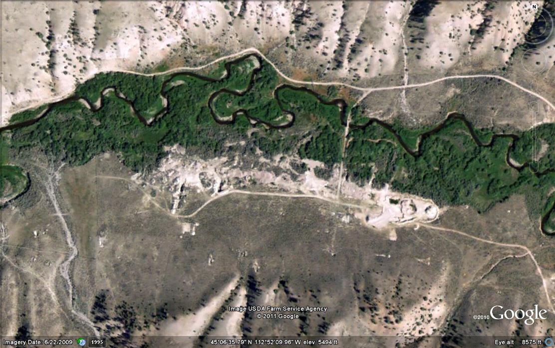
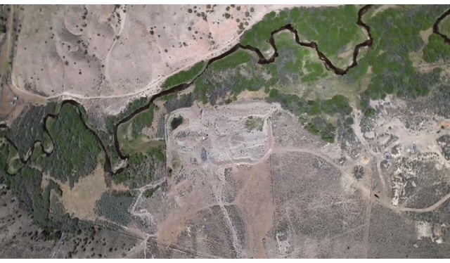
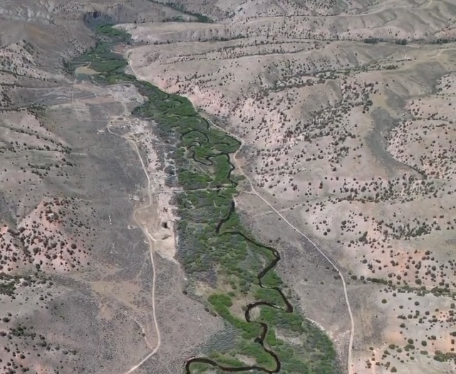
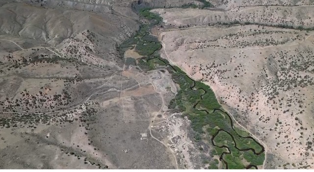
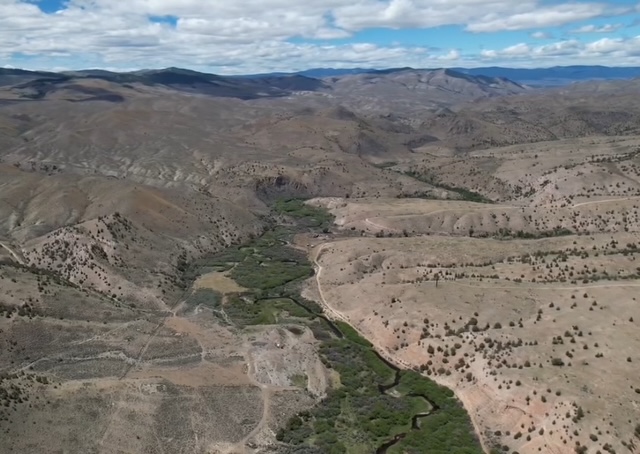
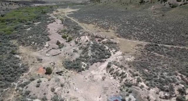
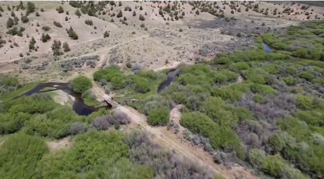
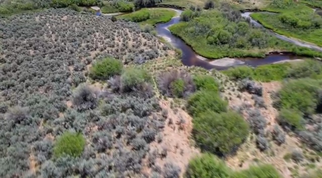
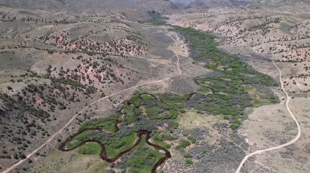
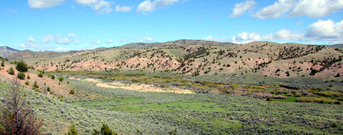
The Cowan Placer Gold Property consists of six (6) private parcels, covering 89.25 acres, in the historic Bannack Mining District near Dillon, Montana. The claim covers over 1 mile of the meandering Grasshopper Creek with rich placer gold deposits that have been drill tested.
A report on the property from 1987 estimates gold resources on the Cowan Bar Placer Property at 63,900 ounces (3.55 million cubic yards at .018 ounces per cubic yard).
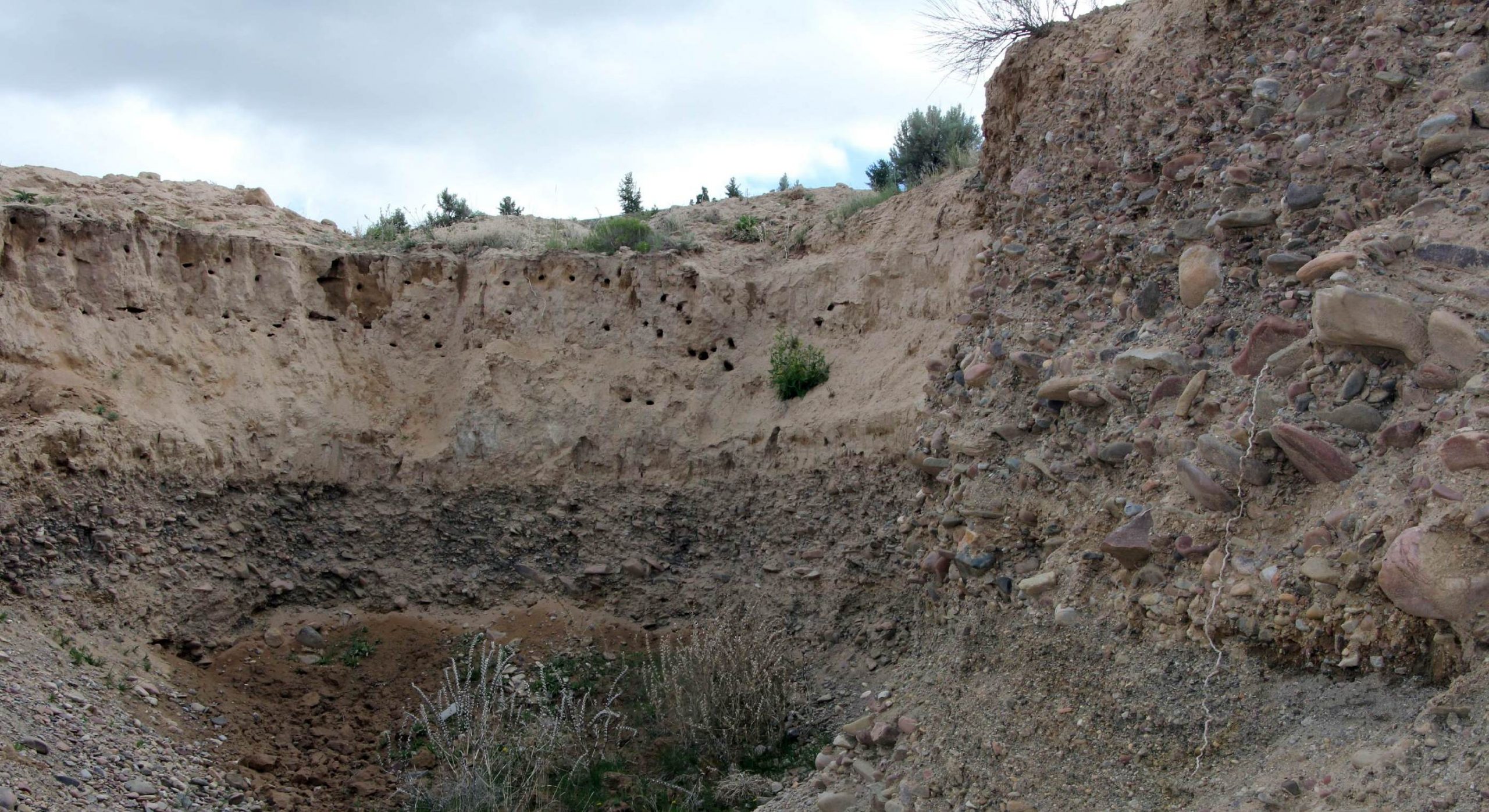
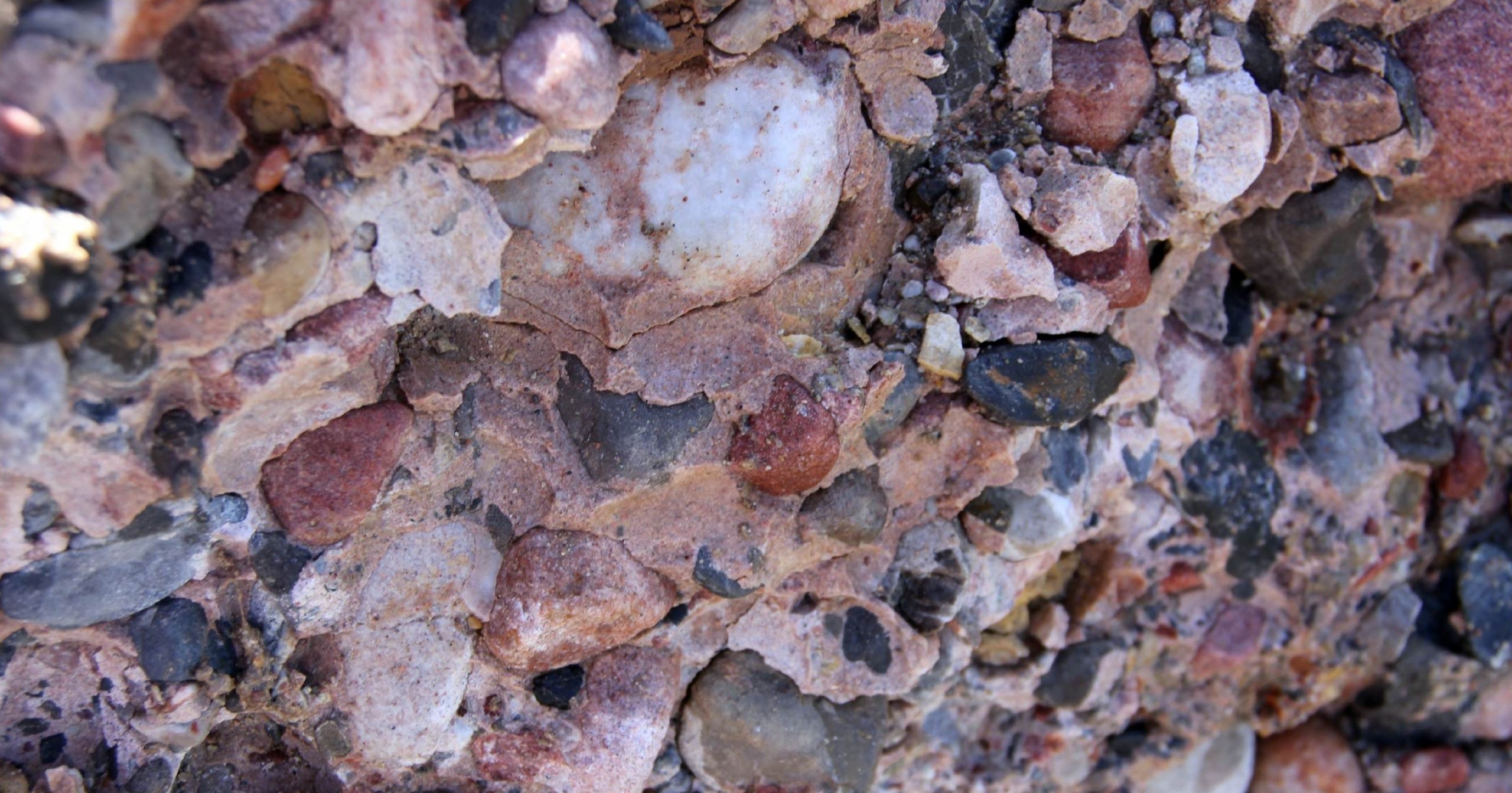
There is 2-6 feet of overburden with over 40 layers of pay gravels. There are also some deeper cemented gravel layers that have not been included in the calculations that could be a valuable source of gold. One test of the cemented gravels gave a value of .461 ounces per ton.
Visitors report panning gold in every pan. It is downstream from Bannack, the site of one of Montana’s biggest gold mining boom towns in the 1860-70’s.
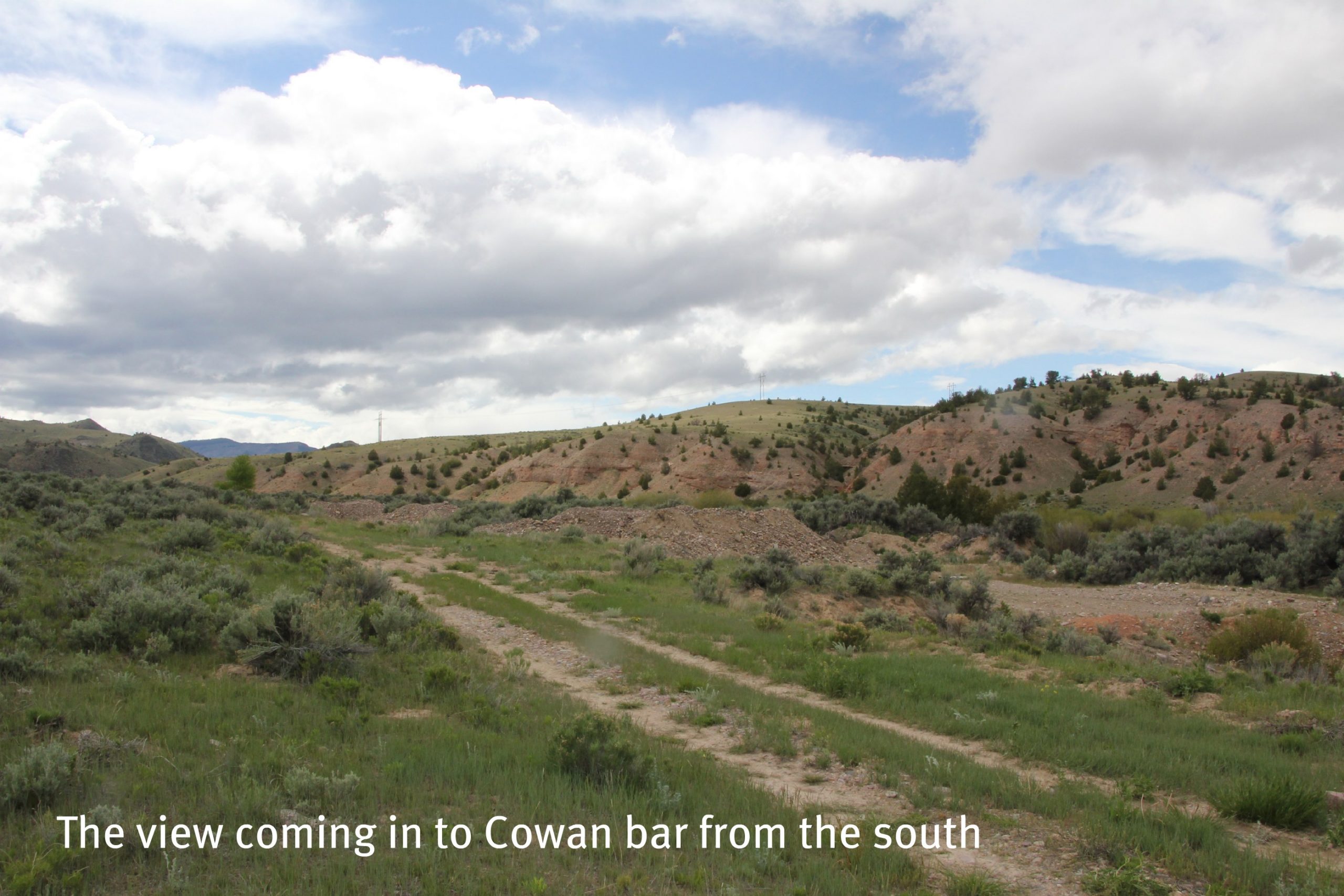
Directions: The Cowan Placer is located 7.4 miles east and downstream of Bannock along the Grasshopper Creek. Access to the property starts 19.3 miles south of Dillon, Montana along Interstate Highway 15, continue 3 miles west on Highway 324 along the north shore of Clark Canyon Reservoir and another 10.5 miles north along a BLM gravel road.
GPS Coordinates: Lat: 45.111112°, Long: -112.867671° (Road Access to Grasshopper Creek)
Mining and Exploration Potential: The Cowan Bar Placer is an advanced exploration and production property that could be developed into a large commercial placer gold mine.
Cowan Bar could support up to a 10,000 yard per day operation, but could also be developed at a smaller, 1,000 yard per day operation.
The 1,000 yard per day mine could be run with 3-4 people using standard placer equipment and a recovery system optimized for the particle size.
The property comes with water rights that cover the entire output of the creek and are sufficient to support the larger mine size.
Cowan Bar is on par with the larger commercial placer mines in Alaska or Yukon, but could be developed and operated at a fraction of the costs.
Commercial dredging is a possibility here and would lower operating costs substantially – albeit with higher upfront capital costs.
However, with current infrastructure a 1,000 yard per day operation could be put in place very easily with a reasonable investment.
This type of operation could generate between $50,000 and $150,000 in revenue per day.
There are extensive drill records, assays, reports and other supporting materials. However, additional exploration may be required.
There are several exciting possibilities for expanding the resource size by up to 5-10x by taking into account all of the layers – including the cemented gravels. There is also potential for turning this project into a hardrock open pit mine at depth.
No systematic and modern professional sampling and testing has been done on this property. There is a huge opportunity to upgrade the resource and make additional discoveries.
One issue that has hampered development in the past was the ineffective recovery techniques for flour and small particle size gold. However, with centrifugal concentrators and other methods this should be no problem.
The mining season in Montana would be approximately six months.
The town of Dillon, Montana is nearby and could provide a base with supply sources, restaurants, hotels, etc.
The Bannack District lies in Beaverhead County, Montana in the southwestern part of the state. Grasshopper Creek (where Cowan Bar is located) is approximately 30 miles long and flows eastward through the Pioneer Mountains in southwestern Montana, eventually joining the Beaverhead River near the town of Dillon in Beaverhead County.
Grasshopper Creek was visited by Lewis and Clark as part of their expedition in 1805. It was rediscovered by prospectors from Idaho in 1862 when gold was discovered in the Grasshopper Creek.
The early prospectors were very successful and it is reported that $600,000 of gold (30,000 ounces) was taken out of Grasshopper Creek in the first year after discovery.
Grasshopper Creek was the first major gold discovery in Montana and news traveled quickly. By 1863, Bannack had a population of 3,000 people. It became the first capital of the Montana Territory.
The first lode discovery was the Dakota claims on the northwest side of Grasshopper Creek. The ore average $18 per ton (at $20 per ounce gold).
Many other lode mines were discovered around Bannack – mostly to the southwest of Grasshopper Creek. The lode mines were mostly at the contact of the large intrusive centered around Bannack.
In 1890, dredges were brought in to work the creeks. These operated until 1902.
Total production in the Bannack District is estimated at 500,000 ounces. Most of the production came in the early periods before good records were kept.
Placer mining accounted for 75% of the production and lode contributed about 25% of total production.
The biggest lodes mines in the district were the Gold Leaf (or Sleeping Princess), Excelsior, Hendricks, Gold Bug and Dakota. The average grade of the mines was about 1 ounce per ton gold.
The Gold Leaf was the largest producer by far and produced about 100,000 ounces of gold.
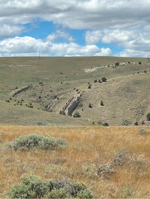
Geology: The geology near Grasshopper Creek is defined by thick deposits of the Beaverhead Formation, which consist of conglomerates, sandstones, and limestones derived from nearby uplifts. These sediments were deposited during the Late Cretaceous to early Eocene as debris shed from rising mountain ranges during the Laramide orogeny. Glacial activity and large flood events also shaped the valleys and may have cemented the older placer gravels.
The gold-bearing quartz veins in the Bannack Mining District formed along faults and fractures near the contacts between the limestones and the granodiorite intrusives. Rich contact areas are marked by abundant garnets and epidote.
The principal lode deposits are replacement bodies in limestone or marble (or skarn). The gold veins are mostly free milling.
The placer deposits at Cowan Bar had multiple periods of deposition and are really many different placer deposits built on top of one another. At the bottom are the cemented gravels then bedrock.
Available Reports:
Geach, R.D., ‘Mines and Mineral Deposits, Beaverhead County, Montana’, Bulletin 85, Montana Bureau of Mines and Geology, 1972.
Miller, Gosta, Letter to Prescott Underwood, Private Correspondence, 1980.
Mulholland, P., ‘Cowan Placer Property, Bannock Mining District’, Private Report, Rough Stock Mining Services, 2020.
Pearson, R.C., ‘Argenta to Bannack, Beaverhead County, Montana, Road Log and Field Trip Guide for American Institute of Professional Geologists, Summer 1988’, Open-File Report 88-412, U.S. Geological Survey, 1988.
Skoog, E.W., ‘Cowan Bar Placer Exploration Report’, Private Report, 1991.
Winchell, A.N., ‘Mining Districts of the Dillon Quadrangle, Montana’, Bulletin 574, U.S. Geological Survey, 1914.