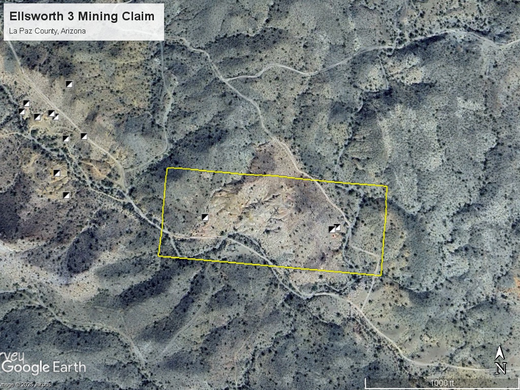
Ellsworth 3 Mining Claim
The Ellsworth 3 mining claim consists of one (1) unpatented lode claim covering 20.66 acres on federal land managed by the U.S. Bureau of Land Management. The claims cover a former producing gold-silver mine located in the Ellsworth Mining District in La Paz County, Arizona.
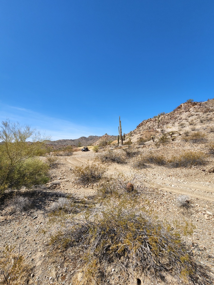
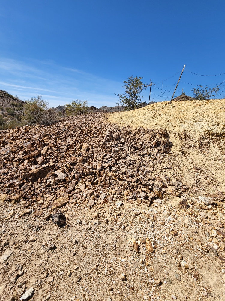
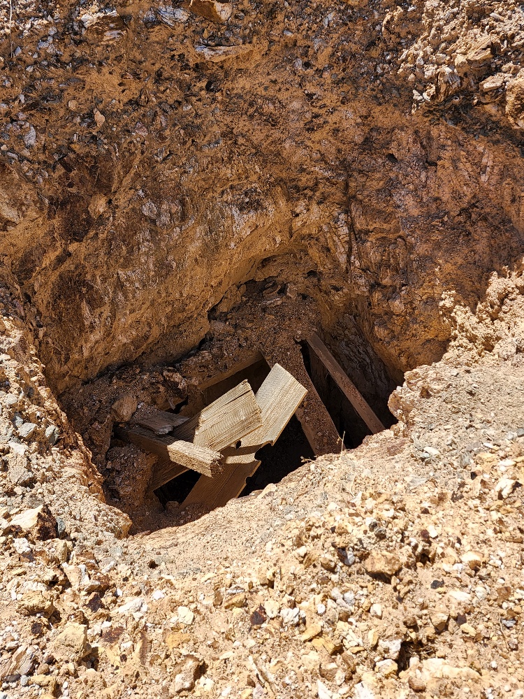
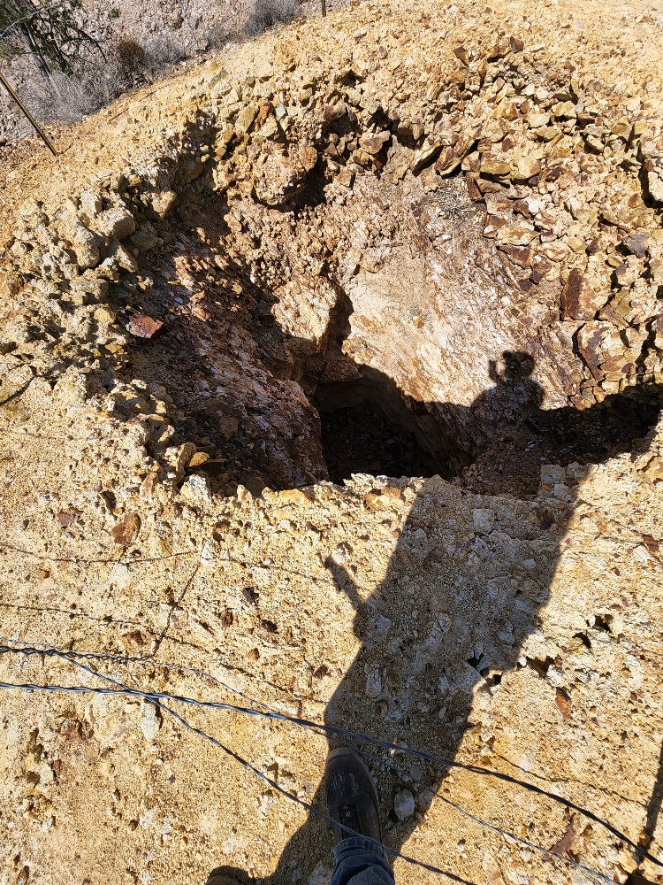
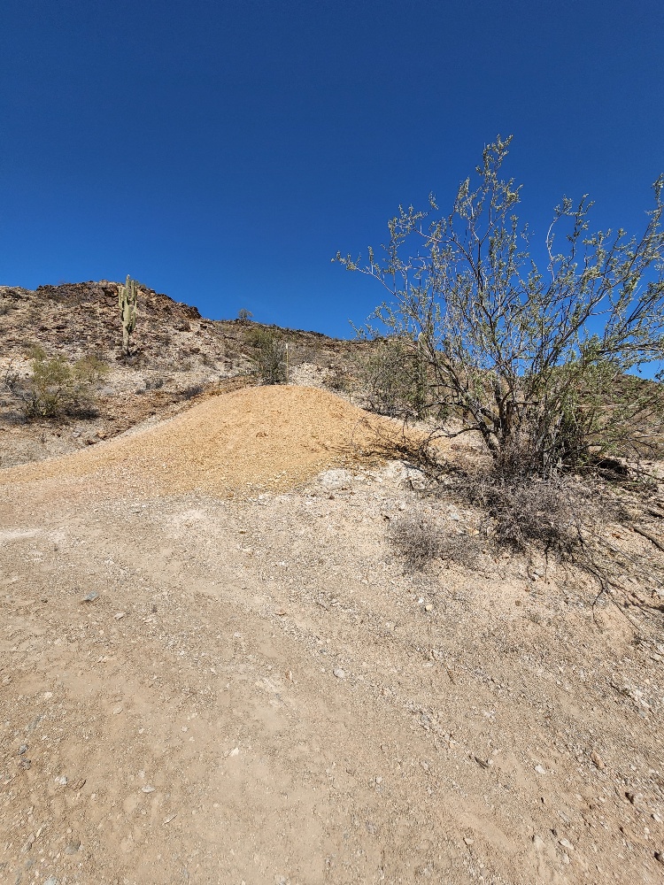
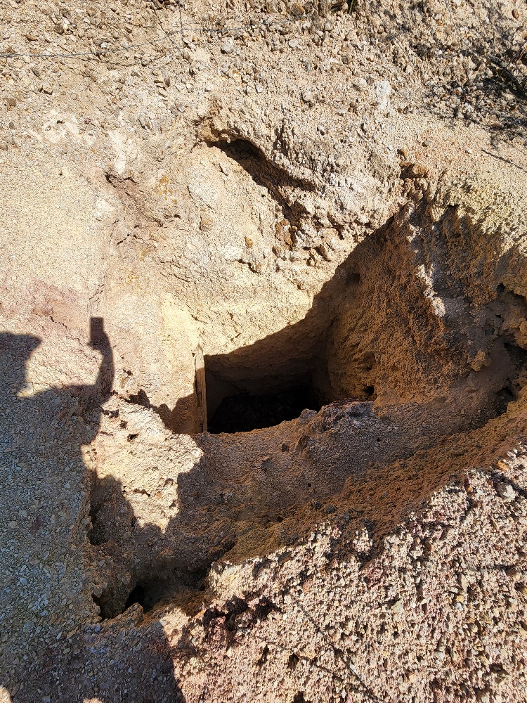
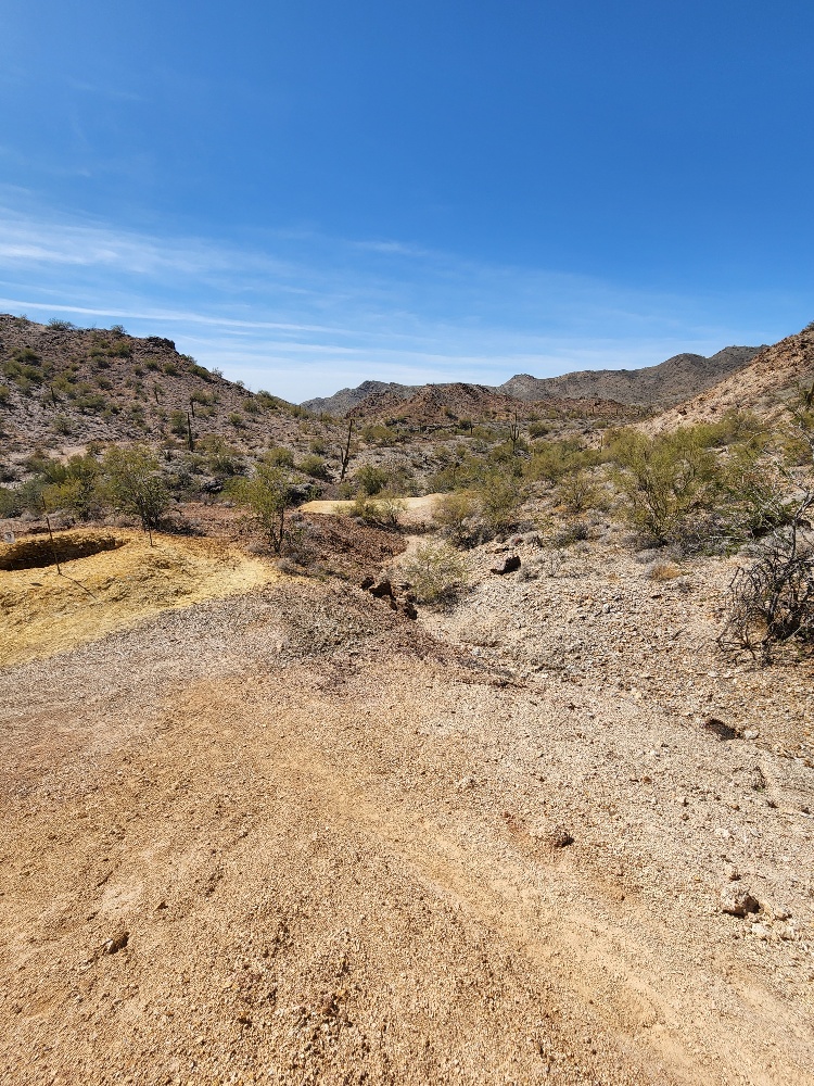
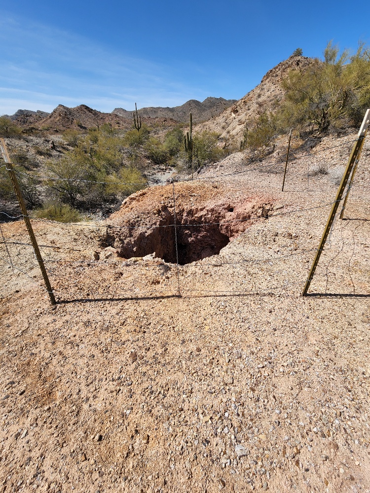
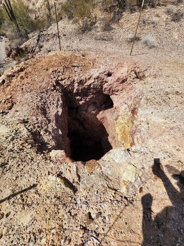
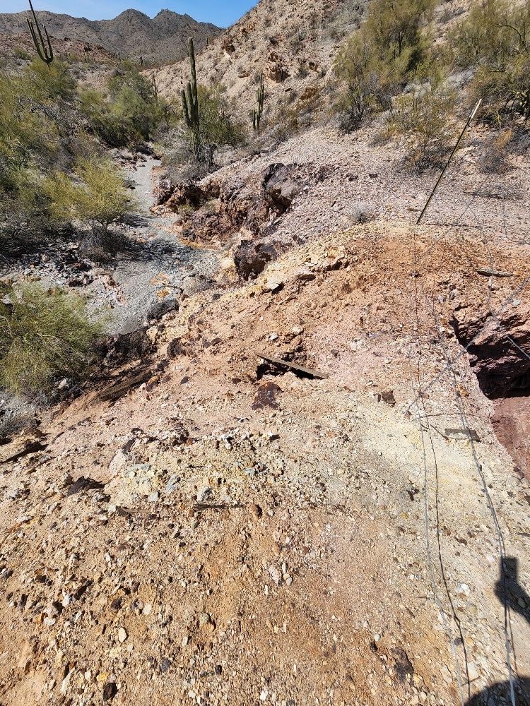
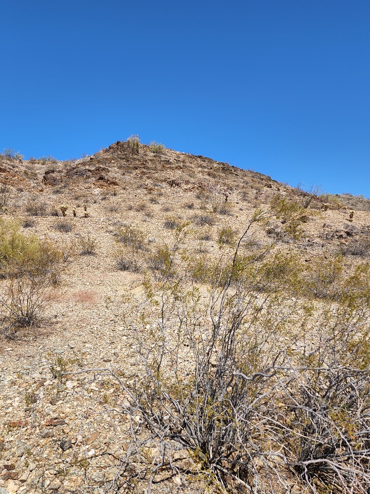
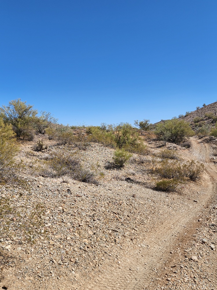
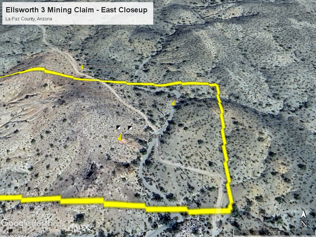
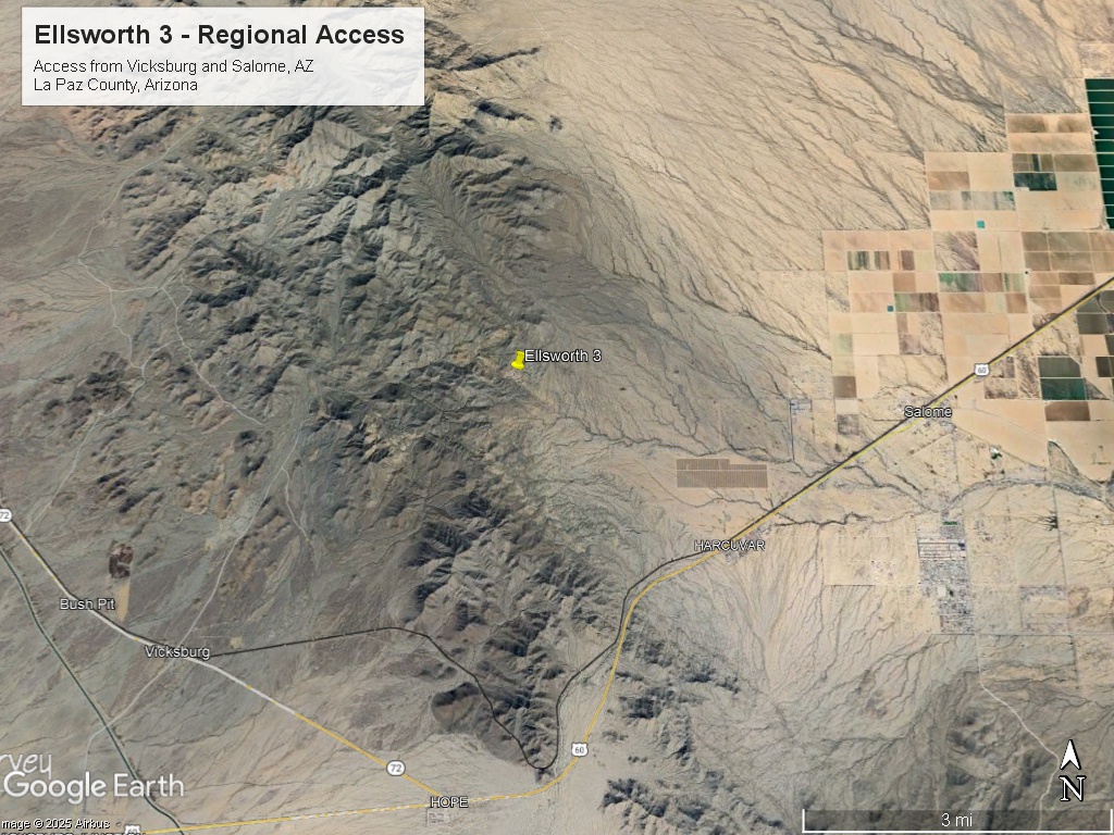
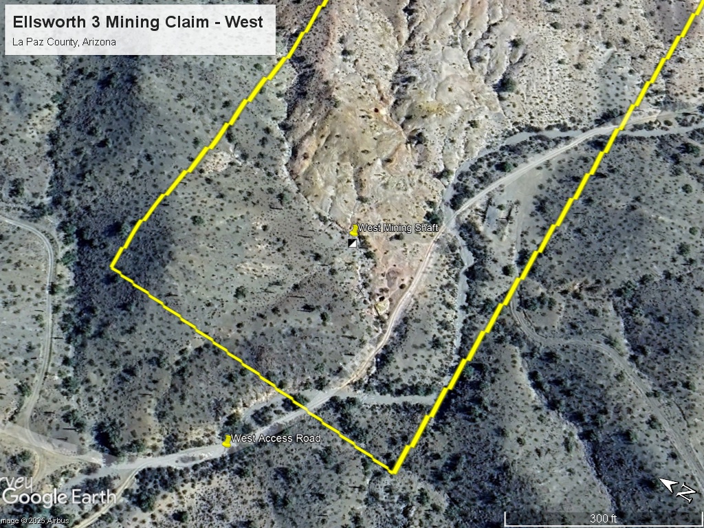
The claim has three (3) shafts (some partially caved), several prospect pits, ore dumps and tailings. There is road access (two roads) through the claim and to the nearby town of Salome, Arizona (off Highway 60).
The Ellsworth District has several high-quality mining and geological reports available – including a Master’s Thesis on the Granite Wash Mountain, geological reports on the mines, assays, and production records. There is also a detailed professional geological map available.
We have had good luck with both dry washing and nugget detecting in this area.
Location and Access: From Salome, Arizona / Highway 60 take Hall Avenue west for 2.7 miles until you get to dirt roads. Take right fork of dirt road and drive 1.8 miles to the claim.
GPS Coordinates: Lat: 33.786944° Long: -113.691504° (East Shafts – just to west of NE road).
Mining and Exploration Potential: The Ellsworth 3 mining claim offers the chance for additional high grade gold veins, polymetallic veins, and bulk tonnage gold deposits.
In addition, there were high grade telluride gold ores found in the area that might offer a home run potential if they could be located. Sorted ores were ran as high as 100 ounces per ton gold. However, subsequent explorers were unable to locate these veins. Soil sampling that includes tellurium could potentially located more of these rich ores.
On a nearby vein in the Ellsworth District we had a gold vein run 6 opt. Also, we found gold in the washes and from metal detecting the walls of the historic workings.
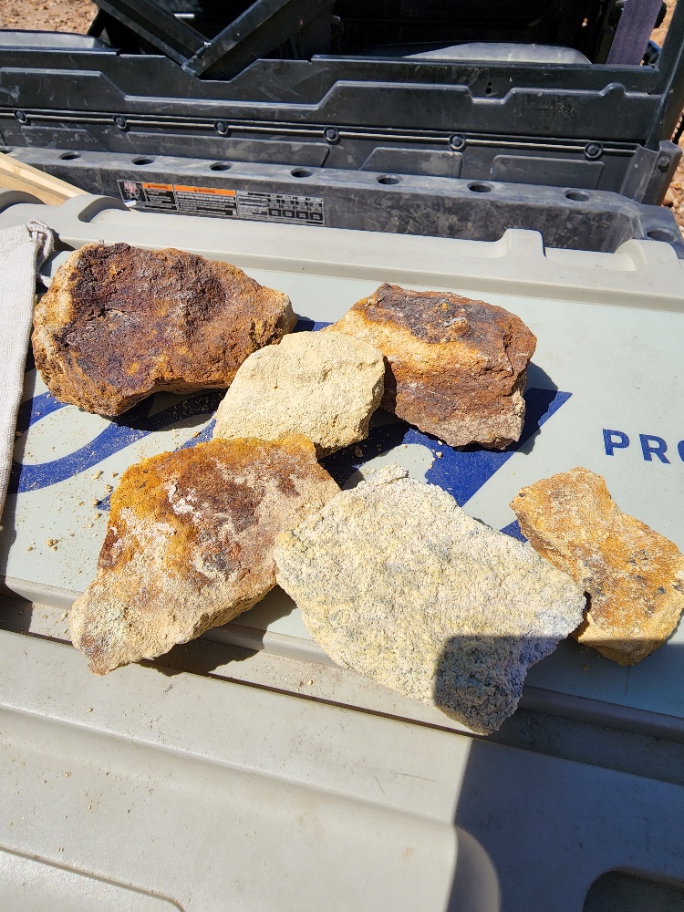
The adits and shafts had easy-to-identify quartz vein material that contained ore grade gold, silver and copper.
The bulk tonnage targets were located in low angle shear zones in the reactive carbonate host rocks. There are replacement bodies at the contact between quartzite and limestone. Historical samples from these zones ranged in the 2 ppm to 12.5 ppm gold and 1.8 to 69.5 ppm silver.
There is also a large igneous body nearby that contains low grade disseminated gold.
Many of these larger features are underneath thin soil and gravel cover. Soil sampling and magnetic and/or EM surveys could locate favorable areas.
The Ellsworth 3 veins are accessed by three shafts, one adit and multiple prospect pits. The veins cover the entire area of the claim. There look to be multiple parallel vein systems that could be explored.
This claim is ideal for both a small operator and a larger exploration play.
It is on BLM ground in an historical mining area that should be relatively easy to permit. I recently helped a client get a Notice Permit in the District and it got approved no problem.
Ellsworth Mining District – The Ellsworth Mining District situated within the larger Granite Wash Mountains area was first discovered in the 1860’s and began production in the 1880’s. The district had underground mines, placer gold, and open pit mines.
Some of the biggest early producing mines in the District were the Ellsworth, Bonanza, Golden Eagle, Socorro, San Marcos, Hercules, and Hidden Treasure.
Between 1891 and 1929 there was $2.5 million in recorded production (at gold prices of $20 per ounce).
The District became more active when the railroad was completed in 1900.
The largest copper mine in the area was the Yuma Mine which has grades of 2.3% copper. The Desert Queen and True Blue mines produced several thousand tons of mostly gold at grades of 0.4 to 0.6 ounces per ton.
The True Blue Mine was discovered by John Ramsey in 1931 after his car got stuck on the side of the road. Rich telluride ores were discovered in the district which ran 10 opt gold and more.
There were dozens of small mining operations in the 1930’s and 40’s with shafts, adits and workings covering the District. Tungsten was also produced commercially during WWII.
After a flurry of activity in the 1930’s and 40’s the District was dormant until the 1970’s when Tenneco and Bear Creek conducted some limited drill programs for copper in the vicinity of the Yuma Mine.
Some exploration was conducted in the 1980’s mostly centered on the Yuma Mine. There was also a gem quality azurite and malachite mine located in the District.
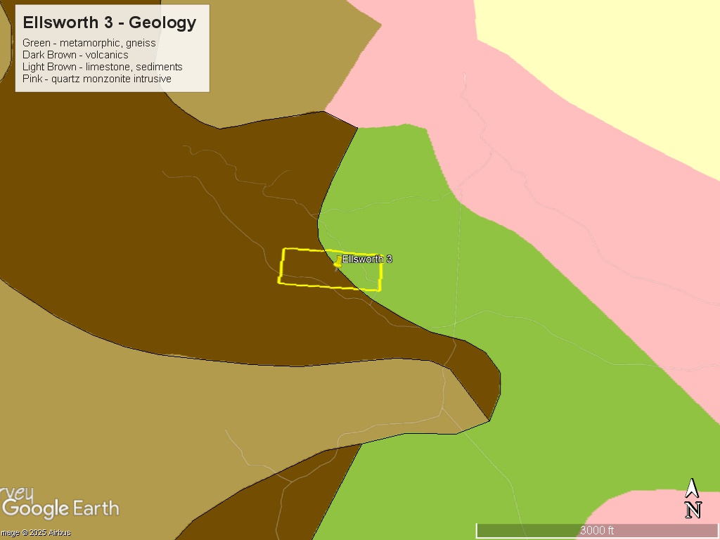
Regional Geology: The Ellsworth 3 Mining Claim is located within the Basin and Range physiographic province. The Basin and Range province covers the southern and western part of Arizona and consists of narrow NE trending mountain ranges between flat, arid valleys and basins.
More specifically, the claim is in the foothills of the Granite Wash Mountains which lie on the intersection of a northeast and north-northwest regional trend.
Like most of the mountain ranges of western Arizona, the Granite Wash Mountains consist of a complex series of stacked, low-angle fault slices of varied rocks units. In general, the rocks are regionally metamorphosed sediments that were intruded by granitic rocks during the Cretaceous.
Local Geology: The Ellsworth 3 Mining Claim is located in the middle of Jurassic sediments (limestones) and is near the contact with a Jurassic granitic intrusive (the likely source of the mineralization).
The country rocks on the claim area are limestones cut by volcanic outcrops and dikes.
There are diabase intrusions found throughout the property that seem to be associated with the mineralization. One theory is that the diabase intrusions have shattered the surrounding rocks opening permeable channels which extend all around the dikes. There may also be a geochemical factor in that the higher iron content at the diabase contact may allow gold in solution to precipitate.
There are four main types of deposits in this district: 1) replacement bodies in the carbonates; 2) quartz veins in the fissures and faults; 3) disseminated gold in the quartz monzonite intrusive; and 4) copper-gold skarn metamorphic deposits.
The replacement bodies are in highly altered limestone, fractured quartzite and schist along low angle shear zones. The shear zones are located at the contacts between major rock units. Much of the prospective shears are concealed beneath pediment gravels.
The replacement zones in the limestones in the low angle shears offer the best chances for a bulk tonnage deposit.
The mineralization in the Ellsworth area is strongly associated with calcite. Prior operators would sort ore on the basis of calcite content and obtain grades of up to 100 ounces per ton.
Calcite gangue material is supposedly high in the tellurides. The tellurides are petzite, hessite, sylvanite, and altaite.
Finding the tellurides may take some effort – they may not look like gold bearing rocks on first inspection. However, the quartz vein material is plentiful and easier to locate.
We also found quartz ore with visible gold that ran 6 opt gold on a nearby claim. This is consistent with historical reports of very high grade fissure veins.
Corn and Ahern in their 1989 report took samples nearby that ran 12 ppm gold and up to 69 ppm silver.
Gray, the operator of the main True Blue Mine in the 1940’s, shipped ore to the El Paso Smelter that assayed 18.3% copper and 6 opt silver.
The Gorham Report in 1935 detailed the rich telluride ores that had values of up to 11.6 opt gold – with sorted ores much higher.
Available Reports:
Ciancanelli, E., ‘Structural Geology of the Western Edge of the Granite Wash Mountains, Yuma County, Arizona’, MS Thesis, University of Arizona, 1965.
Corn, R.M., ‘’Northwestern Granite Wash Mountains Prospect, La Paz County, Arizona’, Corn & Ahern Private Report, 1989.
King, C., ‘The Blue Group of Mining Claims, Yuma County, Arizona’, Private Report for Gorham & Zuver, 1935.
Thompson, J.R., ‘Mineral Resources of the Harquahala Mountains Wilderness Study Area, La Paz and Maricopa Counties, Arizona’, U.S. Geological Survey Bulletin 1701, 1988.
FAQ
Why Arizona?
Arizona is consistently ranked as one of the top mining jurisdictions in the world for being mining-friendly and continuing to produce major discoveries. Arizona is the largest metal mining state in the U.S. and home to many world class copper mines including Morenci, Bagdad, Sierrita, Ray, and Resolution. Arizona also has numerous gold mines and some of the biggest silver-lead-zinc discoveries (Taylor Mine). Arizona is world famous for turquoise and other semi-precious stones and lapidary materials – often found near copper mining areas. Arizona is 38% owned by the federal government and most of this land is available for claim staking. This means some of the best mining ground in the world is open to small prospectors – a very unique situation. There are many mining companies active in Arizona and therefore, multiple potential buyers for any discovery you make. Canadian based junior exploration companies are particularly active in Arizona.
Why Buy a Claim?
Buying a claim is a great way to get started in mining and prospecting. Buying a claim that is professionally staked reduces your upfront work and the risk of making a mistake on your paperwork or in the field. Our claims are in areas with historical mining activity and most have numerous pits, shafts, and adits to explore. Finding these claims takes lots of research that is already done for you. The best place to find gold is where people have already found it!
Why Us?
I have been working in exploration in the southwestern United States and Alaska for 22 years. I have co-founded four junior mining companies and managed numerous drilling and exploration projects. I have worked with large and small mining companies and know what types of projects they are looking for that can be advanced by small prospectors. I have also worked on small hardrock production projects. I usually try to find claims that have known high grade veins that can be produced and that also have some exploration upside. We stand by our claims and fix any problems that come up. We can also help you with your annual filings. All our claims have a BLM serial number and can be found on the U.S. BLM MLRS website database. We hire the same professional claim staking companies that the large mining companies hire and all the claims have professionally drafted and accurate maps.
How is ownership of the claim transferred?
Ownership of mining claims is transferred with a Quit Claim Deed which we prepare. We pay all claim transfer fees and file the claim transfer paperwork with the BLM and La Paz County. The BLM takes about 2-3 weeks to process the claim transfer (Quit Claim) and register the claim in your name. The La Paz County Recorder usually takes 2-3 days to return the recorded Quitclaim Deed. Once the transfer is complete we will send you all the original documents including the file stamped Quitclaim Deed, the original location notices and claim maps.
How Much are the Annual Claim Fees?
The BLM charges a $200 per claim annual maintenance fee which is due on September 1st each year. The annual fees can be paid online through the BLM’s Mineral and Land Records System. La Paz County requires that a Notice of Intent to Hold form is filed the first year by Nov 1st along with payment of the recording fee of $30.
If you own less than 10 mining claims you can qualify for a waiver of the annual maintenance fee by filing a Small Miner’s Waiver. However, the Small Miner’s Waiver requires that you perform $100 in labor or improvements on the claim each year.
Claim fees are due next by September 1, 2025.
International Buyers
International buyers must either have dual US citizenship and US address or have a US entity or company to own the claim.