MOUNTAIN VIEW NORTH MINE
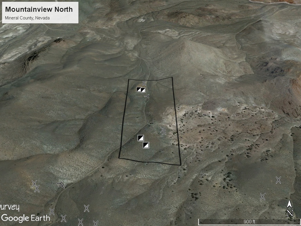
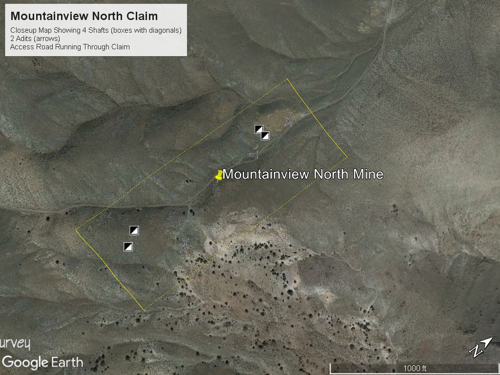
The Mountainview North mining claim consists of one (1) unpatented lode claim covering 20.66 acres on federal land managed by the U.S. Bureau of Land Management. The claims cover a former producing gold-silver mine in the Mountain View Mining District in Mineral County, Nevada.
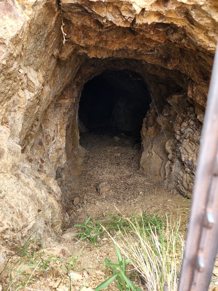
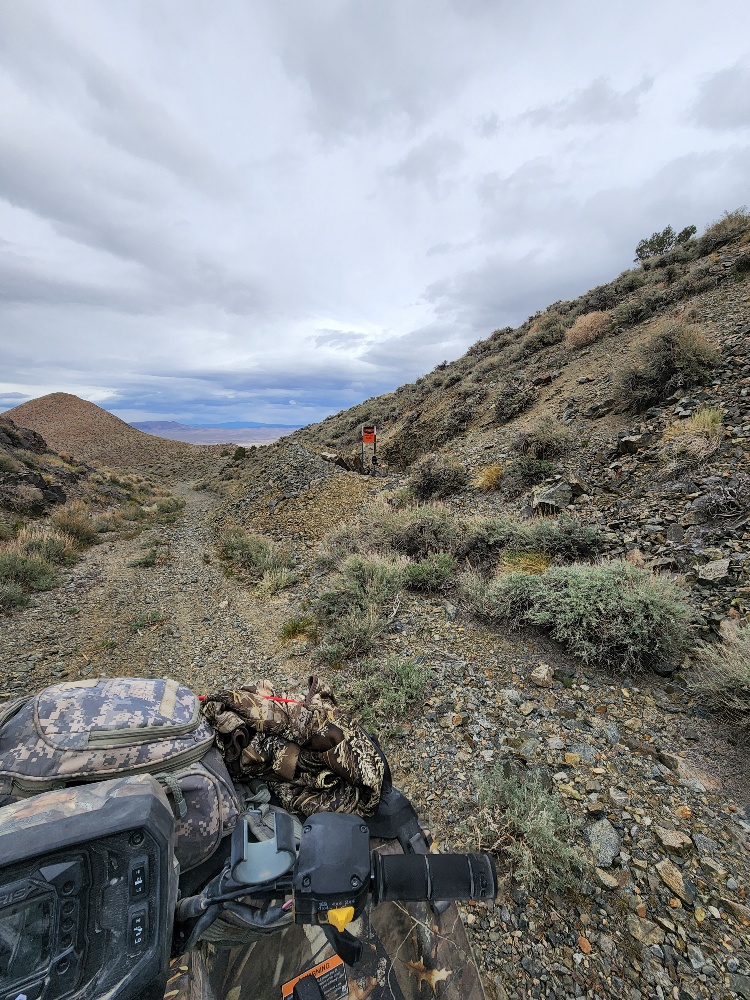
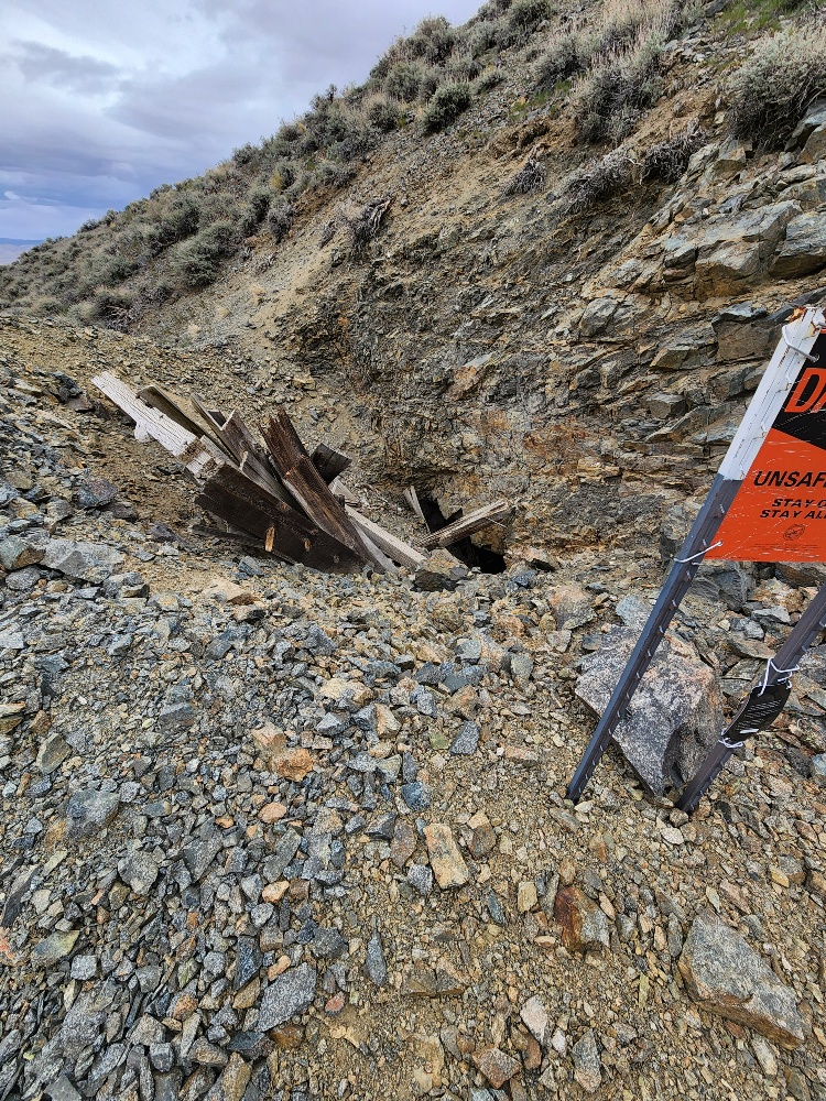
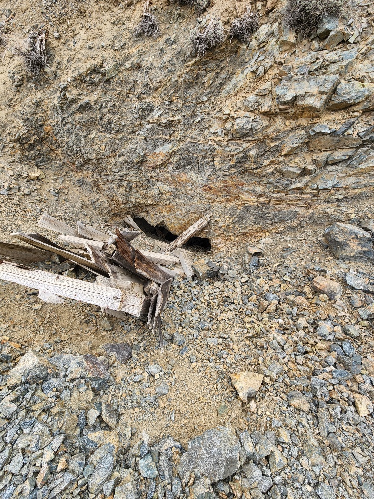
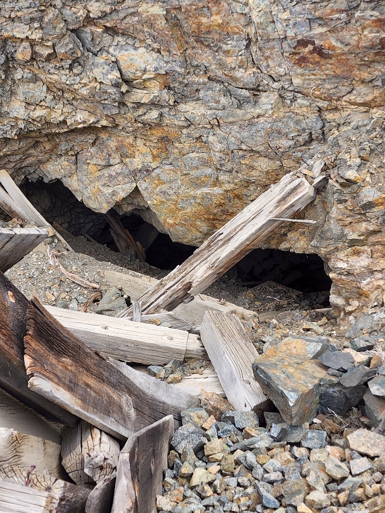
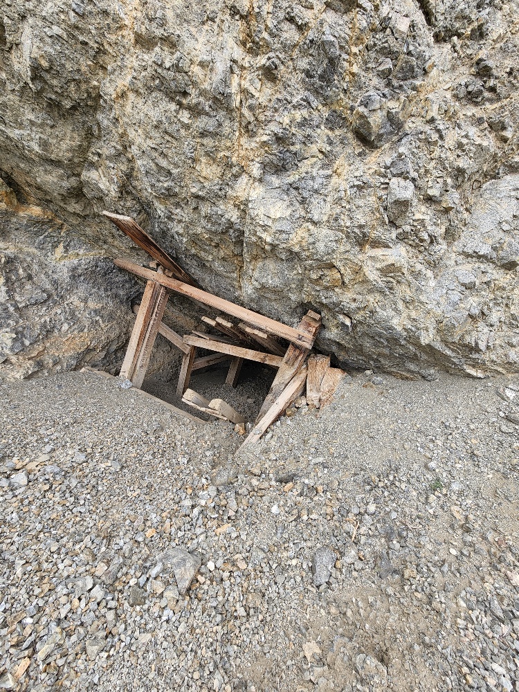
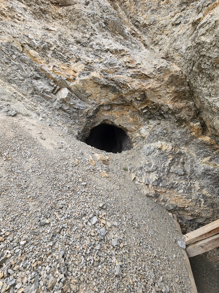
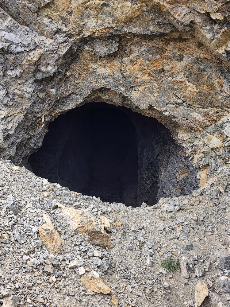
The claim includes four (4) shafts, two (2) adits, and multiple prospect pits.
The Ann Mason deposit is located Around 14 miles to the SE from Mountain View North mining claim. The deposit was discovered in the late 1990s and is considered to be one of the largest undeveloped copper-gold deposits in the United States. The deposit is estimated to contain over 2 billion pounds of copper and 5 million ounces of gold.
Nevada Copper has a large claim block approximately 2.2 miles west of the Mountain View North claim.
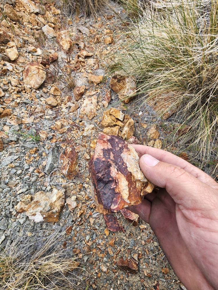
The Mountain View District is known for copper porphyry deposits, epithermal gold and silver, and base metal (silver-lead-zinc) replacement deposits. Historical reports mention grades as high as $25/ton in 1908 dollars (1+ ounce per ton gold).
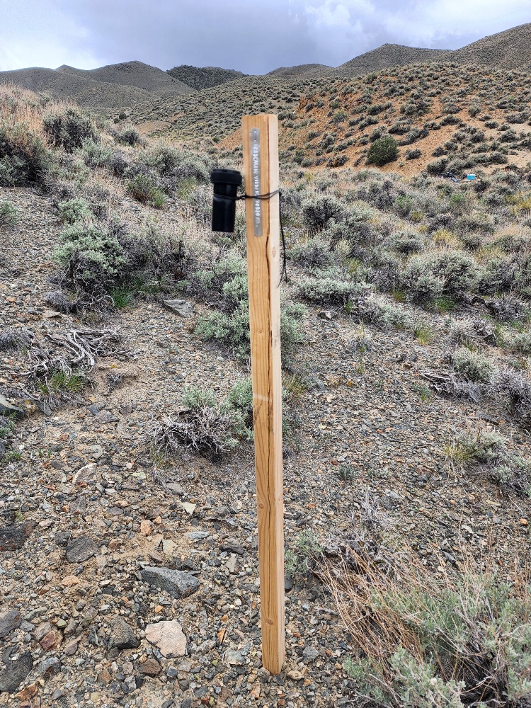
Location and Access: Access to location is relatively simple. From Yerington follow the 95-road headed to NE for 11 miles. At that point you should turn right on intersection to local road and drive for 2 miles headed to SW. After 2 miles of drive you need to follow the jeep trail directed to SSW for 1.2 miles and you will find yourself located in Mountainview North mine.
GPS Coordinates: Lat: 38.985974° Long: -118.924543° (Mountain View North – Northern Adit).
Mining and Exploration Potential: Mountainview North has excellent potential for additional high-grade gold and silver veins along with the potential for copper deposits (porphyry and veins).
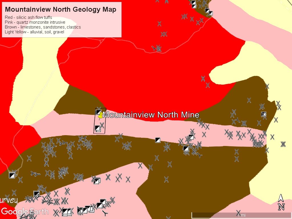
There are multiple adits and declines (mapped as shafts) to explore. The claims straddle a contact zone between quartz monzonite intrusive rocks and shaley-limestone carbonates.
The margins of these igneous intrusives have been very productive for copper, gold and silver in Nevada.
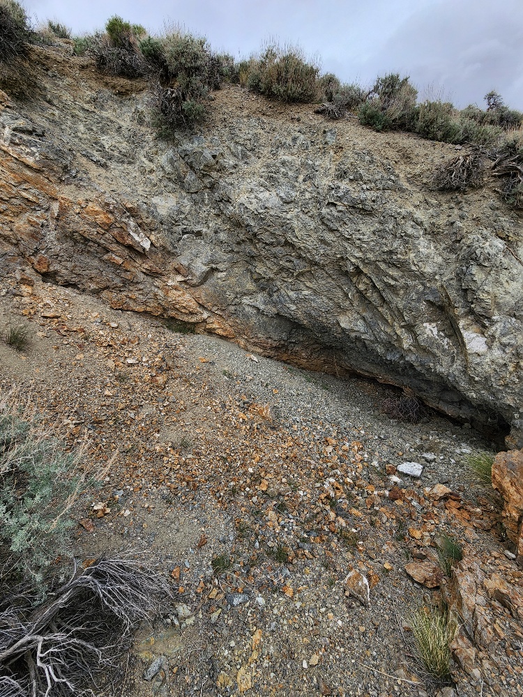
Several of the workings are exactly on the contact and appear to be exploring mineralized shear zones between the two major rock units. Shear zones are areas where the rocks are crushed together forming a porous channel for mineralizing fluids to ascend.
The main quartz monzonite body on the Mountview North claim is a narrow strip running 2.5 miles long and 1,000 to 1,500 feet wide running through the claim in an east-west direction. On either side of the quartz monzonite strip are limestones, shales, and other metasediments. You can see the contact zones in the pictures of the brown tan rocks (limestones, shales) and the darker granodiorites.
In one report on the property there is a thesis that some of the metavolcanic rocks can conceal larger and potentially high grade mineralization beneath them (see discussion below).
There are plenty of workings and tailings piles to explore here. The geological features are exposed at surface which will aid in mapping and development.
The Mountainview North claim has both small production opportunities and a larger exploration play.
Mountain View District: The Mountain View or Granite district is located between two abandoned camps of the same name, about 1.5 miles apart, on the top of the Wassuk Range’s northern edge.
The District was originally called the Granite District and was probably active in the 1870’s. It was abandoned and later revived as the Mountain View. Some of the workings are from the earliest period and some from the 1905-1940 period and later.
William Wilson re-discovered gold at the Mountain View portion of the district in 1904 when the area was part of the Walker Lake Indian reservation. In 1906, a portion of the reservation was opened to prospectors, and William Wilson discovered many new prospects at Mountain View.
By 1908, the District had become more popular and 55 lessees were active. The leasing system was used when there were lots of smaller veins that would be attractive to individuals and small teams, but not justifying large capital investment. The high number of lessees indicates that there were many good high grade veins on the surface. Moreover, during this time period many famous camps were booming such as Goldfield and Tonopah – so competition was high for mining labor. I suspect that the lessee miners focused on the highest of the high grade ore and then moved on without much exploration effort.
Mountain View had a small 5-stamp mill. Also, ore was processed at the Nordyke Mill 15 miles away.
The Ann Mason mine, that is close by, is being developed by Hudbay Minerals (NYSE: HBM) and was expected to be in production by the mid-2020s.
The Ann Mason mine will utilize conventional open-pit mining methods, and the copper and gold will be processed using a combination of flotation and leaching techniques. The mine is expected to have a long life, with plans to extract copper and gold for over 20 years.
The famous Rawhide Mine is located 30 miles to the north and produced over 1M ounces of gold.
Regional Geology: The Mountainview North mine is located in the Walker Lane mineral belt which is part of the Basin and Range physiographic province. The Basin and Range province covers most of Nevada and consists of narrow NE trending mountain ranges between flat, arid valleys and basins.
The Walker Lane mineral belt is an area with a high density of parallel strike-slip faults extending from Reno to Las Vegas roughly along the California- Nevada border. Faulting and volcanic activity make the Walker Lane favorable for hosting gold and silver deposits including some of the most famous precious metal mining districts in the US including the Comstock, Goldfield, Tonopah, Bullfrog, Mineral Ridge, and Round Mountain.
Local Geology: The Mountain View District is located on the northern end of the Wassuk Mountain Range in Mineral County, Nevada.
The Wassuk Mountain Range extends for 50 miles in a north-south direction on the west side of Walker Lake. The Wassuk Range is composed of Triassic metavolcanic and metasedimentary rocks and intruded by Cretaceous and Tertiary quartz monzonite. In some cases, the older metasediments are completely surrounded by the later intrusions forming ‘pendants’.
Most of the workings and veins occur in shear zones and along the contacts at the margins of the intrusives (and near the pendant structures). The shear zones are iron-stained and contain copper oxide minerals.
The pendant structures can form impervious caps on mineralized sections of the quartz monzonite. Robert Holt, a geologist who studied the area in 1965, speculated that the shear zone veins were indicative of a bigger mineralized area underneath the metavolcanic cap pendants.
If so, this would mean that the veins could lead to much larger deposits that are hidden beneath shallow caps of unmineralized rocks.
The shear zones were breaks in this impervious rocks allowing mineralization to leak to the surface. This is what the old-timers found. The real prize might be underneath these shear zones.
The veins can vary from mostly copper to silver-lead-zinc to gold. Some of the veins were reported as 8 to 25 feet in width with crushed granidiorite – indicating a shear zone. These types of veins can have good thickness and grades which make for excellent targets.
As mentioned earlier, values of $25 per ton in 1908 dollars were recorded.
Available Reports:
Ross, D.C., ‘Geology and Mineral Deposits of Mineral County’, Nevada, Nevada Bureau of Mines and Geology, 1961.
Gilbert, J.R., “East Mason Valley and Northern Wassuk”, Inventory and Analysis of Walker Planning Group, 1976.
Holt, Robert, ‘Geological Reconnaissance of the Gillis and Wassuk Ranges, Walker River Reservation, Schurz, Nevada’, Private Report for Walker-Martel Mining Company, 1965.
Lincoln, Francis Church, ‘Mining Districts and Mineral Resources of Nevada’, Nevada Publications. 1923. Pages 146-147.
Mountain View District Report, US Bureau of Mines, Unknown Date.
FAQ
Why Nevada?
Nevada is consistently ranked as one of the top mining jurisdictions in the world for being mining-friendly and continuing to produce major discoveries. If Nevada was a country it would be the 5th largest gold producer in the world (after Australia, Canada, China, and Russia). Nevada is home to the Carlin Trend, the Cortez Trend, the Walker Lane Trend, the Getchell Trend and many other prolific gold producing regions. In addition to gold Nevada also has major mines producing silver, copper, lithium, iron ore, magnesium, gems and many other minerals. Nevada is 85% owned by the federal government and most of this land is available for claim staking. This means some of the best mining ground in the world is open to small prospectors – a very unique situation. There are many mining companies active in Nevada and therefore, multiple potential buyers for any discovery you make. Canadian based junior exploration companies are particularly active in Nevada.
Why Buy a Claim?
Buying a claim is a great way to get started in mining and prospecting. Buying a claim that is professionally staked reduces your upfront work and the risk of making a mistake on your paperwork or in the field. Our claims are in areas with historical mining activity and most have numerous pits, shafts, and adits to explore. Finding these claims takes lots of research that is already done for you. The best place to find gold is where people have already found it!
Why Us?
I have been working in mineral exploration in the southwestern United States and Alaska for 17 years. I have co-founded four junior mining companies and managed numerous drilling and exploration projects. I have worked with large and small mining companies and know what types of projects they are looking for that can be advanced by small prospectors. I have also worked on small hardrock production projects. I usually try to find claims that have known high grade veins that can be produced and that also have some exploration upside. We stand by our claims and fix any problems that come up. We can also help you with your annual filings. All our claims have a BLM serial number and can be found on the U.S. BLM MLRS website database. We hire the same professional claim staking companies that the large mining companies hire and all the claims have professionally drafted and accurate maps.
How is ownership of the claim transferred?
Ownership of mining claims is transferred with a Quit Claim Deed which we prepare. We pay all claim transfer fees and file the claim transfer paperwork with the BLM and Mineral County. The BLM takes about 2-3 weeks to process the claim transfer (Quit Claim) and register the claim in your name. The Mineral County Recorder usually take 1-2 weeks to return the recorded Quit Claim Deed. Once the transfer is complete we will send you all the original documents including the file stamped Quit Claim Deed, the original location notices and claim maps.
How Much are the Annual Claim Fees?
The BLM charges a $200 per claim annual maintenance fee which is due on September 1st each year. The BLM fees can be paid online through their claim management portal. Mineral County requires that a Notice of Intent to Hold form is filed the first year by Nov 1st along with payment of the recording fee of $12 plus $12 per claim.
If you own less than 10 mining claims you can qualify for a waiver of the annual maintenance fee by filing a Small Miner’s Waiver. However, the Small Miner’s Waiver requires that you perform $100 in labor or improvements on the claim each year.
International Buyers
International buyers must either have dual US citizenship and US address or have a US entity or company to own the claim.