PLACERITES 9 PLACER GOLD MINING CLAIM
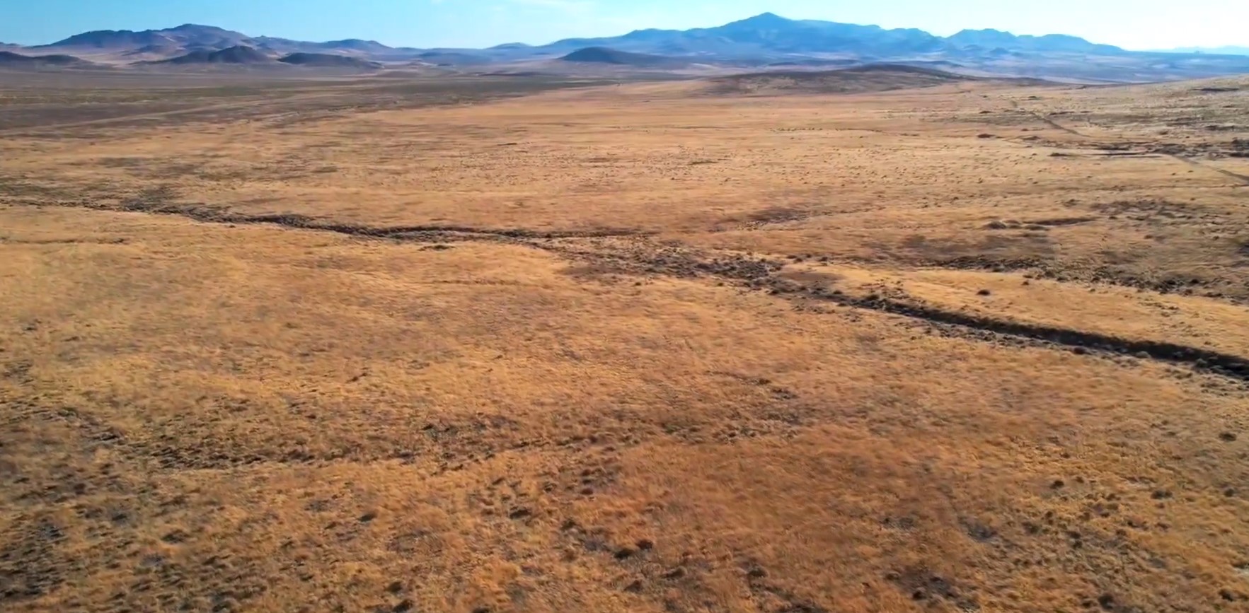
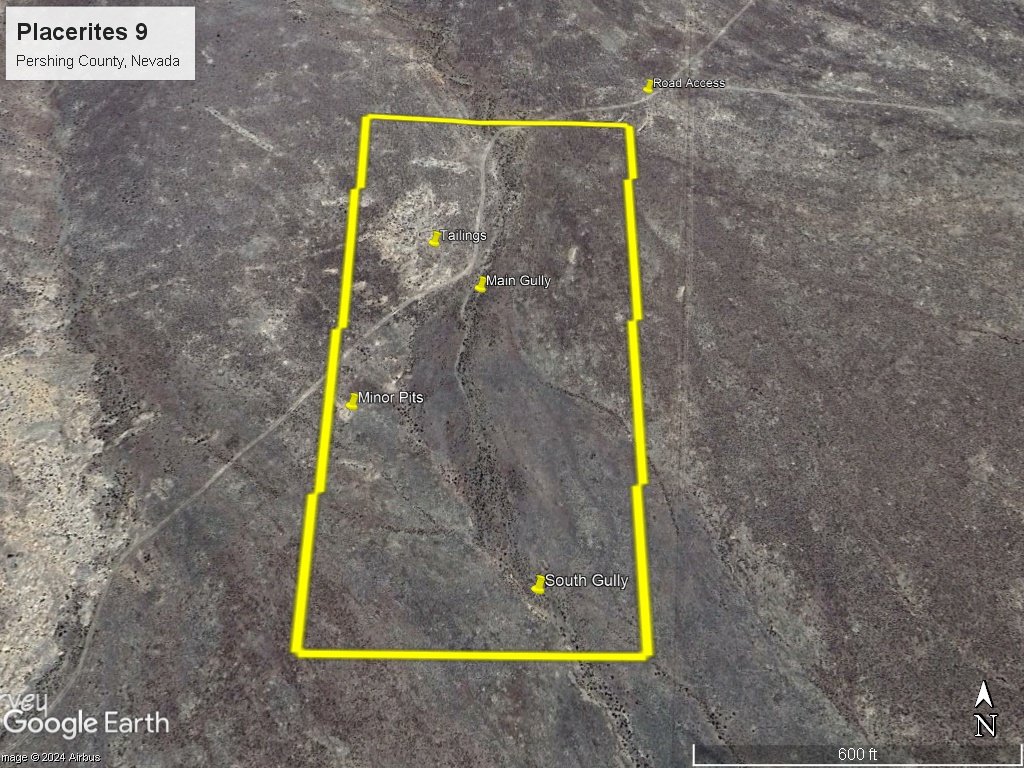
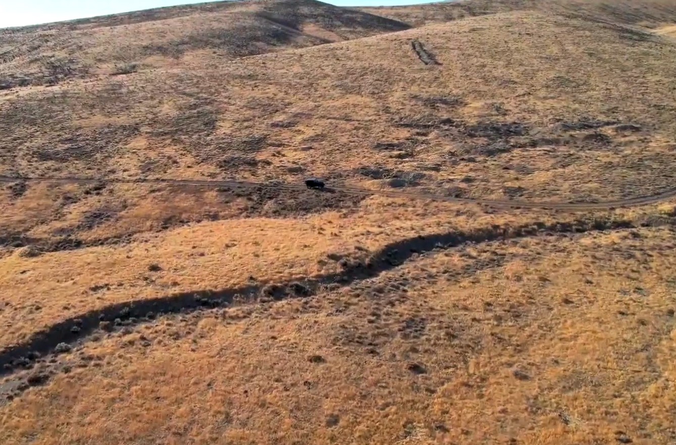
The Placerites 9 claim consists of one (1) unpatented placer mining claim, covering 20 acres, on federal land managed by the U.S. Bureau of Land Management. The claim covers historical placer workings in the Placerites (Placeritos) District.
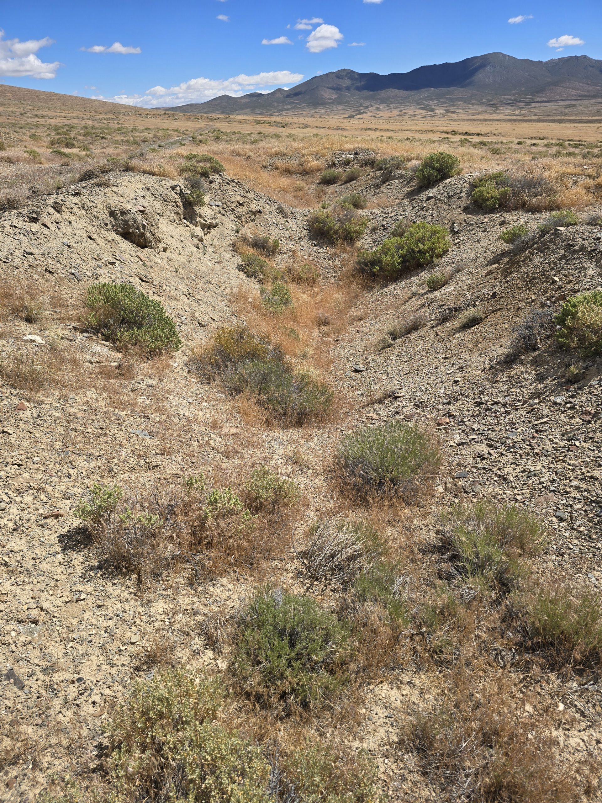
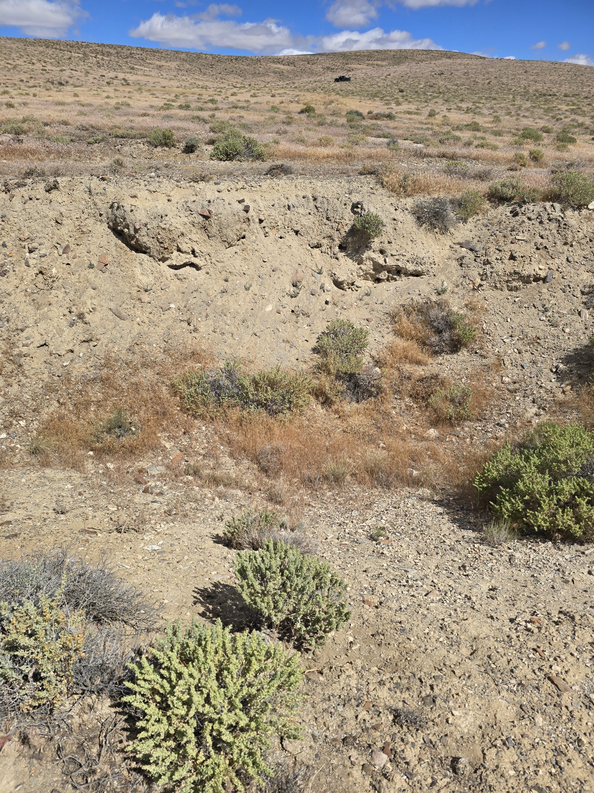
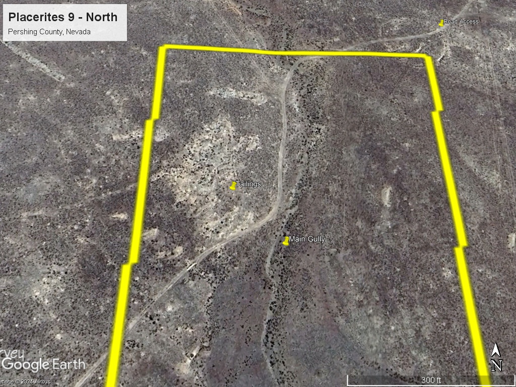
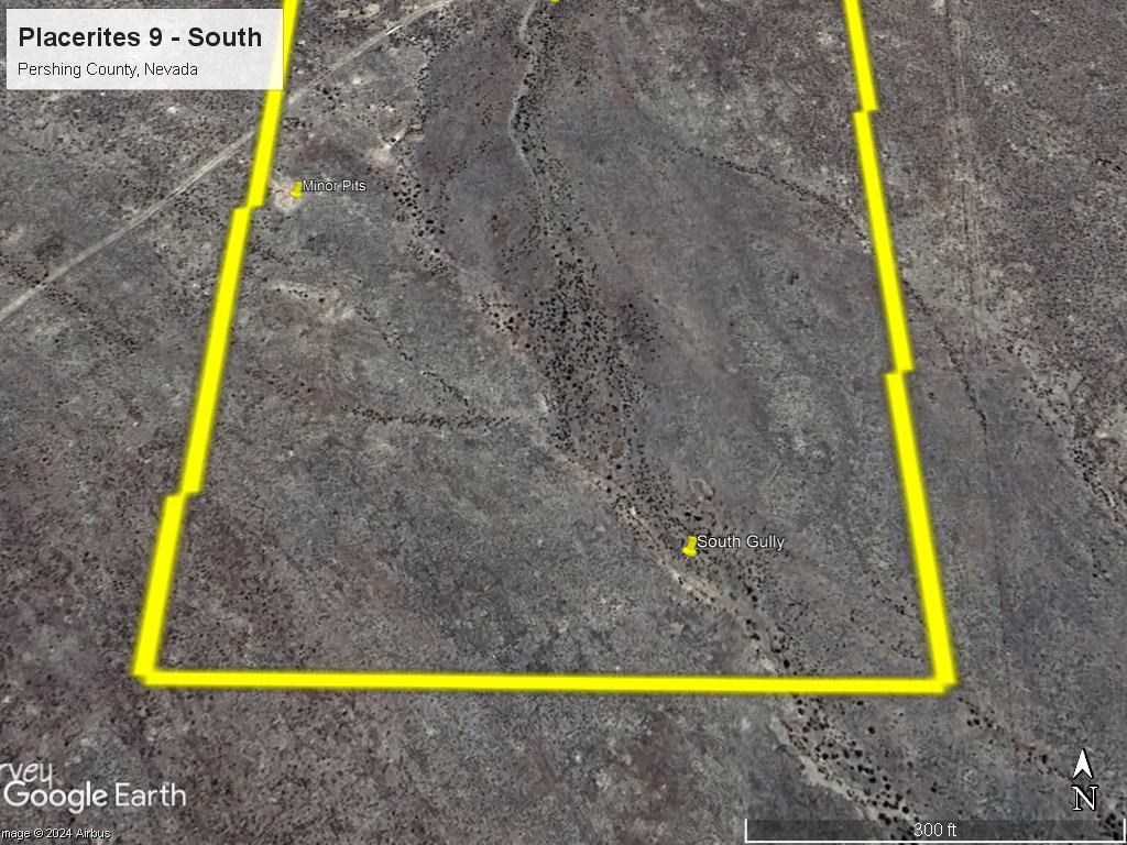
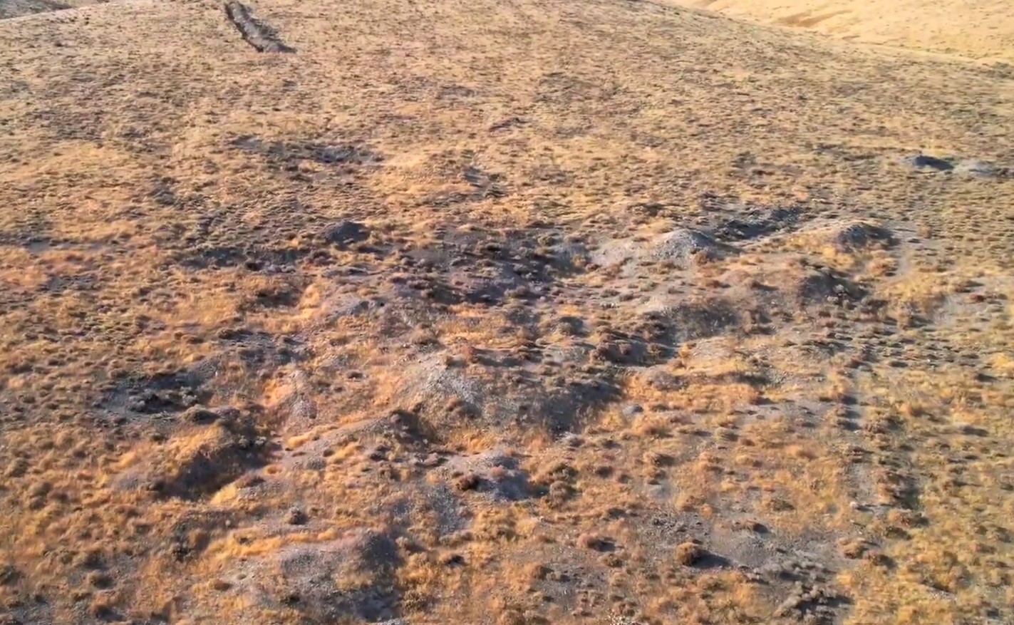
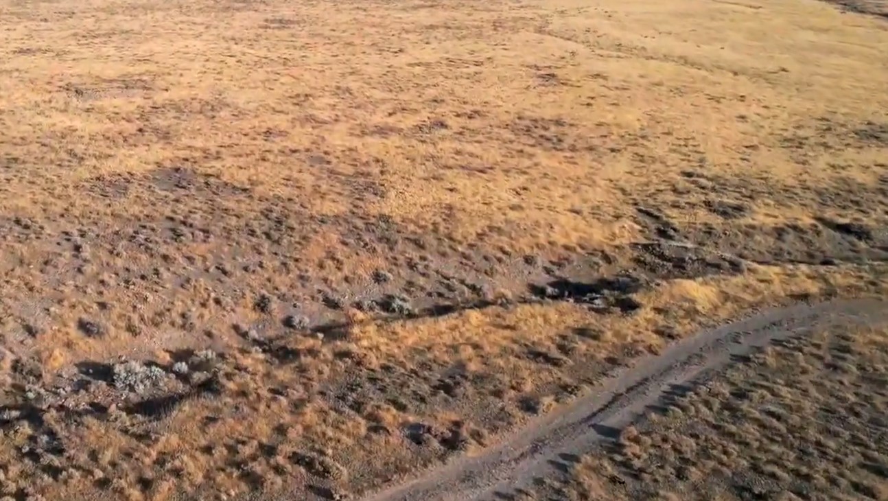
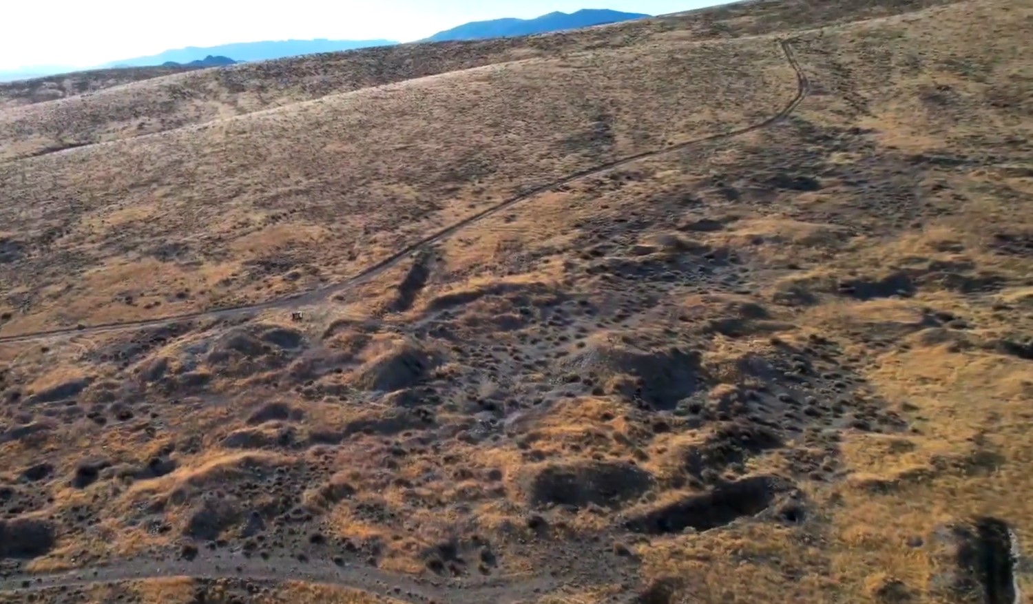
The Placerites 9 claim has multiple shallow pits, tailings piles, and other workings. There are also several washes that should be favorable for placer deposits. The claim has a road that cuts through the claim.
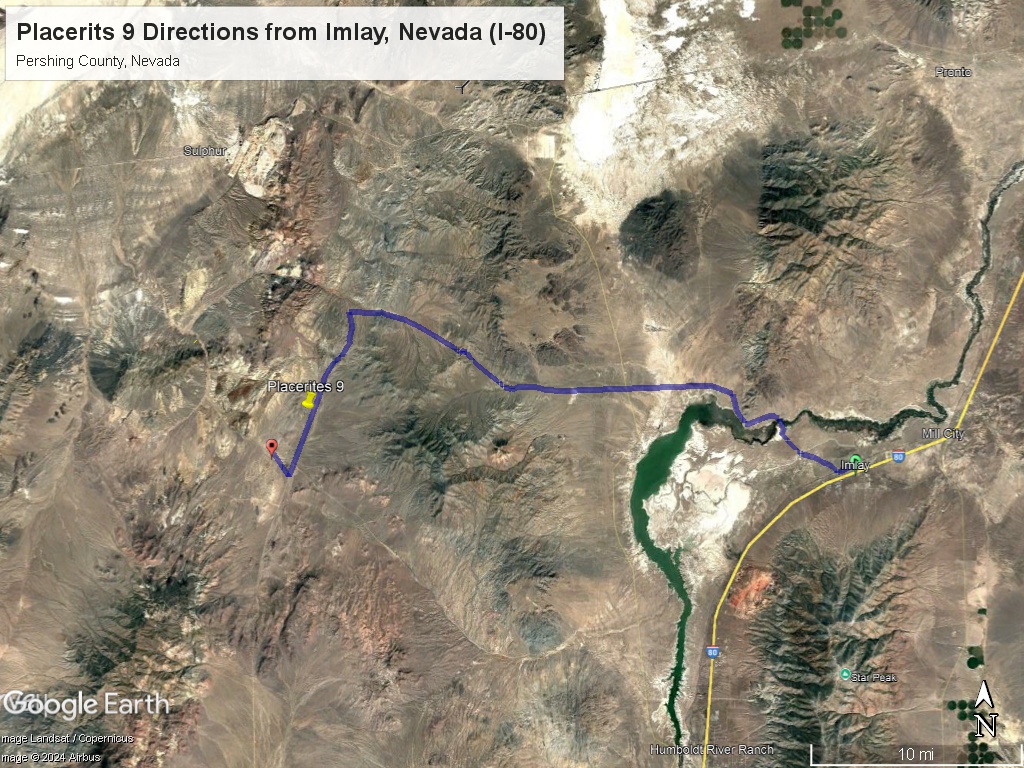
Directions: From Winnemucca, Nevada drive south on I-80 33 miles. Take Exit 145 and go west on Frontage Road. Take Old Idaho Stage road which turns into Lake Road and then 7 Troughs Road for 33 miles. You can also reach the claims by taking Highway 399 west out of Lovelock and taking a right on 7 Troughs Road and driving directly to the claims. Both ways are about equal.
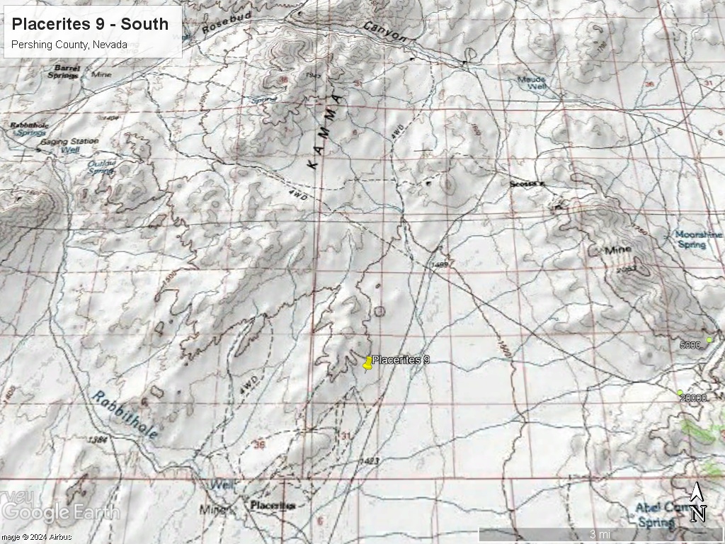
GPS Coordinates: Lat: 40.695852°, Long: -118.644241° (Road Access Point to Main Workings)
Mining and Exploration Potential: The Placerites District has shallow and fairly high grade placer deposits throughout the District.
The gold is on a false bedrock, caliche layer that can be as shallow as a 1 foot but up to 6 feet deep.
Gold is often found in the gullies – there two main gullies that run north-south on the Placerites 9 claim. One of the gullies runs the entire length of the claim – about 1500 feet.
There is a large tailings area that can be accessed by the main road. These tailings could be good for dry washing and detecting.
Former placer tailings are usually prime spots for metal detecting.
Some of the placer deposits are very high grade – up to 1 ounce per cubic yard was recorded by historical reports.
In the book ‘Placer Mining in Nevada’ the grades in the Placerites District were listed as between .05 and .25 ounces per yard – pretty good!
The Placerites area was at one time part of the shoreline of Lake Lahontan – a Pleistocene lake that has since evaporated but at one time was the size of the Great Lakes.
Lake Lahontan drained the surrounding rivers and streams that eroded the nearby gold deposits.
The gold was then re-concentrated by the Lake along the shoreline and in other features (gullies).
Both dry washing and wet methods have been used in Placerites. Dry washing techniques have massively improved in the last 20 years and should be very successful here.
Some of the gravels are quite thick – up to 60 feet. So there could be a large amount of placer gold hiding here. This would explain the interest to two large groups in the District’s history.
Finding some of the Pleistocene gold deposits could be as simple as panning the gullies or soil sampling in a grid pattern.
Because the gold deposits at Placerites are lake deposits from some of the richest areas in Nevada gold country they could be much larger than the typical stream deposits.
The Placerites District is in the low hills on the east slope of the Kamma Mountains, 47 miles south of Lovelock, Nevada.
The Placerites District was first discovered in the 1870’s by four men who recovered 1500 ounces of gold using hand methods.
In 1892 a prospector named ‘Shirt Sleeves Jack’ discovered rich deposits of placer gold and worked them with 3-4 other men. They were estimated to have produced 3,000 ounces of gold but that they ‘dissipated it with high living’.
In 1905 a man name Burks with a group out of Salt Lake City established another operation that produced gold from both the gullies and the hillsides – about 1,000 ounces.
In 1926, EJ Stratton began reworking the area formerly held by ‘Shirt Sleeves Jack’ and his crew. They discovered large amount of gravels that ran 0.05 ounces per cubic yard. They sunk a shaft and got water at 60 feet.
In 1928 the Nev-Mont (Nevada Montana) Mining Co. was formed and acquired 4,000 acres of mining claims in the Placerites District. Their camp was just south of the Stratton / Shirt Sleeves Camp.
Nev-Mont Mining commissioned a detailed geological report (which is available) and did extensive testing and mining. Nev-Mont built a large artificial reservoir to provide water for the operations. They used a dragline shovel and processed 140 yards per day. Nev-Mont ceased operations in the mid 1930’s. However, several smaller operations were active in the District during the 1930’s until World War II.
Finally, in 1984-85 a California company was mining parts of the District on a large scale.
Just to the north is the famous Hycroft Mine which has a 10 million ounce resource.
The key insight from the previous operators was the large amount of placer gold related to the former drainage into Lake Lahontan.
Regional Geology: The Placerites 9 mining claim is located within the Basin and Range physiographic province. The Basin and Range province covers most of Nevada and consists of narrow NE trending mountain ranges between flat, arid valleys and basins.
Local Geology: The Placerites District is within the former boundaries of Lake Lahontan, a Pleistocene lake that formerly covered a large area of Nevada and was up to 400 feet deep. Lake Lahontan was fed by gold bearing streams and rivers that may have re-deposited and concentrated the gold on its former shores – where the Placerites District deposits are found.
The bedrock underlying the alluvial areas are metasediments – mostly shale and slate. Much of the placer gold is coarse and presumably has not traveled far.
Available Reports:
Johnson, M., Geology and Mineral Deposits of Pershing County, Nevada, Nevada Bureau of Mines and Geology, Bulletin 89, 1977.
Lincoln, Francis Church, ‘Mining Districts and Mineral Resources of Nevada’, Originally Published 1923, Republished by Nevada Publications, 1982.
Quade, J., Placerites Canyon District Summary Report, Nevada Bureau of Mines and Geology, 1985.
Reeves, T.V., ‘Report on Property of Nev-Mont Mining Co. Placeritos, Pershing County, Nevada’, 1931.
Vanderburg, W.O., ‘Placer Mining in Nevada’, Bulletin 27, Nevada Bureau of Mines and Geology, 1936.
Vrang, C., ‘Placeritos Report’, Private Report from NVBM District Files, 1932
FAQ
Why Nevada?
Nevada is consistently ranked as one of the top mining jurisdictions in the world for being mining-friendly and continuing to produce major discoveries. If Nevada was a country it would be the 5th largest gold producer in the world (after Australia, Canada, China, and Russia). Nevada is home to the Carlin Trend, the Cortez Trend, the Walker Lane Trend, the Getchell Trend and many other prolific gold producing regions. In addition to gold Nevada also has major mines producing silver, copper, lithium, iron ore, magnesium, gems and many other minerals. Nevada is 85% owned by the federal government and most of this land is available for claim staking. This means some of the best mining ground in the world is open to small prospectors – a very unique situation. There are many mining companies active in Nevada and therefore, multiple potential buyers for any discovery you make. Canadian based junior exploration companies are particularly active in Nevada.
Why Buy a Claim?
Buying a claim is a great way to get started in mining and prospecting. Buying a claim that is professionally staked reduces your upfront work and the risk of making a mistake on your paperwork or in the field. Our claims are in areas with historical mining activity and most have numerous pits, shafts, and adits to explore. Finding these claims takes lots of research that is already done for you. The best place to find gold is where people have already found it!
Why Us?
I have been working in mineral exploration in the southwestern United States and Alaska for 21 years. I have co-founded four junior mining companies and managed numerous drilling and exploration projects. I have worked with large and small mining companies and know what types of projects they are looking for that can be advanced by small prospectors. I have also worked on small hardrock production projects. I usually try to find claims that have known high grade veins that can be produced and that also have some exploration upside. We stand by our claims and fix any problems that come up. We can also help you with your annual filings. We hire the same professional claim staking companies that the large mining companies hire and all the claims have professionally drafted and accurate maps.
How is ownership of the claim transferred?
Ownership of mining claims is transferred with a Quit Claim Deed which we prepare. We pay all claim transfer fees and file the claim transfer paperwork with the BLM and Pershing County. The BLM takes about 2-3 weeks to process the claim transfer (Quit Claim) and register the claim in your name. Once the transfer is complete we will send you all the original documents including the file stamped Quit Claim Deed, the original location notices and claim maps.
How Much are the Annual Claim Fees?
The BLM charges a $200 per claim annual maintenance fee which is due on September 1st each year. The BLM fees can be paid online through their claim management portal. Pershing County requires that a Notice of Intent to Hold form is filed the first year by Nov 1st along with payment of the recording fee of $12 plus $12 per claim.
If you own less than 10 mining claims you can qualify for a waiver of the annual maintenance fee by filing a Small Miner’s Waiver. However, the Small Miner’s Waiver requires that you perform $100 in labor or improvements on the claim each year.
International Buyers
International buyers must either have dual US citizenship and US address or have a US entity or company to own the claim.