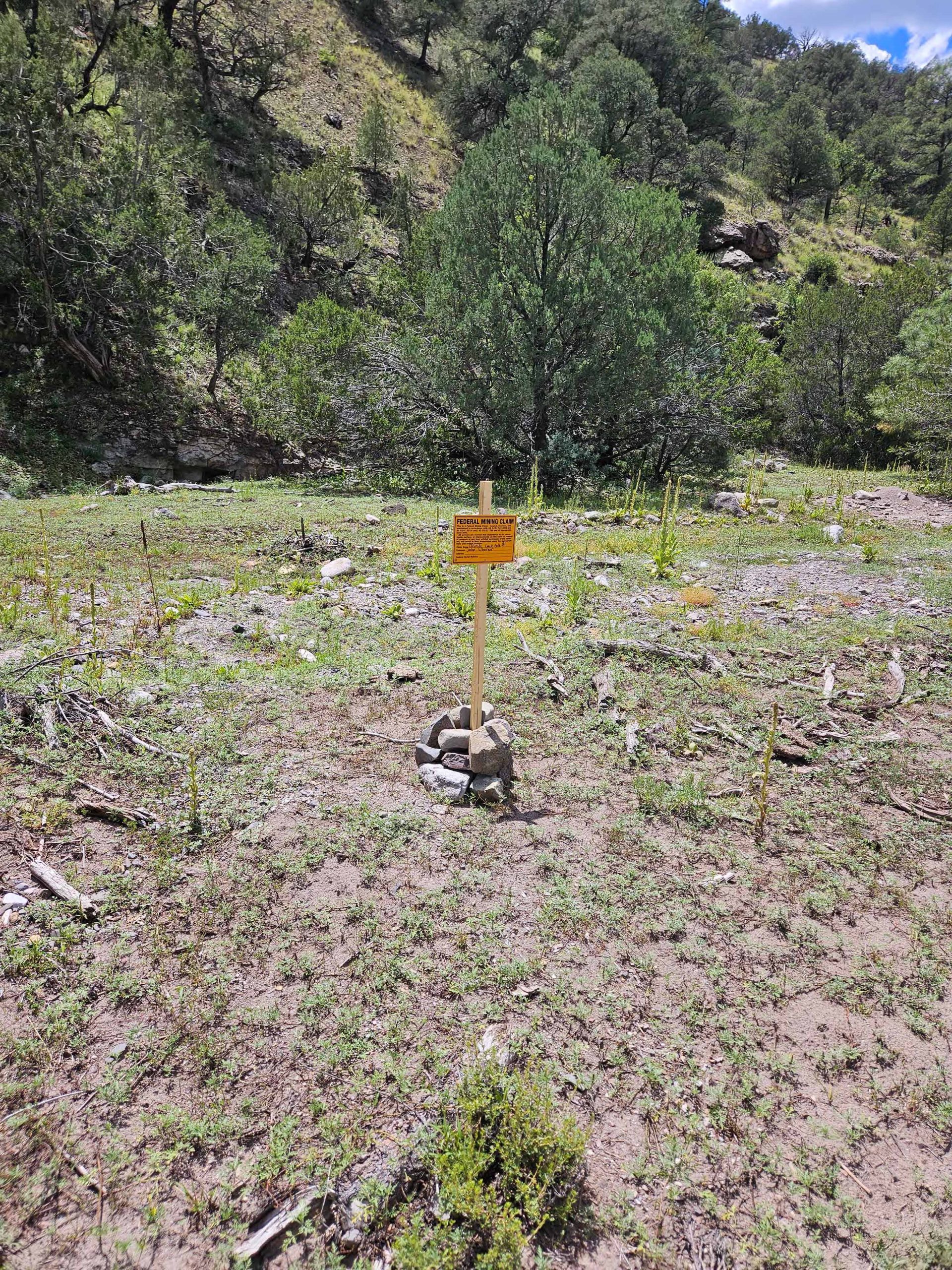
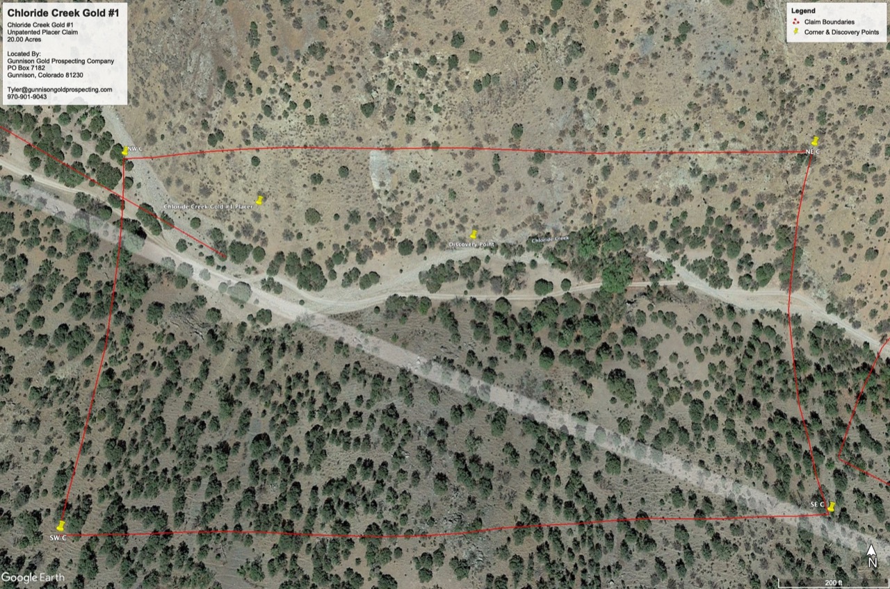
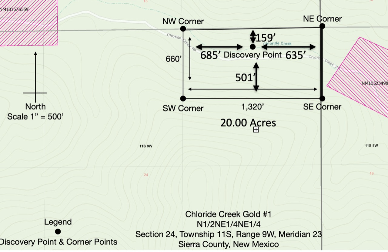
Chloride Creek Gold #1 is a 20-acre placer claim in Sierra County, New Mexico, in the historic Chloride mining district on the east flank of the Black Range. The claim is recorded in Section 24, Township 11 South, Range 9 West, New Mexico Principal Meridian, and the location documents show a standard 20-acre placer layout of roughly 1,320 feet by 660 feet.
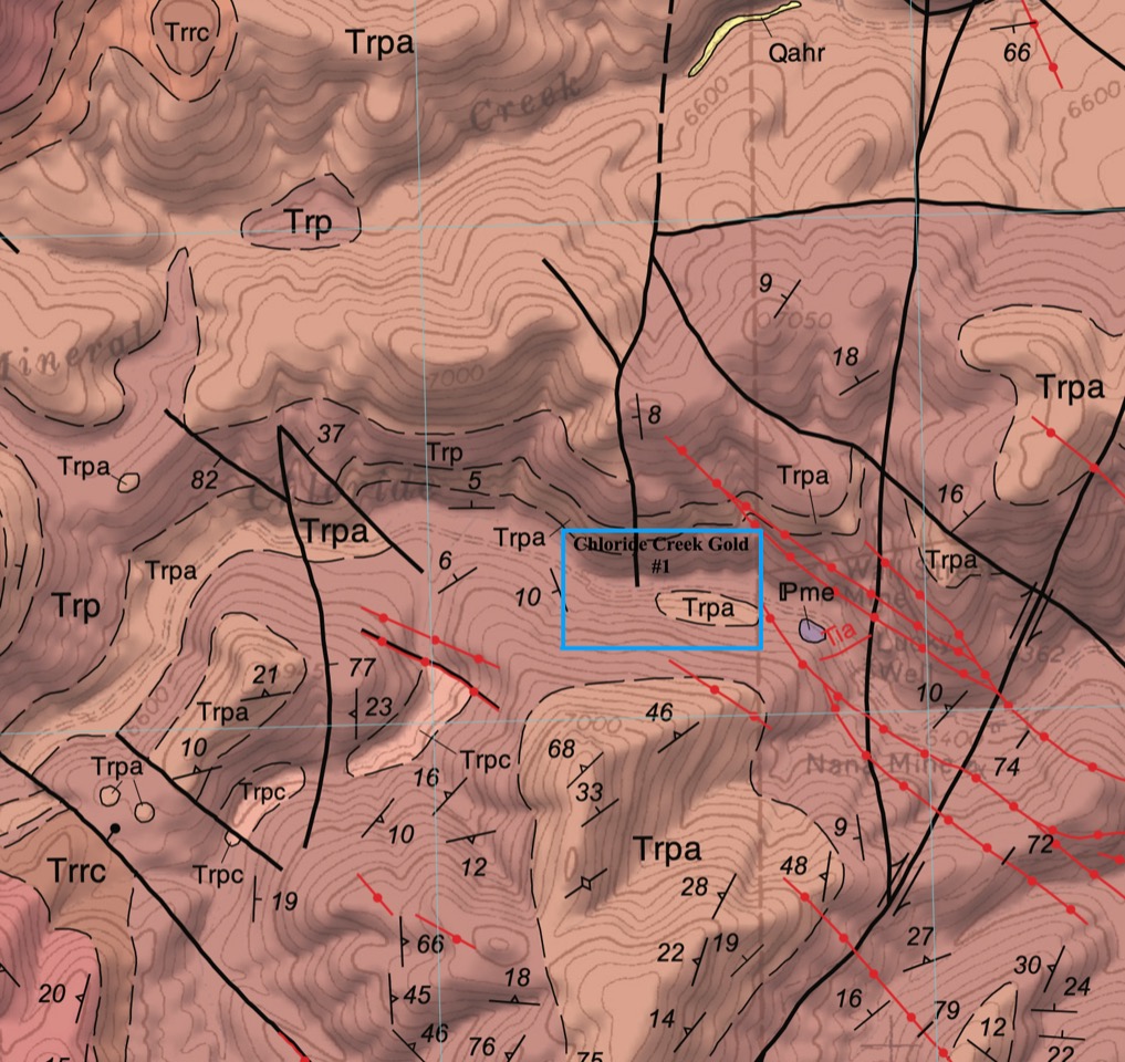
The real appeal here is the district setting. The Chloride district has a long record of precious- and base-metal mining, with intermittent production stretching back well over a century. Richard Harrison described the district as a mature mining camp with more than $18 million in historic metal value produced, and earlier state summaries classify Chloride as one of Sierra County’s important volcanic-epithermal districts, with recorded gold and silver production alongside copper, lead, and zinc.
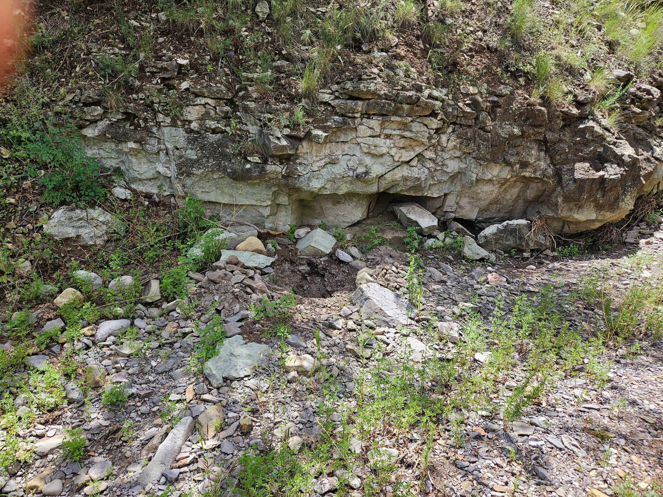
Geologically, Chloride Creek sits in a strongly mineralized volcanic terrain. The district is underlain by Tertiary volcanic and volcaniclastic rocks of the Mogollon-Datil field, cut by high-angle faults and fracture systems that hosted quartz-calcite vein mineralization with local fluorite and barite. Harrison also notes that flow-dome centers such as the Chloride Creek dome helped create radial and tangential fractures that localized mineralization. For a placer claim, that matters because creek gravels and shallow bench material can trap gold weathered out of those mineralized veins upstream. The site photo shows exposed creek-margin bedrock and coarse alluvial material, the kind of setting prospectors typically watch for pay streak concentration in a mountain drainage. Recent New Mexico permitting records also show that placer-gold mining is still being actively pursued elsewhere along Chloride Creek, which speaks to the drainage’s continuing small-scale gold potential.
Summary bullets
- 20-acre placer claim on Chloride Creek in Sierra County, New Mexico.
- Located in the historic Chloride mining district, a long-lived Black Range precious-metals camp.
- Claim documents show a 1,320′ x 660′ placer configuration in Section 24, T11S, R9W.
- District geology is classic fault-controlled epithermal terrain with quartz-calcite veins hosted by volcanic rocks.
- Creek gravels, shallow bench material, and exposed bedrock make this an attractive small-scale placer exploration target.
References:
Harrison, Richard W. “General Geology of Chloride Mining District, Sierra and Catron Counties, New Mexico.” In Truth or Consequences Region, edited by R. E. Clemons, W. E. King, G. H. Mack, and J. Zidek, 265–72. New Mexico Geological Society 37th Annual Fall Field Conference Guidebook. Socorro, NM: New Mexico Geological Society, 1986.